
Aladağ is a district located in southern Türkiye, affiliated with the Adana province, situated at the foothills of the Taurus Mountains. Prominent for its natural and cultural elements, Aladağ is a settlement where tourism activities are carried out on a regional scale for both local people and visitors. The district has an area of 1,347 km² and, as of 2024, is home to a population of 16,190 people.
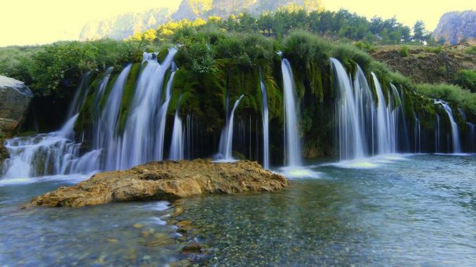
Küp Waterfalls (Aladağ Municipality)
History
The history of Aladağ extends back to ancient times. The region was successively ruled by the Kizzuwatna Kingdom, Hittites, Kue, Assyrians, Macedonians, Romans, Byzantines, Abbasids, Ramadanids, and the Ottoman Empire. The old name of the district was “Karsantı”, given by Turkmen tribes. It gained district status in 1987 and was named “Aladağ”.
Geography
Aladağ is surrounded by the districts of Kozan to its east, İmamoğlu and Karaisalı to its south, and Pozantı to its west. To its north are the provinces of Niğde and Kayseri. The district is located in the Aladağlar region of the Taurus Mountains and takes its name from these mountains. Its mountainous and rugged terrain defines the geographical structure of the district.
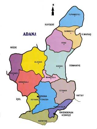
Adana-Aladağ map (Türkiye Map)
Climate
While the Mediterranean climate is effective in Aladağ, climate characteristics vary due to its high altitude. The annual average temperature is 13.6°C, with the highest temperature recorded at 38°C in July and the lowest at -12.5°C in January. The annual precipitation average is 703 mm.
Population and Demography
According to 2024 data, the population of Aladağ is 16,190. 52.45% of this population is male, and 47.55% is female. There are 31 neighborhoods in the district.
Economy
Aladağ's economy is based on agriculture, livestock farming, and forest products. Fruits and vegetables grown in the region constitute the livelihood of the local people. Additionally, forest products and livestock farming also contribute to the district's economy. In recent years, tourism has also become one of the district's important sources of income.
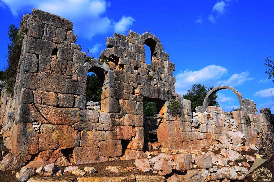
Adana Aladağ Mazılık (Culture Portal)
Tourism
Aladağ boasts various natural areas. Tourist attractions such as Küp Waterfalls, Yedigöze Forest Park, Akören Church, and Meydan Castle are among the visited places. The district, located within Aladağlar National Park, hosts areas where activities such as nature walks, rafting, and camping are carried out. Aladağ Municipality has reached an annual visitor count of 500,000 and has set its target to 1 million visitors.
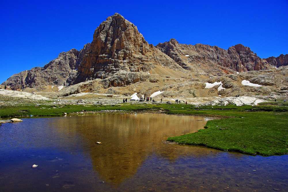
Aladağlar National Park (Culture Portal)
Culture
Aladağ has a rich cultural heritage. Traditional handicrafts, folk dances, and festivals hold an important place in the region. Furthermore, historical structures and ruins in the district reflect the region's cultural richness.
Cuisine
Aladağ cuisine is known for its variety of local dishes. Börek, gözleme, katmer and other pastries, along with local cheeses, are among the frequently consumed local products. Aladağ came to national attention in 2016 with a dormitory fire that claimed the lives of 12 people, including 11 students. This incident sparked significant discussions in Türkiye regarding the safety of student dormitories.
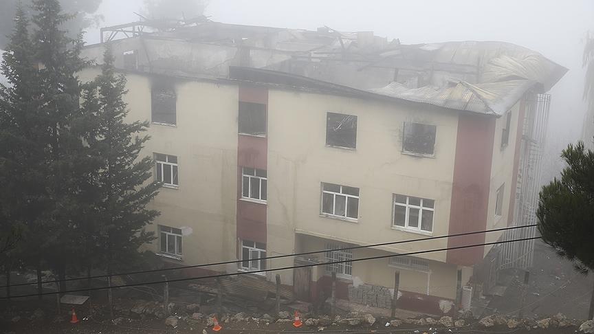
Dormitory fire in Aladağ in 2016 (Anadolu Agency)