+1 More
The Ancient City of Conana is located today approximately 2 km north of the Gönen district of Isparta province, on and around Kaletepe. The settlement, mentioned as Konane in ancient sources, took the name Conana during the Roman Period. The city attracts attention as it is located in the northwest Pisidia region, on a fertile plain of strategic importance and at important road junctions.
Conane Ruins (Türkiye Kültür Portalı)
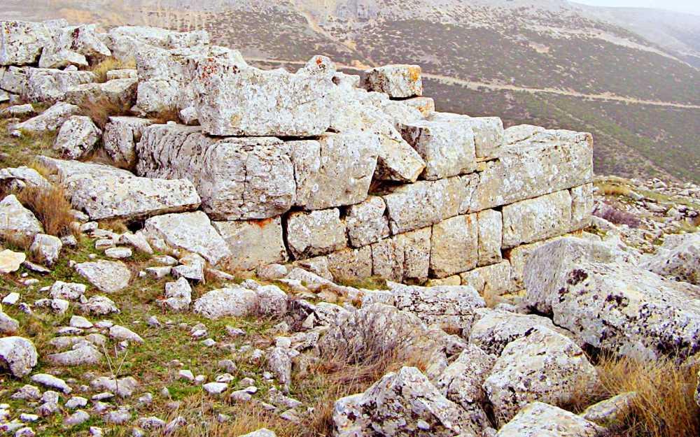
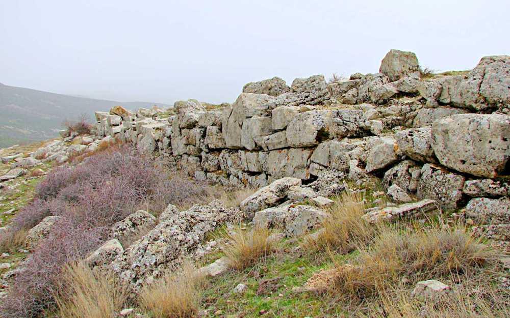
Kaletepe, with an altitude of 1,656 meters, forms the core of the city. Here, very well-preserved fortification walls, traces of civil structures, and street systems have been identified. The settlement began to be used from the Early Hellenistic Period, shifted to the southeastern slopes during the Roman Period, and expanded westward during the Byzantine Period.
To the southeast of Kaletepe, on both sides of the entrance road to the city, there is a necropolis consisting of tumuli and rock-cut tombs. The diameters of the tumuli vary between 5 and 9 meters, and they are surrounded by regular cut stones with their upper parts flattened. While some have a dromos (entrance corridor), large block stone structures with a rectangular plan in the east-west direction are seen in some tombs. Pottery fragments for daily use, belonging to the Late Hellenistic – Early Roman Period, were found in these areas.
Between Mancarlı Sırtı (Mancarlı Ridge) and Kaletepe, there are square-planned structural remains whose function has not been fully determined, as well as a cistern and various spaces at the summit. This data suggests that a small-scale fortress structure also existed on Kaletepe.
In the valley northwest of Kaletepe, Phrygian/Lydian ceramics dated to the 7th and 6th centuries B.C., as well as banded ceramics of Ionian and Eastern Mediterranean origin, have been found. These finds show that the region was in contact with different cultures before the Hellenistic Period. In the Hellenistic Period, traces of small settlements with a diameter of 50–100 meters, where mostly red, brown, and black painted ceramics were concentrated, were identified.
Other Settlement Areas
Akyokuş Tepe, north of Gönen, witnessed settlement from the 2nd millennium B.C. until the Byzantine Period. The extensive necropolis area here extends to the north of modern Gönen.
In the 2009 surveys, 35 inscriptions were documented. Although most of these belong to tombstones, some provide important information about the city. The inscriptions point to the existence of the imperial cult in Conana and to individuals who undertook important religious duties during the Flavian Period. Furthermore, two Roman milestones dated to the Tetrarchy Period, bearing the inscription civitas, were found. These stones confirm the city's location on the Via Sebaste route.
Conane Ruins (Türkiye Kültür Portalı)
Konane/Conana saw continuous settlement from before the Hellenistic Period until Byzantium, and became a strategic center thanks to the agricultural wealth and transportation routes in the region. Research on the political, cultural, and geographical development of the city continues to shed light on the ancient history of Northwest Pisidia.
No Discussion Added Yet
Start discussion for "Ancient City of Conana" article
Geographical Location and Settlement Area
Early Period Findings
Epigraphic and Archeological Data
Historical Significance
This article was created with the support of artificial intelligence.


