+1 More

Hanak (District)
Province(s) | Ardahan | ||||||||
|---|---|---|---|---|---|---|---|---|---|
Area(s) | 547 km² | ||||||||
Population (2024) | 7.836 | ||||||||
Altitude | 1800 meters | ||||||||
Climate(s) | Continental climate | ||||||||
Neighboring Districts | Posof Şavşat Çıldır Damal City Center | ||||||||
Mayor(s) | Erdal Kurukaya | ||||||||
District Governor | Elif Meram | ||||||||
Located in the northeast of Türkiye, Hanak is a district of Ardahan Province that has hosted many civilizations throughout history; it is one of the settlements that draws attention with its geographical structure, historical background, and cultural heritage. In addition to its natural beauty, it also holds significance with its archaeological remains and strategic location.
Hanak, which was under the rule of the Urartian Kingdom until around 680 BC, has the oldest name recorded in written sources as “Tarju,” identified from the Urartian inscriptions found on rocks in the Kırmalar area.
Having hosted many civilizations throughout history, Hanak began to be known by different names with the settlement of the Oghuz Turks in the region. Among these are variants such as “Kanak” and “Kanık.” These names are thought to be related to the dialect used by the Kipchaks, a branch of the Oghuz tribes, and connected to the name of a tribe called “Khanah.” Over time, through linguistic evolution, the initial “K” was dropped, and the final “H” transformed into a “K” to align with Turkish vowel harmony, resulting in the current name “Hanak.”
Hanak was liberated from occupation by Turkish national forces on March 1, 1921; this was politically formalized with the Treaty of Moscow on March 18, 1921. Initially a subdistrict (nahiye) affiliated with Ardahan, Hanak gained district status in 1958 and was administratively connected to Kars. In 1992, when Ardahan became a province, it was incorporated into this province.
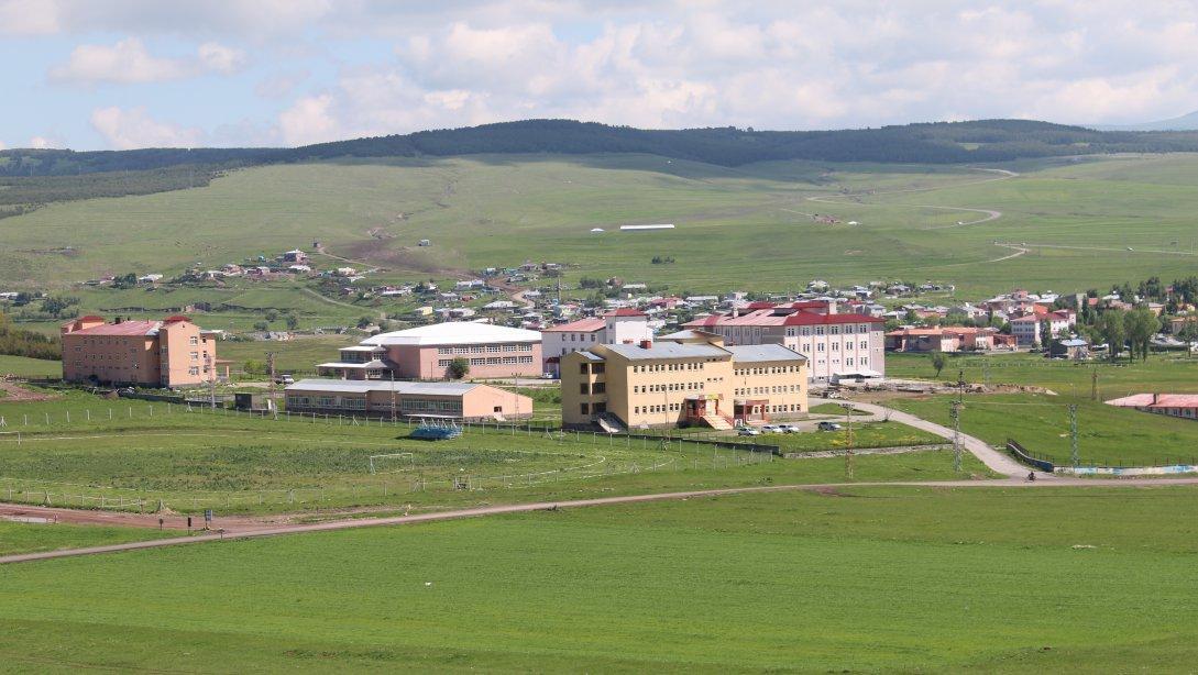
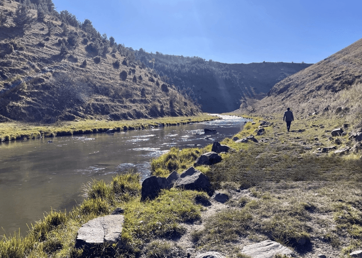
Hanak is bordered by Çıldır to the east, the province of Artvin to the west, Damal district to the north, and the province of Ardahan to the south. Mount Cin lies to the west, while Mount Yelatan and the Oghuz highlands lie to the east. The Hanak River flows through the district from end to end. Its elevation is approximately 1800 meters above sea level.
In Hanak, which has a total land area of 451,867 decares, mountainous areas cover 7,200 decares, agricultural land (cultivated) covers 130,000 decares, pasture-highland-meadow lands cover 308,267 decares, and forested areas are around 6,400 decares.
Geography of Hanak (Anadolu Agency)
Hanak is located in a continental climate zone. Winters are very harsh and cold, while summers are mild and generally rainy. The lowest temperature is around -35 °C, and the highest temperature is around +25 °C.
According to 2024 data, the total population of Hanak district in Ardahan Province is 7,836 people. Of this population, 2,789 live in the district center, and 5,047 live in towns and villages. The district's annual population growth rate is recorded as ‰ -24.8, indicating a decline in population.
The economy of the district is largely based on agriculture and livestock. Especially cattle breeding is widespread. Due to high altitude and climate conditions, agricultural activities are limited. The main crops grown are barley, wheat, and potatoes. In addition, dairy production holds a significant place thanks to the extensive pastures.
There are many structures and ruins in Hanak that hold historical and cultural value. Among the important structures are the church ruins in Selamverdi Neighborhood and Kırnav Castle, located about 5 km southwest of the city center. In addition, the caves carved into rocks in the Harosman area near Ortakent are of great archaeological and historical importance.
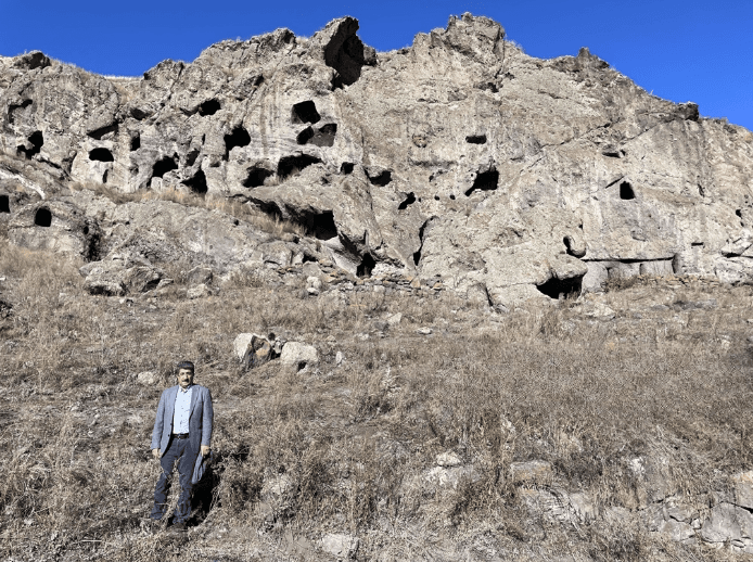
Hanak Caves (Anadolu Agency)
Hanak cuisine carries the basic features of Eastern Anatolian cuisine, and the lifestyle based on livestock has influenced its food culture. Meat dishes, dairy products, and pastries (especially homemade noodles and kete) hold an important place. Hanak string cheese is a registered product with a geographical indication from the Turkish Patent and Trademark Office.
Esen, Sezgin. Flora of Ardahan Province, Posof, Damal, and Hanak Districts. Master's thesis, Artvin Çoruh University, 2010. Accessed May 29, 2025. https://tez.yok.gov.tr/UlusalTezMerkezi/tezDetay.jsp?id=hcyQBNjmRxxbWCN99jJfHg&no=2Hddh3MzTjpNqOnzVw8tsg
Gevker, Şuayib. The Geography of Hanak District Center. Master's thesis, Atatürk University, 2018. Accessed May 29, 2025. https://tez.yok.gov.tr/UlusalTezMerkezi/tezDetay.jsp?id=TOTGq1EzhDe8WLoq4Shbbg&no=hNoj0JTQKPhC41hYLRyKHw
Nuh, Günay. "Harosman Canyon, where historical caves are located in Ardahan, to be opened to tourism." Anadolu Agency. Accessed May 29, 2025. Accessed Address.
Republic of Turkey Ardahan Governorship. "Hanak." Republic of Turkey Ardahan Governorship Website. Accessed May 29, 2025. http://www.ardahan.gov.tr/hanak
Republic of Turkey Ardahan Hanak District Directorate of National Education. "Our Hanak District." Republic of Turkey Ardahan Hanak District Directorate of National Education Website. Accessed May 29, 2025. https://hanak.meb.gov.tr/www/hanak-ilcemiz/icerik/96
Republic of Turkey Ardahan Hanak District Directorate of National Education. "Our Hanak District." Republic of Turkey Ardahan Hanak District Directorate of National Education. Accessed May 29, 2025. Accessed Address.
Turkey Development Foundation. "2024 Provincial and District-Based Population." Turkey Development Foundation Website. Accessed May 29, 2025. https://tkv-dft.org.tr/upload/2024%20Y%C4%B1l%C4%B1%20%C4%B0l%20ve%20%C4%B0l%C3%A7e%20Bazl%C4%B1%20N%C3%BCfus.pdf
Hanak (District)
Province(s) | Ardahan | ||||||||
|---|---|---|---|---|---|---|---|---|---|
Area(s) | 547 km² | ||||||||
Population (2024) | 7.836 | ||||||||
Altitude | 1800 meters | ||||||||
Climate(s) | Continental climate | ||||||||
Neighboring Districts | Posof Şavşat Çıldır Damal City Center | ||||||||
Mayor(s) | Erdal Kurukaya | ||||||||
District Governor | Elif Meram | ||||||||
History
Geography
Climate
Population
Economic Structure
Cultural and Historical Heritage
Cuisine
This article was created with the support of artificial intelligence.