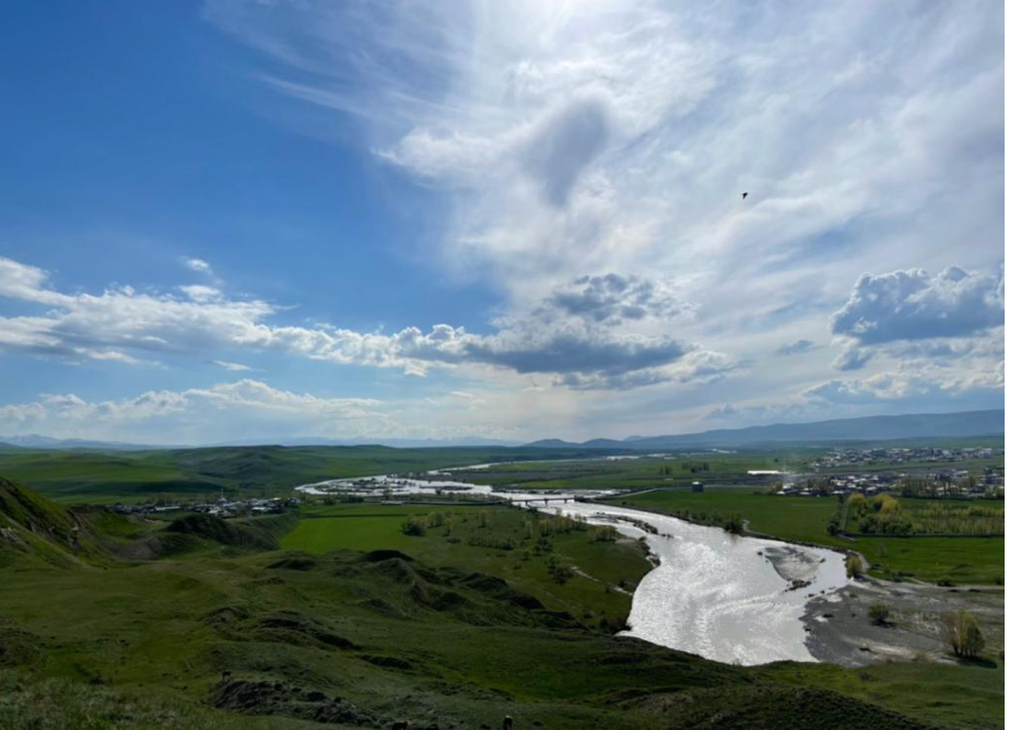
Horasan district is located in the east of Erzurum province, Republic of Türkiye. The district is situated on the Kars-Erzurum highway and railway route, along the banks of the Aras River. Horasan, whose history dates back to the 4th millennium BC, is located on the historical Silk Road between the East and the West, at the intersection of transportation routes. Due to hosting different civilizations, it is a historically and culturally multi-layered settlement.

Horasan (Source: Horasan Governorship)
History
Horasan and its surroundings have been on the migration routes of various communities throughout history. The region came under the rule of many states such as Assyrians, Persians, Romans, Seljuks, and Ottomans. It has been settled since the 4th millennium BC and was subjected to raids by Roman, Assyrian, Urartian, Median, and Persian states. In the AD period, it was under Sasanian, Arab, and Byzantine rule.
After the Battle of Manzikert in 1071, the Seljuk Empire's superiority over the Byzantine, Georgian, and Armenian kingdoms marked the beginning of the Turkish presence in Eastern Anatolia. During this period, Turkish communities from the Horasan region of Iran settled in the area, then known as Üskühat, naming it "Horasan."
With the Çaldıran Campaign of 1514, the Ottoman Empire established dominion over Erzurum and its surroundings, and Horasan became a sub-district of Pasinler district, which was part of the Erzurum Sanjak during this period. Although the Ottoman army achieved some successes during the 1877-1878 Ottoman-Russian War, the Horasan-Köprüköy-Pasinler line was occupied by Russians, and then the army retreated to Erzurum.
Following the Russian forces' withdrawal after the 1917 Russian Revolution and the Armenian units taking control, the Turkish army, under the command of Kazım Karabekir Pasha, recaptured Erzurum on March 12, 1918, and Horasan on March 25, 1918. During the Republican period, Horasan, which was a village in the Zanzak (Akçataş) sub-district of Pasinler, became a sub-district center in 1940 and gained district status in 1953.
Horasan also stands out as one of the settlements where Sufi traditions, continuing the teachings of Ahmet Yesevi in Anatolia, were influential. Many Sufis who spread throughout Anatolia are known to have lived in this region.
Geography
Horasan is located in the east of Erzurum, at the junction of the Kars-Ağrı highway. It is bordered by Sarıkamış to the east, Eleşkirt to the southeast, Karayazı to the south, Köprüköy to the west, and Narman districts to the north. Its surface area is 1,662 km², and its altitude is 1,650 meters. The district's topography consists of wide plains stretching along the Aras River and gently sloping ridges. Zars Stream and Serküllü Stream also pass through the district boundaries. Its geopolitical position serves as a transit point for Erzurum's connections with Kars, Ağrı, and Ardahan.
Climate
The district has a continental climate. Winters are long and harsh, while the summer season is short-lived. Rainfall is high in some areas during the spring months.
Population – Demographics
According to 2024 TÜİK data, the population of Horasan district is 35,642 people. 50.91% of this population is male (18,145 people), and 49.09% is female (17,497 people). A decrease in the district's population has been observed as of 2024 compared to 39,467 in 2017.
Economy
Horasan's economy is predominantly based on agriculture and livestock farming. The irrigation facilities of the Aras River play an important role in agricultural activities. Various agricultural products, especially wheat, are cultivated. Livestock farming is more common in rural settlements.
Tourism – Culture – Cuisine
Horasan is a settlement associated with the Erenler culture and reflects the cultural structure of Eastern Anatolia. Although some structures were damaged by the 1983 earthquake, there are many places of visit in the region that have survived from the past to the present day.

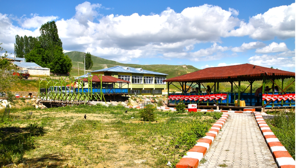
Hızırilyas Hot Springs (Source: Horasan Governorship)
Historical and Natural Places
- Places of Visit: Güreşken Baba, Hasan Dede, Horasan Baba, Huykesen Baba, Karaşeyh, Kuzuçam Baba, Eskici Baba, Sanamer-Hacı Ahmet Baba, Veli Baba, Postlu Baba, Şeyh Ocağı, Kubbeli
- Urartian Inscription: An inscription near Yazılıtaş village, depicting the campaign of Urartian King Menua
- Rivers: Aras River, Zars Stream, Serküllü Stream
- Hızırilyas Hot Springs
Cuisine
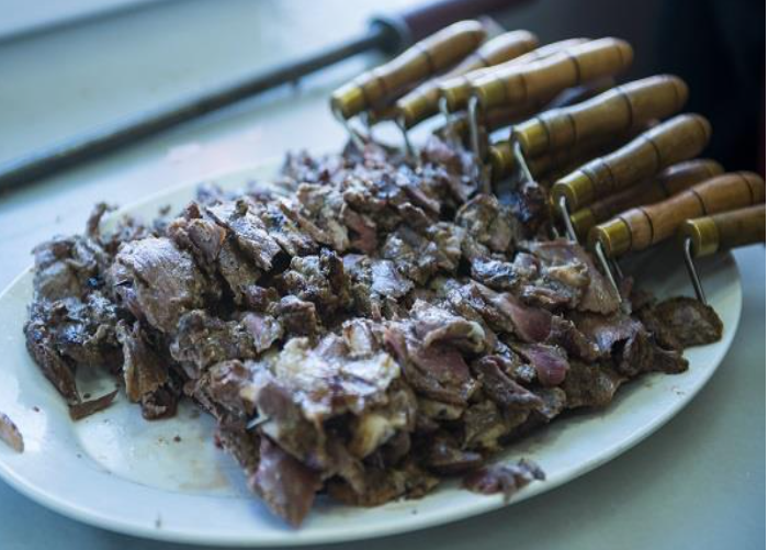
Horasan cuisine reflects the general culinary culture of the Erzurum region. Dishes such as Cağ kebabı, water pastry (su böreği), ayran aşı (yogurt soup), and lor dolması (stuffed lor cheese) are widely consumed in the district.

Cağ kebabı (Source: Ministry of Culture and Tourism)


