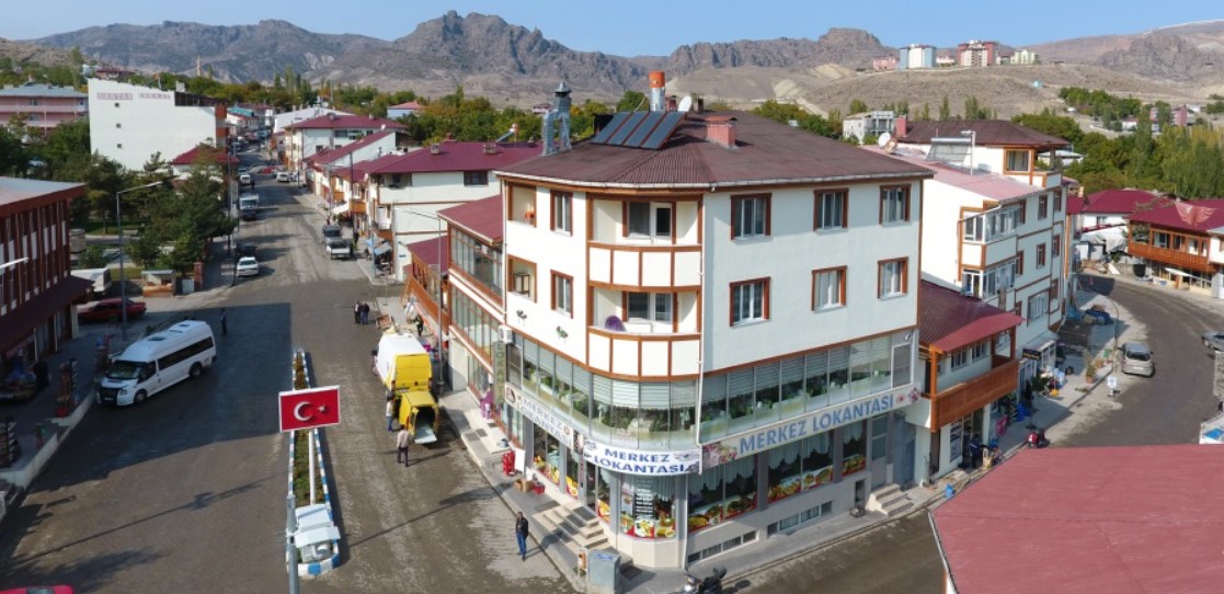
Olur, is an administrative unit located in the Erzurum province of the Republic of Türkiye. Geographically, it is situated at the intersection of the Black Sea Region and the Eastern Anatolia Region. The district has a topographically rugged structure, surrounded by forested areas, rivers, and high-altitude plateaus. The district center is located in the Olur Stream valley and is approximately 170 kilometers by road from Erzurum city center.

Olur (Olur Municipality)
History
Olur and its surroundings have been a settlement area for different civilizations throughout history. Archaeological findings indicate that the first settlements in the region date back to the Paleolithic period. The region successively came under the dominion of the Urartu, Assyrian, Persian, Roman, and Byzantine Empires, and after the Battle of Manzikert in 1071, it passed into the control of the Seljuk State. During the Ottoman Empire period, Olur was a kaza (district) subordinate to the Kars Sanjak, and with the establishment of the Republic of Türkiye, it took its place in the administrative organization as a district of Erzurum province.
Geography
Olur district is located in the northeastern part of Erzurum province. Its administrative borders are neighbors with Şavşat and Ardanuç districts of Artvin province to the north, Yusufeli district of Artvin province to the east, Tortum district of Erzurum province to the south, and Uzundere district of Erzurum province to the west. The district's terrain is generally mountainous and rugged. Its proximity to the Black Sea Region causes differentiations in the region's climate characteristics from the typical continental climate of the Eastern Anatolia Region. The main water source of the district is Olur Stream and various creeks that flow into it. In high-altitude areas, there are large plateaus and forests as natural vegetation.
Climate
In Olur district, a transitional climate is observed, resulting from the interaction of the Black Sea climate and the continental climate. During the summer season, average temperatures range between 20 and 25 °C, while in winter, temperatures can drop below -10 °C. The annual average precipitation is higher compared to other regions of the Eastern Anatolia Region. Precipitation generally intensifies in spring and autumn, and regular rainfall is also observed during summer months. Snow cover can be long-lasting, especially in high-altitude areas.
Population
According to the 2024 Address-Based Population Registration System (ADNKS) data from the Turkish Statistical Institute (TÜİK), the population of Olur district is 6,220. Of this population, 3,149 are men and 3,071 are women. It is noteworthy that the district's population is generally low due to the predominance of rural settlements and has shown a decrease of -79.8% compared to the previous year. Reasons for this decrease may include rural-to-urban migration and other potential demographic factors.
Economy
The economic structure of Olur district is primarily based on agriculture and animal husbandry. In agricultural production, wheat, barley, potatoes, beans, and fodder crops hold a significant place. Livestock farming activities include cattle and small ruminant breeding. In recent years, beekeeping has also shown development among economic activities. Forestry activities are also present in the district. Despite the region's potential, the tourism sector does not yet make a significant economic contribution.
Tourism, Culture and Cuisine
Olur holds potential for tourism with its natural beauties and historical structures. The plateaus in the district offer suitable areas for outdoor activities such as hiking, camping, and mountaineering. Olur Castle and the historical ruins around it provide information about the region's past. Local handicrafts and traditional way of life are among the interesting elements for cultural tourism.
Olur's culinary culture has characteristics that reflect the interaction of Black Sea and Eastern Anatolian cuisines. Mıhlama, hıngel, cağ kebabı, and dishes prepared with local herbs are characteristic examples of the region's cuisine. Additionally, there are varieties of jam, honey, and cheese produced with local products.
Olur District Center (25. Boyut)
Historical Remains, Castles, Watchtowers and Ancient Sites in Olur and Its Surroundings
Olur and its surroundings, due to their location on strategically important passage areas throughout history, have hosted various defense structures. Small castles and watchtowers located on the Oltu, Olur, Yusufeli, and Artvin route are generally structures characteristic of the Middle Ages and were built for passage control. It is known that some of them continued to be used after being repaired during the Ottoman period.
Watchtowers: Among the watchtowers identified in the region are the structures found in the villages of Köprübaşı, Aşağı Karacasu (Aşağı Peneskirt), Beğendik (Pitanos), Kaledibi, Filizli (Keleşat), Keçili (Niyakom), and Sarıbaşık at the Oltu-Olur-Yusufeli road junction. These towers, by virtue of their location, provided dominance over strategic points.
Petrus (Eğlek) Ancient Site and Castle: It is located on Pertus hill, approximately 17 kilometers southwest of Olur district center. According to legends, the city of Pertus, founded by the Greek-Pontic king Dikran, is now in ruins. Basic remains of church-like and residential structures can be seen at the ancient site.
Keçili Village Vavuser Hill Niyakom (Nikoma, Vank, Kalmahi, Vachedzori) Monastery: It is located approximately 25 kilometers northwest of Olur, on Vank hill, where Ulahur Gorge, Vank Stream, and Perisor Mountains converge. It is 12 kilometers from Çataksu village. It has a triangular-planned castle, compatible with the terrain, surrounded by rocks on three sides, and contains cisterns and granaries. Near the castle, there is a monastery complex that was repaired during the Greek-Pontic period. This complex includes a closed-cross planned, domed church, five chapels, two rectangular-planned structures whose function has not been determined, and a two-story, octagonal-planned bell tower. The structure was built with cut stone and lime mortar and features columns, doors, and window details adorned with floral motifs.
Çataksu (Tavuzker) Village Church Ruins: Tavuzker, an important settlement and Ottoman Sanjak Center in the 19th century, was destroyed during the 1877-1878 Ottoman-Russian War. In the middle of the village, there are two church ruins, one with a circular plan and one with a basilical plan, believed to belong to different Christian communities. Parts of both structures have been ruined down to their foundations. The remaining walls are occasionally 3-4 meters high.
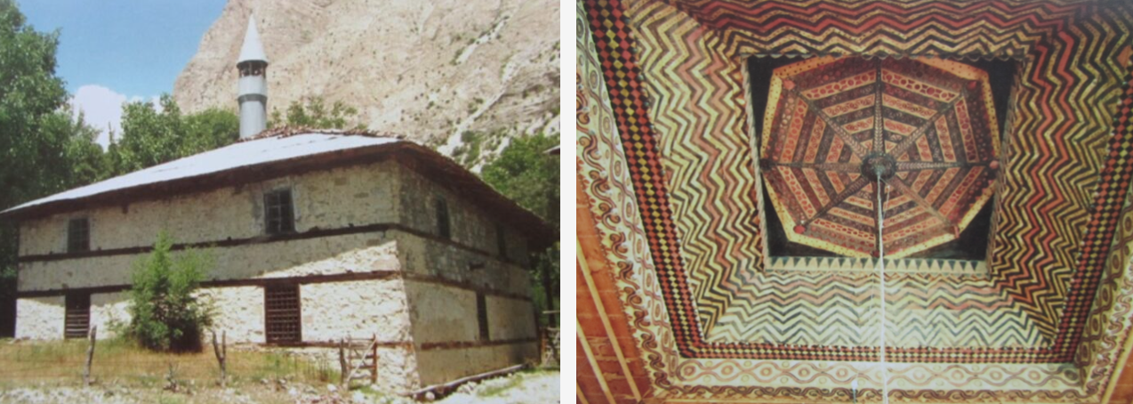
Çataksu (Tavuzker) Village Mosque and Complex: It is known that beys from the lineage of Ishak Pasha in Doğubayazıt resided in Çataksu in the 17th and 18th centuries. The complex, built by Derviş Mehmed Bey in the 17th century, consists of a palace (now ruined), a hammam (remains exist), a baldachin-style tomb, and a mosque constructed mainly with wooden materials. The mosque, which has an inscription dated H.1082 (M.1671), has undergone renovations and draws attention with its wooden painted ceiling, wooden pillars, minbar, and last prayer area (son cemaat yeri).

Çataksu Mosque ( Erzurum Encyclopedia)
Olur Places to Visit
Karaoğlan Visitation Site: It is a single grave surrounded by rubble stones, located at the summit of Evigen Mountain, northeast of Yukarı Karacasu (Peneskirt) Village. It is rumored to belong to a martyred person and is visited by the local people.
Mikâf Visitation Site: It is another single grave surrounded by rubble stones, located on Kotek Hill within the borders of Ormanağzı (Karnavaz) Village. It is visited, believed to belong to a person thought to have been martyred.
Sarıbaba Visitation Site: It is a single grave surrounded by rubble stones, located at the highest point of the Sarıbaba Mountains within the borders of Olgun (Akurtis) Village. It is visited by the local people.


