Büyükdeniz Lake - Rize
Büyükdeniz Gölü is a unique natural formation located in the Black Sea Region of Türkiye, in the district of Çamlıhemşin, Rize, near the summits of the mountains. This lake is one of the finest examples of a type known as glacial lakes. As the name suggests, glacial lakes form when massive ice masses (glaciers) eroded the Earth’s surface thousands of years ago, carving out depressions. Büyükdeniz Gölü is a remarkable legacy of the ice ages left by nature.

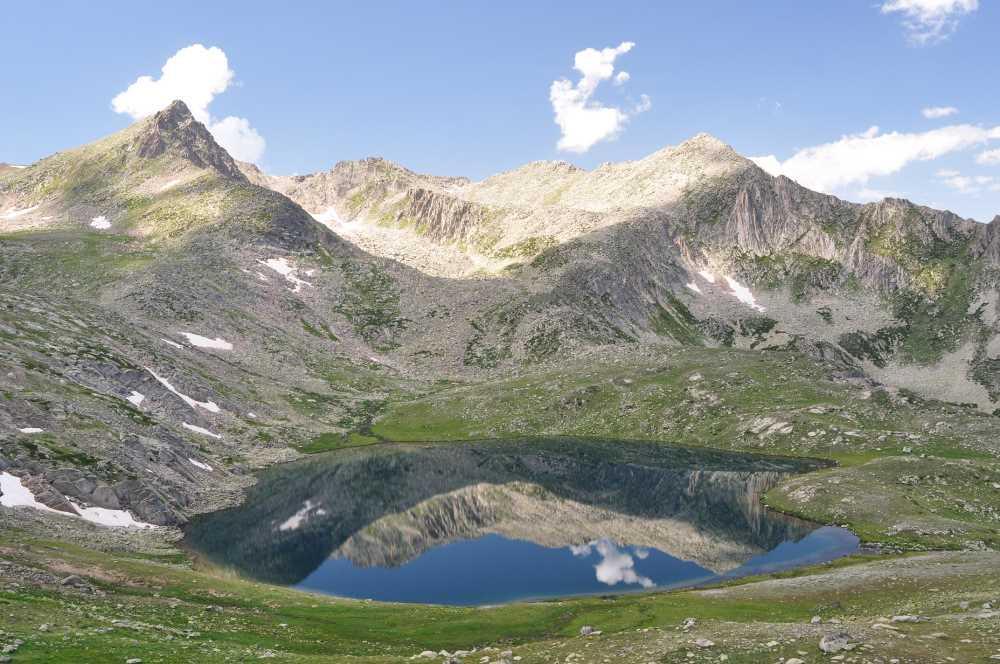
Büyükdeniz Gölü (Culture Portal)
🗺️ Where Is It Located?
Büyükdeniz Gölü lies among the majestic peaks of the Kaçkar Mountains, rising to the southeast of Rize.
The lake is situated at an elevation of approximately 2900 metres above sea level. This height is nearly three kilometres! As a result, the surrounding area is covered in snow for much of the year. It lies within the Kaçkar Mountains National Park, an important protected area valued for its natural beauty and biodiversity. As its name suggests, Büyükdeniz Gölü is one of the largest among the smaller lakes in the Kaçkar Mountains. Its surface area is approximately 0.07 square kilometres (70,000 square metres).【1】

Büyükdeniz Gölü (Anadolu Agency )
🧊 How Was It Formed?
These high mountain lakes are known as cirque lakes or moraine-dammed lakes.
Glacial Erosion: Hundreds of thousands of years ago, thick glaciers covered the peaks of the Kaçkar Mountains. As these massive ice bodies moved, they carved out depressions in the underlying rock, much like a giant spoon scooping out a bowl. These depressions are called cirques.
Moraine Deposition: As the glaciers moved, they carried with them rocks, soil, and mud—collectively known as moraine—and piled this debris along one edge of the cirque, forming a natural dam.
Water Accumulation: After the glaciers melted and retreated, snowmelt and rainfall collected in these depressions, forming Büyükdeniz Gölü.

Büyükdeniz Gölü (Anadolu Agency )
💧 What Are the Lake’s Characteristics?
The water of Büyükdeniz Gölü is very cold and pristine.
- The lake is fed by melting snow and glacial ice, resulting in consistently low water temperatures.
- The surrounding area is home to high-altitude vegetation adapted to harsh conditions, including endemic plant species. The region also provides habitat for special animal species such as the wild goat and predatory birds.
- Together with the imposing peaks of the surrounding Kaçkar Mountains—particularly the Kaçkar Massif—the lake creates a breathtaking landscape. The sloping terrain to the southeast of the lake offers the best views of its beauty.
🚶 How to Get There?
Reaching this lake requires a hiking trek.
- Due to its remote location away from settlements, it is not possible to reach the lake by vehicle.
- Most visitors travel from Çamlıhemşin district to Ayder Plateau, and from there to the Yukarı Kavron Plateau.
- From Kavron Plateau, a roughly two-hour hike along narrow trails leads to the lake. Although this trek is physically demanding due to the high altitude, it offers spectacular natural scenery.
Citations
[1]
Anadolu Ajansı. “Kaçkar Dağlarının Zirvesinde Buzul Gölü Keyfi.” Anadolu Ajansı. Erişim 9 Kasım 2025. https://www.aa.com.tr/tr/turkiye/kackar-daglarinin-zirvesinde-buzul-golu-keyfi/890788.