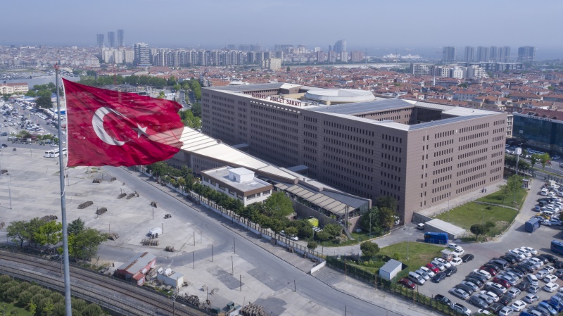
Bakırköy is a district located on the European Side of Istanbul, along the coast of the Marmara Sea. The district, whose history dates back to ancient times, has undertaken various administrative, military, religious, and social functions under different statuses during the Roman, Byzantine, Ottoman, and Turkish Republic periods. Bakırköy, which took its current name in 1925, was particularly known as Hebdomon during the Byzantine period and took its place in history as an important settlement.
History
The history of Bakırköy dates back to the Byzantine period. During the Roman Empire, Hebdomon, located on the Via Egnatia route, became an important settlement with summer palaces, religious structures, and military encampments. During the Latin and Arab invasions, the structures were damaged and eventually abandoned. During the Ottoman period, after the conquest of Istanbul, this settlement, known as Makriköy, was administered as a village connected to the district of Küçükçekmece for a period.
The transition process to the modern administrative structure of the Ottoman Empire began in the mid-19th century with the Tanzimat Edict; during this process, Bakırköy was connected to the Mutasarrıflık of Kaza-yı Erbaa and eventually gained district status. After the proclamation of the Second Constitutional Era in 1908, it operated as the 20th Municipality Department affiliated with the Istanbul Şehremaneti. With the regulation made in 1910, the name Bakırköy district began to be used instead of Küçükçekmece.
In the Republican period, Bakırköy officially became a district of Istanbul in 1926 and reached its present borders over time with the separation of districts such as Bahçelievler, Güngören, Bağcılar, and Küçükçekmece.
Geographical Location and Borders
Bakırköy is located in the Çatalca-Kocaeli section of the Marmara Region and is positioned in the southwest of Istanbul. To its north are Güngören and Bahçelievler, to its east Zeytinburnu, to its west Küçükçekmece, and to its south is the Marmara Sea.
Geologically, the region has layers from the Devonian, Eocene, Neogene, and alluvium periods. It contains various geological features such as shale, limestone, gravel, terrestrial-marine facies, and alluvial deposits.
Archaeological and Cultural Heritage
Bakırköy possesses a rich cultural heritage from the Roman and Byzantine periods. Although most of the archaeological remains from the Hebdomon settlement period have not survived to the present day, the region's past can be traced through various written sources and limited archaeological findings.
Research has revealed traces of palace ruins, religious structures, and military facilities among the structures in Hebdomon, especially those located on the Via Egnatia road. Most of these remains were destroyed during the modern urbanization process without sufficient documentation and conservation efforts.

Bakırköy Courthouse (Ministry of Justice)
Neighborhoods and Settlement Structure
There are currently 15 neighborhoods in Bakırköy:
- Ataköy 1st Section
- Ataköy 2-5-6th Section
- Ataköy 7-8-9-10th Section
- Ataköy 3-4-11th Section
- Basınköy
- Cevizlik
- Kartaltepe
- Osmaniye
- Sakızağacı
- Şenlikköy
- Yenimahalle
- Yeşilköy
- Yeşilyurt
- Zuhuratbaba
- Zeytinlik
Demographic Structure
With a population of 219,893, Bakırköy is one of Istanbul's oldest urbanized areas. Population density is particularly high in the Ataköy and Osmaniye neighborhoods.
Transportation Infrastructure
Bakırköy, centrally located in terms of transportation, has widespread metrobus, Marmaray, sea bus, and bus lines. It has connections to Istanbul's main transportation axes via the coastal road and the E-5 highway.
Bakırköy has been one of Istanbul's important settlement areas throughout history. Shaped by military, religious, and political functions since the Roman period, this region maintained its administrative structure during the Ottoman and Republican periods, eventually becoming one of Istanbul's central districts.


