This article was automatically translated from the original Turkish version.
+1 More

Çaykara is a district of Trabzon province in East Black Sea Region, Türkiye. Its association with Uzungöl has made Çaykara a well-known tourist place. The district exhibits the typical natural features of the Black Sea region, including its forests, mountains and highland pastures.
The history of Çaykara generally parallels that of Trabzon. The earliest inhabitants of the region were the Colchians, ancestors of the Laz people. Subsequently, the area came under the rule of the Kingdom of Pontus, the Roman Empire, the Byzantine Empire and the Empire of Trebizond. In 1461, it became part of the Ottoman Empire following the conquest of Trabzon by Fatih Sultan Mehmet. According to Ottoman records from 1486, approximately 1,277 people lived in the villages of Çaykara. By 1681, the villages had fully converted to Islam. In 1915, during World War I, the district was occupied by the Russian army. Until 1925, Çaykara was a village under the jurisdiction of Of district. It gained district status on 1 June 1947. 27 February is celebrated as the district’s “Liberation Day”.
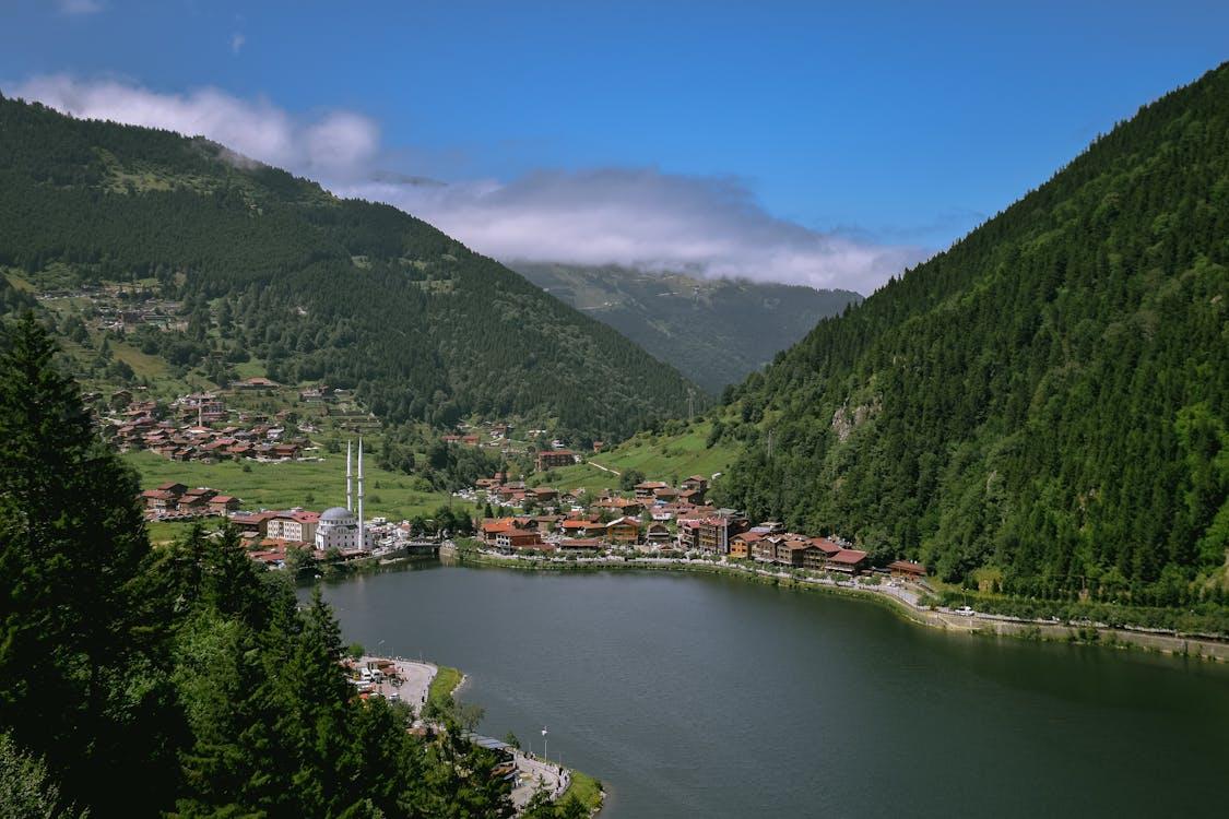
Çaykara is located in the southeast of Trabzon. It has a mountainous land structure. The Soğanlı Mountains and Haldizen Mountains lie within the district boundaries. The most famous natural area in the district is Uzungöl. Uzungöl is a landslide dam lake formed by the blocking of Haldizen Creek by rocks falling from the slopes. The area surrounding the lake contains diverse plant vegetation and wildlife.

Çaykara, Villages (Source: Pexels)
The economy of Çaykara is based on agriculture and tourism. Agriculture primarily focuses on hazelnut, tea and maize. In recent years, tourism activities have increased significantly. Uzungöl in particular welcomes numerous domestic and foreign tourists each year.
Uzungöl is a landslide dam lake formed by rocks falling from the slopes and blocking Haldizen Creek. The lake is approximately 1,000 metres long, 500 metres wide and about 15 metres deep. The village of Şerah, located near Lake, is situated in close proximity to the lake. The lake and its surroundings have been declared a “Special Environmental Protection Area” by Environment and the Ministry of Environment and Urbanization.
Çaykara hosts tourism activities, particularly around Uzungöl, with hiking trails, accommodation facilities and restaurants. Activities such as paragliding, mountaineering and fishing can be organized around the lake. Additionally, Murat Yaylası within the district boundaries is also used for tourism purposes.
Educational services in Çaykara are managed by the Çaykara District National Education Directorate. The district has various schools. Çaykara has 16 school, 112 classrooms, 197 teacher and 1,714 students.
Çaykara exhibits cultural characteristics unique to the Black Sea region. Local cuisine, folk dances and handicrafts form part of its cultural heritage.
Çaykara, Uzungöl (Source: Pexels)
Ministry of Environment and Urbanization, General Directorate of Nature Conservation. "Uzungöl." Accessed April 19, 2025.
Trabzon Kültür ve Turizm Müdürlüğü. https://trabzon.ktb.gov.tr. Accessed April 19, 2025.
Trabzon Valiliği. http://www.trabzon.gov.tr. Accessed April 19, 2025.
Çaykara Belediyesi. "Tarihçemiz." Accessed April 19, 2025. https://www.caykara.bel.tr/Sayfa/66/tarihcemiz.
Çaykara İlçe National Education Directorate. https://caykara.meb.gov.tr. Accessed April 19, 2025.
History
Geography
Economy
Uzungöl
Tourism
Education
Culture
Additional Current Information