Iğdır
Country | Türkiye | ||||||||
|---|---|---|---|---|---|---|---|---|---|
Area(s) | 3.539 km² | ||||||||
Population | 206.857 | ||||||||
Districts | Tuzluca Karakoyunlu Aralık Merkez | ||||||||
Climate(s) | Continental Climate | ||||||||
License Plate Code | 76 | ||||||||
Area Code(s) | 476 | ||||||||
Mayor(s) | Mehmet Nuri GÜNEŞ | ||||||||
Governor(s) | Ercan TURAN | ||||||||
Key Attractions | Iğdır Castle Küllütepe Mound Memorial Museum Historical Mausoleums Iğdır Caravanserai Tuzluca Caves | ||||||||
Iğdır is a province located on the eastern border of Türkiye, situated on the northwestern foothills of Mount Ararat at an altitude of 870 meters above sea level. Due to its geographic position, Iğdır lies within the fertile Iğdır Plain, through which the Aras River flows. This strategic location has historically made the city an important center for trade and transportation. In particular, the routes extending eastward from Erzurum follow the Aras Valley and pass through Iğdır, indicating its critical role as a transportation hub.

Mount Ararat (Photo: Özkan Aygün)
The city derives its name from Iğdır Bey, the eldest son of Deniz Han, who was the youngest son of Oğuz Han. The name “Iğdır” conveys meanings such as "kindness, bravery, greatness, nobility, and heroism." The tribe of Iğdır settled historically in the regions of Azerbaijan and along the Aras River. The name of İğdir Bey, the first leader of the tribe to which the Karakoyunlu State also belonged, was eventually given to the region. While pronounced as "Iğdır" in Anatolia and Azerbaijan, the original pronunciation is "İgdir," and the local people pronounce it as "İydir."
Iğdır and its surroundings have been an important settlement area since prehistoric times. Archaeological excavations in the region indicate that habitation dates back as far as 4000 BCE. During the period of Urartian rule, the region developed significantly in agriculture and animal husbandry, and fortified settlements were established. The Urartians reinforced the area with irrigation canals and fortresses. In this period, Surmeli (Surmari) Plain and the Karakale ruins became important centers. However, in the 6th century BCE, the Medes overthrew the Urartians and took control of the region. The Persians later ended Median rule and incorporated Iğdır into their satrapy system.
Following the Persians, the region came under the influence of Alexander the Great in the 4th century BCE and was introduced to Hellenistic culture. However, this dominance was short-lived, and after Alexander's death, the region was captured by the Parthians and subsequently by the Sasanians.
During the Roman Empire's eastern campaigns, Iğdır frequently changed hands between the Romans and the Sasanians. In the 7th century, the region served as a key front during wars between the Byzantines and the Sasanians, but by the mid-7th century, it was conquered by the Arabs and incorporated into the Islamic world.
After the Battle of Manzikert in 1071, the Seljuks began settling in Iğdır and its surroundings. During this time, Iğdır became part of the Surmeli (Surmari) Emirate, under the Seljuk administration. In the 12th century, the region was taken over by the Ilkhanids, a Mongol dynasty that significantly influenced the region's cultural landscape.
After the fall of the Ilkhanids, Iğdır came under the control of Turkoman principalities such as the Karakoyunlus and Akkoyunlus. During this era, Turkoman tribes settled in the region, accelerating its Turkification. The Karakoyunlu dynasty, with its center in Erzurum and northern Eastern Anatolia, made Iğdır an important location.
In 1514, following the Battle of Chaldiran, Sultan Selim I (Yavuz Sultan Selim) annexed Iğdır into Ottoman territory. However, due to ongoing wars with the Safavids, control over the region fluctuated. During the Ottoman period, Iğdır became a sanjak (district) affiliated with the Erzurum Eyalet (Province) and was integrated into the Ottoman administrative system. While conflicts between the Ottomans and Safavids continued through the 17th century, Ottoman dominance became firmly established from the 18th century onward.
Following the Ottoman defeat in the Russo-Turkish War of 1877–1878, Iğdır and its surroundings were occupied by Russian forces in 1878. During this period, the Russians attempted to alter the region’s demographic structure by settling Armenians in the area.
After the Bolshevik Revolution in 1917, the Russians withdrew, but Armenian militias took their place. Between 1918 and 1920, violent attacks by these militias resulted in significant civilian casualties. The Turkish population in Iğdır and the surrounding area mounted a strong resistance against these attacks.
In 1920, the Turkish army under the command of Kazım Karabekir expelled the Armenians and re-integrated Iğdır into Turkish territory. Initially part of Kars Province, Iğdır became Türkiye’s 76th province on May 27, 1992.
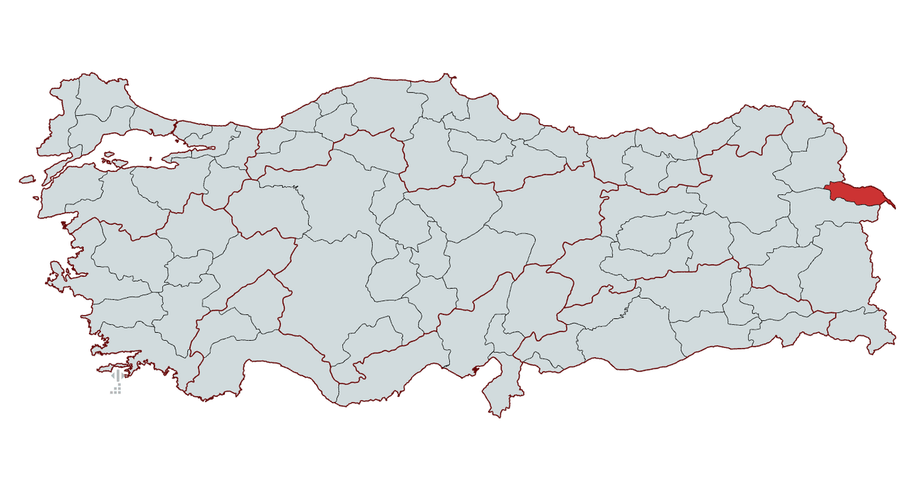
Iğdır is a strategically located province in the easternmost part of Türkiye, sharing borders with three countries. It lies within the Erzurum-Kars Section of the Eastern Anatolia Region, positioned between 39° 55' – 40° 07' N latitude and 43° 20' – 44° 56' E longitude. Geographically, it is bordered by Azerbaijan (Nakhchivan) and Armenia to the east, Kars to the west, and Ağrı to the south. Iğdır is the only Turkish province that shares an 88-kilometer border with Armenia, which grants it significant geopolitical importance. Moreover, its approximately 11-kilometer border with Nakhchivan makes Iğdır the location of the Dilucu Border Gate, Türkiye’s only land connection to Azerbaijan.
The eastern boundary of Iğdır is formed by the Aras River, which also serves as a natural border between Türkiye and Armenia. The province features a diverse topography, including mountainous terrain to the north and flat plains to the south. A section of Mount Ararat, Türkiye's highest peak, lies within Iğdır’s southern border. This location provides the province with fertile lands ideal for agriculture and livestock farming while also establishing it as a critical trade and transportation corridor along Türkiye’s eastern frontier.
Although located in the Eastern Anatolia Region, Iğdır exhibits a microclimate that distinguishes it from neighboring provinces. The Iğdır Plain, stretching along the Aras River, moderates the climate, making winters milder and summers hot and dry. The average annual temperature ranges between 11–12°C. Winter temperatures can drop below freezing, yet remain milder than in surrounding provinces. Summer temperatures may reach up to 40°C. The average annual precipitation is about 250–300 mm, indicating a semi-arid climate.
The vegetation in Iğdır varies according to soil and climate conditions. Much of the plain is covered with farmland and meadows. Along the Aras River, willow, poplar, and walnut trees are common in wetland areas. Due to its microclimate, the province supports the cultivation of fruits such as apricots, peaches, apples, pears, pomegranates, and grapes. These features make Iğdır one of the most agriculturally productive provinces in Eastern Anatolia.
Due to its geographical structure, Iğdır features both mountainous regions and expansive plains. Notable mountain formations are found in the north and south of the province. The most prominent mountain is Mount Ararat, accompanied by ranges such as the Tuzluca Mountains and Zor Mountain.
Located in southeastern Iğdır, Mount Ararat stands at 5,137 meters, making it the highest mountain in both Türkiye and Anatolia. It consists of two peaks—Great Ararat and Little Ararat—and straddles the border between the provinces of Iğdır and Ağrı. The northeastern slopes of the mountain lie within Iğdır. Due to the province’s mild climate, these slopes are less snow-covered than other regions.
Situated in the west and northwest of the province, these mountains lie to the southwest of the Tuzluca district. They are known for their extensive salt deposits, which gave the district its name. The area is also rich in underground resources and supports active salt mining operations.
Located in the north of Iğdır near the Armenian border, Zor Mountain serves as a natural boundary. It rises to 3,196 meters and is one of the most prominent elevations in the region, located near the Aras Valley.
Despite being in Eastern Anatolia, Iğdır’s microclimate and broad flatlands give it a topographical character distinct from its neighbors. Several fertile plains across the province are fed by the Aras River, creating prime conditions for agriculture.
The largest and most important plain in the province, the Iğdır Plain stretches from east to west along the Aras River. With an elevation ranging from 850 to 900 meters, it is one of the lowest-lying plains in Eastern Anatolia. Its low altitude and favorable climate allow for the cultivation of a variety of fruits such as apricots, apples, pears, peaches, pomegranates, and grapes. The plain is the center of intensive agricultural activity and plays a vital role in the province’s economy.
Located within the Aralık district, east of the Aras River and close to the Armenian border, this plain is highly suitable for grain cultivation and livestock farming. Its proximity to the Dilucu Border Gate, which connects to Nakhchivan, also lends it strategic commercial significance.
This small plain is situated in the Melekli township, near Iğdır city center. It is particularly suited for fruit and vegetable cultivation. With the development of irrigation infrastructure, greenhouse farming has become increasingly common here.
Found in the Tuzluca district, this plain comprises the district’s wide lowlands and provides pasturelands for livestock. Additionally, the region’s underground salt deposits make it an important site for salt production.
The plains of Iğdır—especially the Iğdır Plain—are key zones of agricultural productivity. The Aras River and its alluvial deposits have made these plains among the most fertile agricultural areas in Eastern Anatolia.
The most important river in Iğdır is the Aras River, which originates near Erzurum, flows through northern Iğdır, and forms the natural border between Türkiye and Armenia. The Arpaçay River merges with the Aras near the Tuzluca district, and this river system is vital to the province’s agricultural activities.
While Iğdır does not possess large natural lakes, there are several small ponds and wetlands. Notable examples include Üçkaya (Ekerek) Lake and Balık Lake, both of which are significant wetlands. Streams such as the Karasu Creek also contribute to the region’s water resources.
According to 2023 data, the total population of Iğdır Province is 206,857. Of this number, 107,490 are male (51.96%) and 99,367 are female (48.04%). In recent years, a slight decrease in population has been observed, with a decline of 2,881 people compared to the previous year. The majority of the population resides in the provincial center, while the rural areas show lower population density.
With an economy based on agriculture and animal husbandry, Iğdır holds a unique position within the Eastern Anatolia Region. Thanks to its fertile lands, fruit cultivation and farming are primary sources of income. The Aras River provides essential irrigation for the province's expansive farmlands, facilitating diverse agricultural production.
The main grain crops include wheat, barley, and corn, while industrial crops such as sugar beet and cotton are also cultivated. Due to its microclimate, fruit growing is highly developed in Iğdır. Notably, the Iğdır apricot is one of the earliest-harvested apricot varieties in Türkiye and is in high demand both domestically and internationally. Other important fruits include apples, pears, peaches, pomegranates, and grapes.
Cattle and small livestock farming are common in rural areas. Dairy production and cheesemaking form a significant part of the province’s animal-based economic activities. Beekeeping is also well-developed, particularly in upland areas, and Iğdır honey is known for its distinctive aroma.

Iğdır Apricot (Photo: Hüseyin Yıldız, Anadolu Ajansı)
Trade with Azerbaijan and Iran provides economic benefit to the region. Key sectors in border trade include agricultural products, animal-based foodstuffs, construction materials, and textiles. As the Armenian border remains closed, there is no active trade with that country.
The industrial sector in Iğdır is still in a developmental stage. Most industrial activity consists of agriculture-based industries and small-scale enterprises. Facilities for the processing of flour, animal feed, milk and dairy products, fruit juice production, and brick manufacturing represent the core of local industry. The salt deposits in Tuzluca district have fostered the growth of salt mining, contributing to the local economy.
Iğdır, with its rich cultural heritage, holds an important place in the field of traditional handicrafts. Its geographic location and historical background have fostered the development of diverse crafts influenced by multiple cultures.
Weaving in Iğdır is particularly renowned for carpet and kilim production. Local carpets are woven using the Gördes Knot technique and are distinguished by their vivid colors and rich motifs. While influenced by Caucasian and Western Iranian traditions, these carpets have developed their own regional identity through local motifs. Wool is typically used, and natural dyes are preferred in the weaving process.

Karabakh Rug (Photo: SERKA Kalkınma Ajansı)
Iğdır dolls are a traditional craft item that combines Caucasian-style clothing with local motifs. Designed as miniature versions of traditional outfits worn on national and special occasions, these dolls reflect the cultural identity of the region.
Produced through training courses offered by the Iğdır Public Education Center, these handmade dolls are crafted by local women and embody the traditional costumes of Iğdır and its surroundings. Entirely handmade, they contribute to the preservation and transmission of the region’s cultural heritage to future generations.

Iğdır Dolls (Photo: SERKA Kalkınma Ajansı)
Located in the Tuzluca district, these caves have been used for salt mining since the Hittite period. The salt chambers and galleries inside the caves are believed to offer natural therapeutic benefits, particularly for respiratory conditions such as asthma and bronchitis. Various projects are underway to develop the site for tourism.

Tuzluca Salt Cave (Photo: SERKA Kalkınma Ajansı)
Situated in the village of Harmandöven, this caravanserai was built during the Seljuk period in the 12th century. Located on the historic Silk Road, it is an important example of Seljuk architecture. Restoration efforts are currently in progress to promote it as a tourist attraction.
Dating back to the 14th and 15th centuries, these mausoleums—mainly found in the Karakoyunlu district—were built as monumental tombs for notable figures. Known for their stone craftsmanship and architectural details, prominent examples include the Karakale Mausoleum and Ram’s Head Tombstones.
Located in the center of Iğdır, this memorial museum was built to honor Turks massacred by Armenian militias between 1915 and 1920. Serving both as a monument and museum, it exhibits documents, photographs, and artifacts from that period. At 43.5 meters tall, it is one of the highest monuments in Türkiye.

Memorial Museum (Photo: SERKA Kalkınma Ajansı)
Located in the Melekli township, Küllütepe is one of the oldest settlements in the region. Archaeological excavations have dated it back to 4000 BCE, with findings such as pottery, stone tools, and other artifacts indicating habitation since the Neolithic period.
This historic fortress is located near the city center and dates back to the Urartian period. Due to its strategic position, it was used by various civilizations throughout history. Portions of the structure still stand today, offering visitors insights into the region’s past.
Iğdır boasts a rich culinary culture shaped by its geographical and cultural diversity, featuring a wide variety of dishes from meats to desserts.
A signature meat dish of Iğdır, Bozbaş is made with lamb shank and chickpeas, flavored with turmeric, which gives it a distinctive yellow color. Traditionally, it is slow-cooked in a stone oven to enhance its flavor.

Bozbaş Dish (Photo: SERKA Kalkınma Ajansı)
Literally meaning "stone meatballs," this dish derives its name from the traditional method of pounding lamb or mutton on a stone. The minced meat is then seasoned, shaped into meatballs, and cooked.
Known in Iğdır for nearly two centuries, this hearty dish is typically consumed in winter. Made with ingredients like mung beans, wild greens (evelik), bulgur, rice, noodles, and green plums, it is cooked in meat broth. The dish was registered with a geographical indication in 2021.
A local delicacy made from a small variety of eggplant called "kara badımcan", this jam is created by processing the eggplants and boiling them with sugar. It has been a geographically indicated product since 2021.

Eggplant Jam (Photo: SERKA Kalkınma Ajansı)
Made from red rose petals harvested in May, this jam is known for its unique flavor and pinkish hue. The petals are boiled and simmered with sugar, making it one of Iğdır’s most distinct desserts.
Iğdır's culinary traditions reflect the region’s historical and cultural richness. Each dish holds a special place in the local gastronomy through its ingredients and cooking methods.
Iğdır is connected to surrounding provinces and neighboring countries via a road network. It falls under the jurisdiction of the 18th Regional Directorate of Highways, which oversees infrastructure maintenance and development. The Iğdır Branch Office, located in the city center, manages the region’s roadways.
The Iğdır Şehit Bülent Aydın Airport is the main air transit hub of the province. Opened in 2012, it is located about 16 km from the city center. The airport offers regular flights to major cities such as Ankara and Istanbul, and served 383,239 passengers in 2024.
To integrate Iğdır into the railway network, the Kars-Iğdır-Aralık-Dilucu Railway Project has been launched. Feasibility studies were completed in 2022, and the line is expected to be operational by 2027. This route will connect Iğdır to Iran and Nakhchivan via the Baku-Tbilisi-Kars Railway, aiming to boost the province’s international trade potential.
The current Governor of Iğdır is Ercan Turan, who was appointed by Presidential Decree No. 2023/376 on August 9, 2023.
Iğdır Belediyesi. “Şehir Tarihi.” Iğdır Belediyesi Resmi Web Sitesi. Son erişim: 20 Şubat 2025. https://www.igdir.bel.tr/sehir-tarihi
T.C. Sanayi ve Teknoloji Bakanlığı. “Tarihçe.” SERKA Kalkınma Ajansı. Son erişim: 20 Şubat 2025. https://www.serka.gov.tr/bolgemiz/igdir/tarihce
T.C. Kültür ve Turizm Bakanlığı. “Genel Bilgiler.” Türkiye Kültür Portalı. Son erişim: 20 Şubat 2025. https://www.kulturportali.gov.tr/turkiye/igdir/genelbilgiler
Metin, Tuncel. “IĞDIR.” TDV İslam Ansiklopedisi. Son erişim: 20 Şubat 2025. https://islamansiklopedisi.org.tr/igdir--sehir
T.C. Kültür ve Turizm Bakanlığı. “Tarihçe.” Iğdır İl Kültür ve Turizm Müdürlüğü. Son erişim: 20 Şubat 2025. https://igdir.ktb.gov.tr/TR-55672/tarihce.html
Nişanyan Yeradları. “Türkiye ve Çevre Ülkeler Yerleşim Birimleri Envanteri.” Iğdır İl Kültür ve Turizm Müdürlüğü. Son erişim: 20 Şubat 2025. https://www.nisanyanyeradlari.com/?y=I%C4%9Fd%C4%B1r&ul=Hepsi&o=c&s=1&n=0
Iğdır Belediyesi. “Coğrafi.” Iğdır Belediyesi Resmi Web Sitesi. Son erişim: 20 Şubat 2025. https://www.igdir.bel.tr/cografi
T.C. Sanayi ve Teknoloji Bakanlığı. “Iğdır Coğrafya.” SERKA Kalkınma Ajansı. Son erişim: 20 Şubat 2025. https://www.serka.gov.tr/bolgemiz/igdir/igdir-cografya
T.C. Iğdır İl Özel İdaresi. “cografik konum.” Iğdır Özel İdare. Son erişim: 20 Şubat 2025. http://www.igdirozelidare.gov.tr/cografik-konum
T.C. Kültür ve Turizm Bakanlığı. “Coğrafya.” Iğdır İl Kültür ve Turizm Müdürlüğü. Son erişim: 20 Şubat 2025. https://igdir.ktb.gov.tr/TR-55671/cografya.html
Türkiye İstatistik Kurumu. Son erişim: 20 Şubat 2025. https://cip.tuik.gov.tr/
Nufusu. “Iğdır İlçeleri Nüfusu.” Son erişim: 20 Şubat 2025. https://www.nufusu.com/ilceleri/igdir-ilceleri-nufusu#google_vignette
T.C. Kültür ve Turizm Bakanlığı. “El Sanatları.” Iğdır İl Kültür ve Turizm Müdürlüğü. Son erişim: 20 Şubat 2025. https://igdir.ktb.gov.tr/TR-55687/el-sanatlari.html
T.C. Kültür ve Turizm Bakanlığı. "Iğdır Kümbetleri." Iğdır İl Kültür ve Turizm Müdürlüğü. Son erişim: 20 Şubat 2025. https://igdir.ktb.gov.tr/TR-55721/kumbetler.html
T.C. Kültür ve Turizm Bakanlığı. “Kervansaraylar , Hanlar.” Iğdır İl Kültür ve Turizm Müdürlüğü. Son erişim: 20 Şubat 2025. Son erişim: 20 Şubat 2025. https://igdir.ktb.gov.tr/TR-55722/kervansaraylar--hanlar.html
T.C. Kültür ve Turizm Bakanlığı. “Kaleler.” Iğdır İl Kültür ve Turizm Müdürlüğü. Son erişim: 20 Şubat 2025. https://igdir.ktb.gov.tr/TR-55719/kaleler.html
Iğdır Belediyesi. "Şehir ve Turizm." Son erişim: 20 Şubat 2025. https://www.igdir.bel.tr/sehir-turizm
T.C. Sanayi ve Teknoloji Bakanlığı. “Iğdır Gezilecek Yerler.” SERKA Kalkınma Ajansı. Son erişim: 20 Şubat 2025. https://www.serka.gov.tr/bolgemiz/igdir/igdir-gezilecek-yerler
T.C. Sanayi ve Teknoloji Bakanlığı. “Iğdır Yöresel Yemekler.” SERKA Kalkınma Ajansı. Son erişim: 20 Şubat 2025. https://www.serka.gov.tr/bolgemiz/igdir/igdir-yoresel-yemekler
T.C. Kültür ve Turizm Bakanlığı. “Yemekler.” Iğdır İl Kültür ve Turizm Müdürlüğü. Son erişim: 20 Şubat 2025. https://igdir.ktb.gov.tr/TR-55677/yemekleri.html
T.C. Sanayi ve Teknoloji Bakanlığı. “Ulusal ve Uluslararası Ulaşım Bağlantıları.” SERKA Kalkınma Ajansı. Son erişim: 20 Şubat 2025. https://igdir.serka.gov.tr/sanayi-merkezi/ulusal-ve-uluslararasi-ulasim-baglantilari?utm
T.C. Sanayi ve Teknoloji Bakanlığı. Ulusal ve Uluslararası Ulaşım Bağlantıları [JPG]. SERKA Kalkınma Ajansı. Erişim adresi: https://www.serka.gov.tr/bolgemiz/igdir/igdir-gezilecek-yerler
T.C. Sanayi ve Teknoloji Bakanlığı. Iğdır Yöresel Yemekler [JPG]. SERKA Kalkınma Ajansı. Erişim adresi: https://www.serka.gov.tr/bolgemiz/igdir/igdir-yoresel-yemekler
Özkan, Aygün (12 Ekim 2021). Ağrı [JPG]. Pexels. Erişim adresi: https://www.pexels.com/tr-tr/fotograf/daglar-bulutlar-alpler-erozyon-9870403/
Hüseyin, Yıldız (15 Temmuz 2023). Iğdır'ın coğrafi işaretli "şalak" kayısısında üretim 45 bin tona ulaştı [JPG]. Anadolu Ajansı. Erişim adresi: https://www.aa.com.tr/tr/ekonomi/igdirin-cografi-isaretli-salak-kayisisinda-uretim-45-bin-tona-ulasti/2946340

Iğdır
Country | Türkiye | ||||||||
|---|---|---|---|---|---|---|---|---|---|
Area(s) | 3.539 km² | ||||||||
Population | 206.857 | ||||||||
Districts | Tuzluca Karakoyunlu Aralık Merkez | ||||||||
Climate(s) | Continental Climate | ||||||||
License Plate Code | 76 | ||||||||
Area Code(s) | 476 | ||||||||
Mayor(s) | Mehmet Nuri GÜNEŞ | ||||||||
Governor(s) | Ercan TURAN | ||||||||
Key Attractions | Iğdır Castle Küllütepe Mound Memorial Museum Historical Mausoleums Iğdır Caravanserai Tuzluca Caves | ||||||||
Etymology
History
Ancient Period
Roman, Byzantine, and Sasanian Periods
Seljuks and Ilkhanid Period
Ottoman Empire and Safavid Period
Republican Period
Geography
Location and Borders
Climate and Vegetation
Topography
Mountains
Mount Ararat (Ağrı Dağı)
Tuzluca Mountains
Zor Mountain
Plains
Iğdır Plain
Aralık Plain
Melekli Plain
Tuzluca Plain
Rivers and Lakes
Demographics
District Populations (2023):
Economy
Agriculture and Animal Husbandry
Trade and Industry
Culture and Tourism
Traditional Handicrafts
Weaving
Iğdır Dolls
Tourist Attractions
Tuzluca Caves
Iğdır Caravanserai
Historical Mausoleums (Kümbets)
Memorial Museum (Anıt Müze)
Küllütepe Mound
Iğdır Castle
Cuisine
Bozbaş
Taş Köfte
Omaç Aşı
Patlıcan Reçeli
Kızıl Gül Reçeli
Transportation
Road Transportation
Air Transportation
Rail Transportation
Local Administration
Governor
This article was created with the support of artificial intelligence.