
Kumluca is a district located west of Antalya, known for its agricultural production, historical richness, and natural beauty. Situated approximately 95 kilometers from Antalya city center, Kumluca is surrounded by Finike to the east, Kemer to the west, Elmalı districts to the north, and the Mediterranean Sea to the south. The district gets its name from the sandy, alluvial-rich soils of the coastal plain where it is located. Kumluca, recognized throughout Türkiye for its greenhouse farming activities, also hosts ancient cities of the Lycian civilization and untouched coves. It gained district status in 1958.
Kumluca Bringing Together the Colors of Nature ( Source: Kumluca Municipality )
History
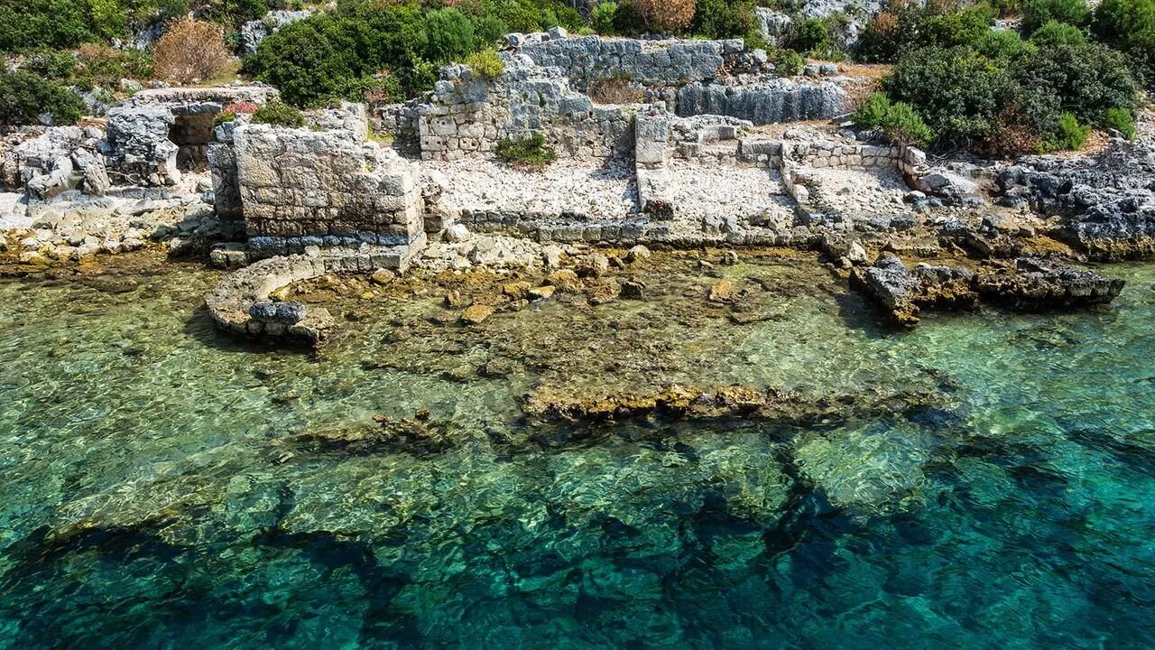
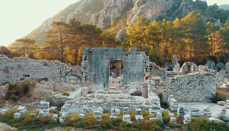
Kumluca and its surroundings have been inhabited since prehistoric times. The region hosted important settlements of the Lycian civilization in ancient times, such as Olympos, Rhodiapolis, Gagai, Corydella, and Idebessos. Rhodiapolis Ancient City, in particular, holds great archaeological significance with its theater, bath, and agora structures dating back to the Roman period. During the Ottoman era, the region was a small village dependent on the Elmalı Sanjak. It maintained its village status in the early years of the Republic and was separated from Finike to become a district in 1958. It developed rapidly after 1980 with agricultural development projects and has now acquired the appearance of a modern district.
Ancient Texture Modern Beauty ( Source: Kumluca Municipality )
Geography and Climate
Kumluca is established on a vast plain extending along the Mediterranean coast, at the foothills of the Beydağları Mountains. The district's area is approximately 1,225 km². While the southern part of the district is coastal, the northern section consists of mountainous areas. The Mediterranean climate prevails in the district, with hot and dry summers and mild and rainy winters. The average annual temperature is 18–20°C, and the precipitation is approximately 1000 mm. The Kumluca Plain, which has fertile agricultural lands, is supported by modern irrigation systems.
Population and Demographics
According to the 2024 Address-Based Population Registration System (ADNKS) data, the population of Kumluca district is 72,114 people. 50.4% of the population are male, and 49.6% are female. The district center and plain villages are areas where the population is concentrated. Inward migration has accelerated, especially with the development of the greenhouse farming and construction sectors. Education and health infrastructure have improved in recent years; there is a vocational college and numerous high schools in the district. The district is one of Antalya's most consistently receiving rural migration centers.
Economy
Kumluca's economy is predominantly based on agriculture. As one of Türkiye's major centers for covered cultivation, the district produces vegetables such as tomatoes, peppers, eggplants, and cucumbers. Greenhouse farming is conducted with modern methods, and products are grown for export. Additionally, citrus and banana cultivation also hold significant importance in the economy. Small-scale livestock farming and beekeeping are also practiced in the district. Tourism is developing thanks to natural beaches and camping areas along the coast, such as Adrasan, Olympos, and Karaöz. The service sector, supported by yacht and nature tourism, becomes active during the summer months.

Gelidonya Lighthouse ( Source: Kumluca Municipality)
Tourism, Culture, and Cuisine
Kumluca is a district rich in cultural and natural heritage. The ancient Lycian cities of Rhodiapolis, Gagai, and Idebessos are attractions for history enthusiasts. Olympos Ancient City and Çıralı Beach are not only historical sites but also have a nature conservation priority as nesting grounds for loggerhead sea turtles (caretta caretta). Adrasan and Karaöz bays diversify tourism with their clean seas and suitability for nature sports. The annual "Kumluca Agriculture and Greenhouse Festival" and traditional camel wrestling are also among the cultural events in the district.
Kumluca cuisine reflects a blend of Mediterranean eating habits and Yörük culture. Olive oil dishes, vegetable dishes, tahini sauces, local soups, and goat milk desserts are prominent flavors. Citrus products and fresh vegetables grown in greenhouses form the basis of the local cuisine.