+2 More
Rhodope Mountains
Location | Bulgaria Greece | ||||||||
|---|---|---|---|---|---|---|---|---|---|
Coordinate(s) | 41°30′N 24°30′E | ||||||||
Highest Point | 2191 m (Golyam Perelik) | ||||||||
Length(s) | 240 km | ||||||||
Area(s) | 14.000 km² | ||||||||
Geological Age | Precambrian | ||||||||
Climate(s) | Transitional between Continental and Mediterranean | ||||||||
Biodiversity | Over 2000 Plant Species, More Than 300 Bird Species | ||||||||
Cultural Groups | Bulgarians, Turks, Pomaks, Greeks | ||||||||
Conservation Status | Natura 2000 Sites UNESCO Candidate Areas | ||||||||
Key Sites | Pamporovo, Trigrad, Shiroka Laka, Perperikon | ||||||||
The Rhodope Mountains (Bulgarian: Родопи Rodopi, Greek: Ροδόπη Rodópi) are among the oldest and geologically most complex mountain systems in Southeastern Europe. Located in the southeastern part of the Balkan Peninsula, this mountain range is significant in terms of natural resources, rich biodiversity, diverse climatic conditions, and cultural heritage. The mountains span both Bulgarian and Greek territories and have historically been influenced by several civilizations, including the Thracians, Romans, Byzantines, and Ottomans, making the region a landscape of both natural and cultural diversity.

Rhodopes in Autumn (Pexels)
The Rhodope Mountains are situated approximately at 41°N latitude and 24°E longitude. Covering the southern part of Bulgaria, the mountains affect four Bulgarian provinces (Smolyan, Kardzhali, Pazardzhik, and Blagoevgrad), while on the Greek side, they fall within the administrative regions of Eastern Macedonia and Thrace. They extend approximately 240 km from east to west and have an average north-south width of 100–120 km. The mountains are bordered by the Thracian Plain to the north, the Rila Mountains to the west, coastal lowlands near the Aegean Sea to the south, and the Western Strandzha to the east. This geographical setting results in the presence of multiple climatic zones, offering a geoecological mosaic with diverse ecosystems.
The Rhodopes are geographically divided into two main regions:
The topography of the Rhodope Mountains includes expansive plateaus, steep valleys, limestone hills, and karst formations. Covering approximately 12% of Bulgaria's territory, this mountain system is one of Europe's oldest and exhibits significant geomorphological diversity.
The Rhodope Mountains are notable for their Precambrian geological formations. The dominant rock types are metamorphic, including gneiss, amphibolite, marble, and schist, spread across extensive areas. Additionally, granitic intrusions and Neogene sedimentary rocks are also observed in certain sections. The Rhodopes are part of a broader geological unit known as the Rhodope Massif, which has a geological history dating back approximately 700 million years. This massif has been shaped by prolonged tectonic processes within the Alpine-Himalayan orogenic belt. Karstic regions within the mountains host landforms such as caves, dolines, uvalas, and poljes resulting from dissolution processes. The karst landscapes around Trigrad and Yagodina hold scientific and touristic importance.
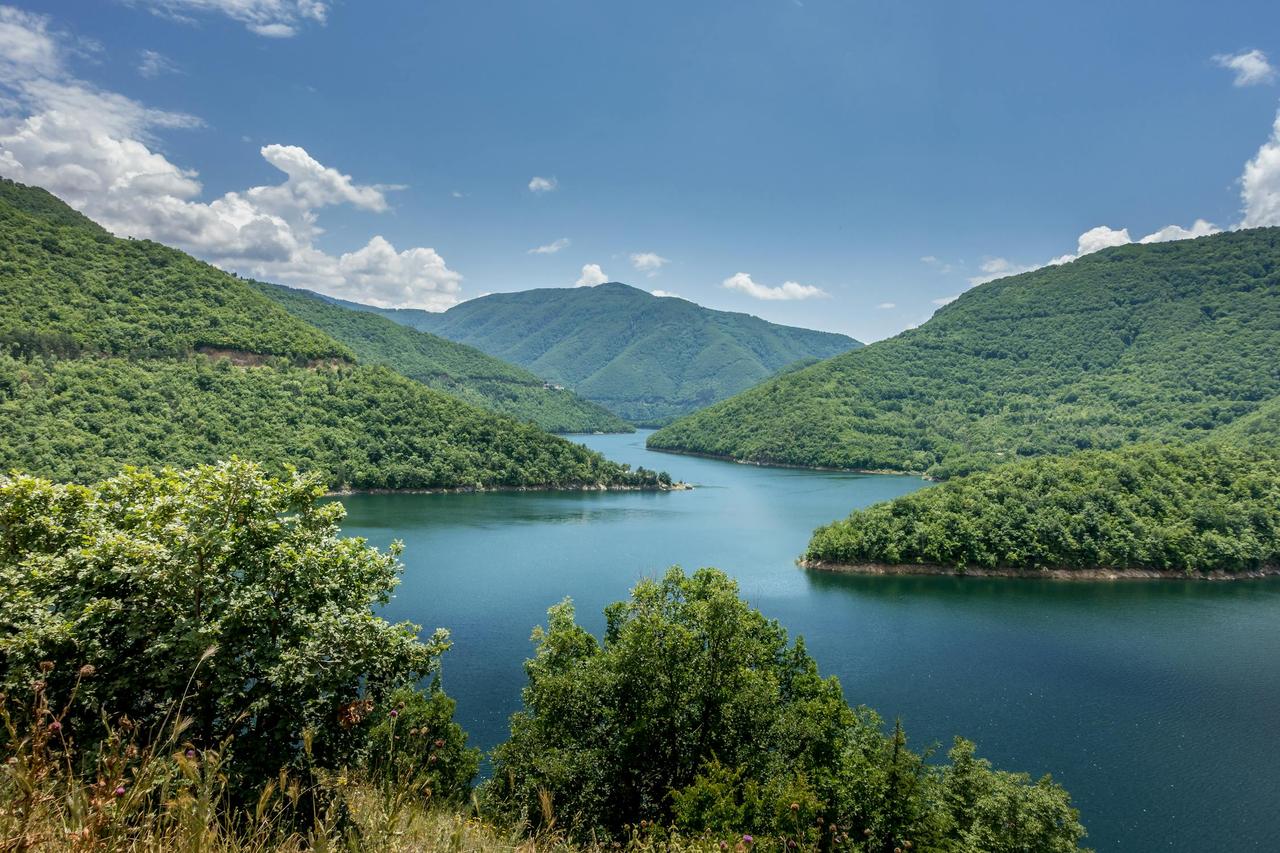
Water resources in the Rhodopes are critical for both natural ecosystems and human settlements. Most of the region's hydrological systems are part of the Maritsa (Meriç) River basin. Major rivers originating from the mountains include the Arda, Vacha, Mesta (Nestos), Dospat, and Chepelare. These rivers display seasonal flow regimes, and several hydroelectric power plants have been constructed along them.
The Rhodopes are also rich in dam reservoirs, including Kardzhali, Studen Kladenets, Dospat, Batak, and Vacha, which are used for drinking water supply, energy production, and irrigation. Glacial-origin small lakes can also be found at higher altitudes.

The Rhodope Mountains Smolyan Lake (Pexels)
The Rhodope Mountains lie within a transitional zone between continental and Mediterranean climates. Due to variations in elevation, orientation, and distance from the sea, microclimatic diversity is pronounced. The Western Rhodopes are generally under the influence of a moist and cool continental climate, while the southern and eastern slopes experience the moderating effects of the Mediterranean climate. The annual average temperature ranges from 6 °C at higher elevations to 13 °C in lower areas. Annual precipitation varies between 600 and 1,400 mm. Snow cover remains for 4 to 6 months in higher areas, which is important for winter sports and ecological cycles.
The Rhodopes represent one of the most floristically rich regions in the Balkans. Over 2,000 vascular plant species have been identified, with approximately 25% being endemic. Oak forests (Quercus spp.) dominate the lower altitudes, while beech (Fagus sylvatica) and black pine (Pinus nigra) are found at mid-elevations. Spruce (Picea abies) and silver fir (Abies alba) dominate the upper zones. A notable relic species is the Rhodope violet (Haberlea rhodopensis), which is endemic to the region and has persisted since the Ice Age, drawing attention in botanical and ecological studies.
The Rhodopes are one of Europe’s most faunistically diverse mountain regions. The area is especially rich in mammals, hosting predators such as brown bear (Ursus arctos), wolf (Canis lupus), lynx (Lynx lynx), and wildcat (Felis silvestris). Over 300 bird species inhabit the region, including rare and endangered species like the cinereous vulture (Aegypius monachus), red kite (Milvus milvus), and golden eagle (Aquila chrysaetos). The region also has high biodiversity in terms of reptiles, amphibians, and insects.
Conservation efforts in the region are actively pursued by both Bulgaria and Greece. On the Bulgarian side, the Golyam Perelik Protected Area, Trigrad Gorge Reserve, and Shiroka Laka Reserve are notable for biodiversity protection. On the Greek side, the Dadia Forest, Nestos River Delta, and several Natura 2000 sites are located. These conservation areas not only protect natural habitats but also preserve traditional land-use systems and the cultural heritage of local communities.
The Rhodopes are home to diverse ethnic and cultural communities. On the Bulgarian side, Bulgarians, Pomaks, and Turks live in the region, while on the Greek side, Greeks, Turks, and Pomaks are present. Settlements generally consist of small villages located in valleys. Prominent urban centers include Smolyan, Kardzhali, Devin, and Zlatograd. Major sources of livelihood include agriculture, forestry, tobacco cultivation, animal husbandry, and handicrafts. Due to the mountainous terrain, large-scale industrialization is limited.

Rhodopes in Winter (Pexels)
The Rhodope Mountains have significant tourism potential due to their natural and cultural assets. Winter sports are prominent, especially in centers like Pamporovo. Sites such as the Trigrad Cave, Yagodina Cave, Shiroka Laka Ethnographic Village, Perperikon Archaeological Site, and Asen Fortress are significant for both nature-based and cultural tourism. The promotion of ecotourism and sustainable tourism activities contributes to the regional economy. Hiking, mountain biking, and wildlife observation have gained popularity in recent years.
Access to the Rhodope Mountains is primarily via road transport. Due to the mountainous terrain, roads are narrow, winding, and often require maintenance. Urban centers such as Smolyan, Devin, and Zlatograd are connected to major highways. Rail transport is limited and mainly provides external regional connections. In recent years, sustainable transport projects and environmentally friendly infrastructure investments have become a focus.
Assenov, Assen. “Environmental Protection and Political Borders: Natura 2000 in the Rhodope Mountains.” Ankara University Journal of Environmental Sciences 5, no. 1 (2013): 49–60. Accessed May 27, 2025. https://dergipark.org.tr/tr/pub/aucevrebilim/issue/40102/477040
Borısova, Bilyana. “Landscape Planning Based on Catchment Basins: A Case Study from Typical Watersheds in the Rhodope Mountains.” Ankara University Journal of Environmental Sciences 5, no. 1 (2013): 13–26. Accessed May 27, 2025. https://dergipark.org.tr/tr/pub/aucevrebilim/issue/40102/477033
Bulgarian Society for the Protection of Birds (BSPB). “Eastern Rhodopes – Nature Conservation Centre.” Accessed May 27, 2025. https://bspb.org/en/nature-conservation-centre-eastern-rhodopes/
Euronews. “A Journey to the Rhodope Mountains to Discover Biodiversity in Bulgaria.” Euronews, December 21, 2021. Accessed May 27, 2025. https://tr.euronews.com/gezi/2021/12/21/bulgaristan-da-biyocesitliligi-kesfetmek-icin-rodop-daglar-na-yolculuk
European Green Belt. “Rhodopes.” European Green Belt. Accessed May 27, 2025. https://www.europeangreenbelt.org/european-green-belt/pearls-of-the-european-green-belt/rhodopes
Milliyet. “The Secrets of Longevity in the Rhodopes!” Milliyet. Accessed May 27, 2025. https://www.milliyet.com.tr/gundem/rodoplar-da-uzun-yasamin-sirlari-2884831
Pexels. "The Vacha Dam Reservoir Has Been Created as a Part of Cascade Development on the Vacha River in Southern Bulgaria..." Photo bu Kiril Gruev. Accessed May 27, 2025. https://www.pexels.com/photo/the-vacha-dam-reservoir-has-been-created-as-a-part-of-cascade-development-on-the-vacha-river-in-southern-bulgaria-vacha-river-one-of-the-main-right-tributaries-of-the-maritsa-is-the-sec-17441820/
Pexels. “An Aerial Photography of Trees on a Snow Covered Ground near the Mountains.” Photo by Vasilis Kavoukis. Accessed May 27, 2025. https://www.pexels.com/photo/an-aerial-photography-of-trees-on-a-snow-covered-ground-near-the-mountains-12149126/
Pexels. “Autumn in the Rhodope Mountains.” Photo by Mehmet Turgut Kirkgoz. Accessed May 27, 2025. https://www.pexels.com/tr-tr/fotograf/sonbahar-rodop-daglari-28912427/
Pexels. “Smolyan Lakes, Bulgaria.” Photo by Janko Ferlič. Accessed May 27, 2025. https://www.pexels.com/photo/smolyan-lakes-bulgaria-28143954/
Wild Rodopi. “Wild Rodopi | Wildlife Research & Biodiversity Conservation.” Wild Rodopi. Accessed May 27, 2025. https://www.wildrodopi.org/rodopi-biodiversity/
Rhodope Mountains
Location | Bulgaria Greece | ||||||||
|---|---|---|---|---|---|---|---|---|---|
Coordinate(s) | 41°30′N 24°30′E | ||||||||
Highest Point | 2191 m (Golyam Perelik) | ||||||||
Length(s) | 240 km | ||||||||
Area(s) | 14.000 km² | ||||||||
Geological Age | Precambrian | ||||||||
Climate(s) | Transitional between Continental and Mediterranean | ||||||||
Biodiversity | Over 2000 Plant Species, More Than 300 Bird Species | ||||||||
Cultural Groups | Bulgarians, Turks, Pomaks, Greeks | ||||||||
Conservation Status | Natura 2000 Sites UNESCO Candidate Areas | ||||||||
Key Sites | Pamporovo, Trigrad, Shiroka Laka, Perperikon | ||||||||
Geographical Location and Boundaries
Regional Division and Topography
Geology and Geomorphology
Hydrography
Climatic Characteristics
Flora and Vegetation Types
Fauna (Animal Diversity)
Protected Areas and National Parks
Demographics and Settlements
Tourism
Transportation and Infrastructure
This article was created with the support of artificial intelligence.