+2 More

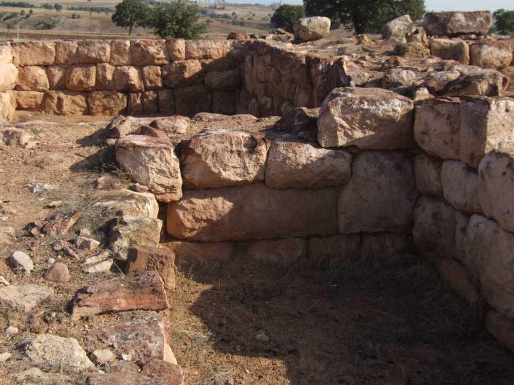
Şapinuva is an archaeological site and ancient city located approximately 3 kilometers southwest of Ortaköy district in Çorum province, and about 53 kilometers from Çorum city center. The ancient city is situated on a plateau descending eastward on the northern slopes of the Özderesi Valley, a tributary of the Çekerek River. The settlement covers roughly 9 square kilometers and is divided into two parts: the lower city and the upper city. Positioned at the end of the Kelkit Valley—one of the entry routes into Anatolia from the Caucasus—Şapinuva held strategic importance.
Şapinuva Archaeological Site (Türkiye Kültür Portalı)
Şapinuva was an important military, religious, and administrative center during the Hittite Empire. It flourished in the first half of the 14th century BCE under Great King Tudhaliya II and his wife, Queen Taduhepa. Hittite records contain correspondence indicating Şapinuva’s high administrative status. A tablet found at Tokat Maşat Höyük provides direct evidence of the city’s military and governance roles. The existence of royal palaces and units such as the army command has been documented in the city.
Şapinuva Archaeological Site (Türkiye Kültür Portalı)
The site was discovered through surface surveys conducted by Prof. Dr. Aygül Süel and Dr. Mustafa Süel in 1988–1989. Excavations began in 1990 and continue under the auspices of Hitit University. The digs focus on two main areas: the Inter-Hill Area and Ağılönü.
This area includes various monumental structures, protective walls, and archive spaces. The so-called A Building is a 2,500 m² symmetrical monumental structure where approximately 4,000 cuneiform tablets and fragments from three different archives were found. These tablets contain administrative, military, religious, and political texts, confirming the reign of Tudhaliya II and Queen Taduhepa here.
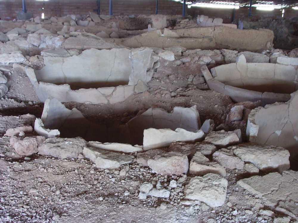
B Building, located 150 meters east, features a ramped double-door entrance and contained about 70 large jars, thought to have been used for commercial purposes. C Building, 120 meters south, is a religious structure divided into three sections. D Building includes a ceremonial hall with carved orthostats and an L-shaped room. A pool believed to be used for ritual purposes was found inside the hall. Additionally, metal workshops dating to the Hittite period were identified in this area.
Approximately 600 meters north of the Inter-Hill Area and surrounded by dry riverbeds, this peninsula-like area has been excavated since 2000. Workshops and shops have been uncovered, including ritual animal-headed jugs. North of Ağılönü, a 12-layered stone-paved area and sacrificial pits for liquid and burning offerings were found. This area is unique in Anatolian archaeology.
Most tablets discovered are written in Hittite, with some in Hattic, Hurrian, and Akkadian. The archives primarily date to the Middle Hittite period (14th century BCE) and include military orders, administrative correspondence, religious texts, and divination documents.
Today, Şapinuva is an accessible destination for both cultural and nature tourism. It lies along the Hittite Way cultural route and is near İncesu Canyon Cultural Park. Together with Hattusa, Alacahöyük, and the Çorum Archaeological Museum, Şapinuva is recommended as part of the Hittite tourism circuit. Visitors typically explore the Inter-Hill and Ağılönü areas.
Anadolu Ajansı. “Şapinuva Antik Kenti Beyaz Örtüyle Kaplandı.” Accessed June 18, 2025. https://www.aa.com.tr/tr/yasam/sapinuva-antik-kenti-beyaz-ortuyle-kaplandi/3475588.
Gerçek, Semih. Cesur, Sevgül Çilingir. “Şapinuva (Ortaköy) Örenyeri.” Türkiye Turizm Ansiklopedisi, 2019. Accessed June 18, 2025. https://turkiyeturizmansiklopedisi.com/sapinuva-ortakoy-orenyeri.
T.C. Kültür ve Turizm Bakanlığı. “Örenyerleri.” Çorum İl Kültür ve Turizm Müdürlüğü. Accessed June 18, 2025. https://corum.ktb.gov.tr/TR-58772/orenyerleri.html.
Türkiye Kültür Portalı. “Şapinuva Ören Yeri - Çorum.” Accessed June 18, 2025. https://www.kulturportali.gov.tr/turkiye/corum/gezilecekyer/sapinuva-orenyeri.
No Discussion Added Yet
Start discussion for "Şapinuva Archaeological Site " article
Historical Significance and Function
Archaeological Discoveries and Excavations
Inter-Hill Area
Ağılönü Area
Linguistic and Cultural Data
Tourism and Current Status
This article was created with the support of artificial intelligence.