


This article was automatically translated from the original Turkish version.
+2 More
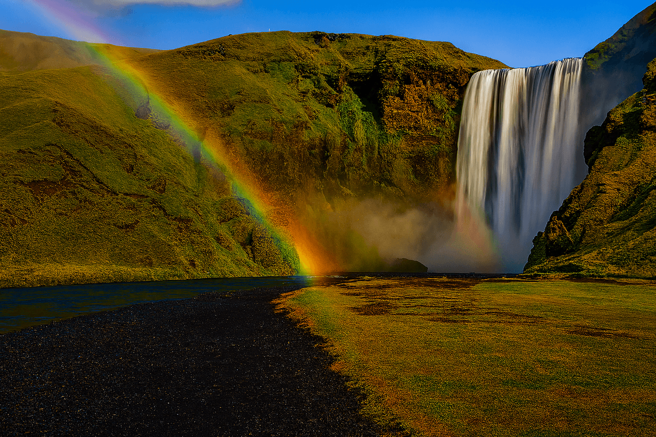
(Generated by artificial intelligence)
Skógafoss Waterfall
Location | Southern Iceland Skógar Village | ||||||||
|---|---|---|---|---|---|---|---|---|---|
Elevation / Width | 62 m / 25 m | ||||||||
Water Source | Skógá River (Fed by Glacial Melt) | ||||||||
Geology | Basalt Lava Flows, Tuff Layers, Volcanic Rocks | ||||||||
Ecosystem | Moss, Lichen, Seabirds and Songbirds | ||||||||
Scientific Importance | Field Studies on Glacial Regime and Volcanic Layers | ||||||||
Skógafoss Waterfall is located just outside the village of Skógar, within the municipal boundaries of Rangárþing eystra in southern Iceland, between the Eyjafjallajökull and Mýrdalsjökull glaciers. The waterfall is fed by the waters of the Skógá River. With a drop of 62 metres and a width of approximately 25 metres, Iceland’s most iconic waterfalls is widely regarded as one of the country’s most emblematic natural features.
Among Iceland’s largest waterfalls, Skógafoss is a remnant of the massive coastal cliff formed when the island’s shoreline receded thousands of years ago. Along this geomorphological transition line, numerous waterfalls occur; however, Skógafoss is the largest and one of the most accessible.
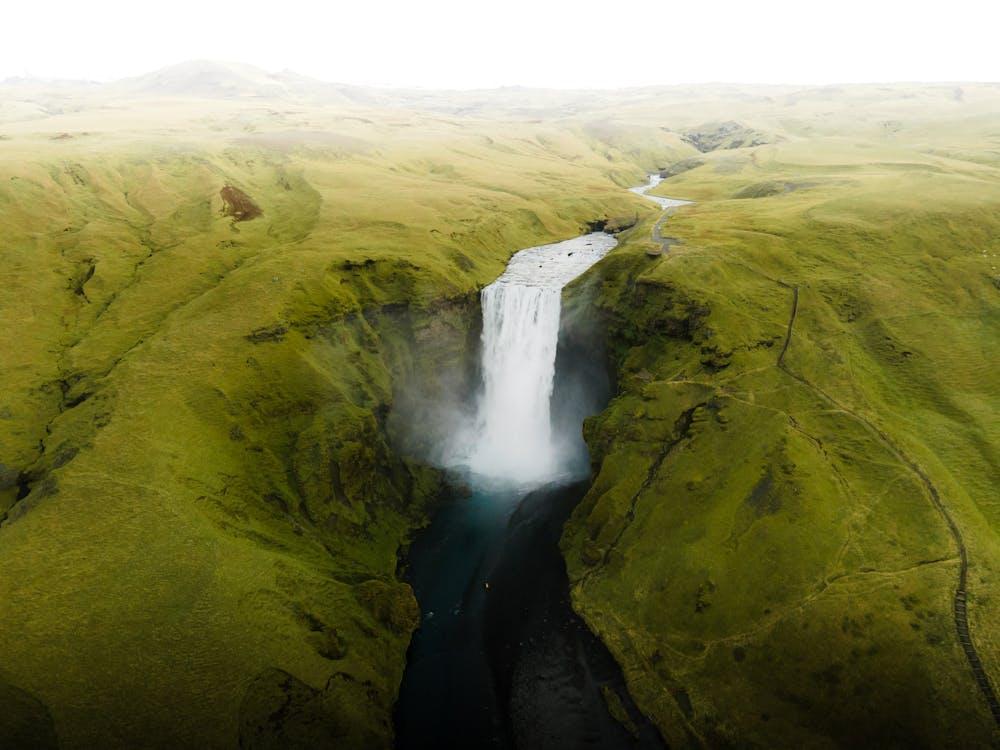
Skógafoss Waterfall (Pexels)
The region where Skógafoss is located has been shaped by active tectonic processes along the Mid-Atlantic Ridge. Surface lava flows, basalt layers and tuff deposits form the foundation of the waterfall’s vertical structure. The area is rich in volcanic rocks, which are resistant to erosion and have enabled the waterfall’s long-term preservation.
Lower strata consist of ancient lava flows, while upper layers contain younger volcanic lavas. The rock structure through which the water cascades allows for vertical flow while maintaining the stability of the surrounding cliff walls.
The Skógá River draws its source primarily from the meltwaters of the Eyjafjallajökull and Mýrdalsjökull glaciers. This ensures a continuous flow throughout the year. During summer months, increased glacial melting raises the river’s discharge, intensifying the water flow over the waterfall. In winter, although water levels decline relatively, Skógafoss maintains a flow regime resistant to freezing.
At the base of the waterfall, a large pool forms from the falling water. Over time, this pool has accumulated sediments and developed deltaic formations around its margins. Additionally, the powerful water drop generates a permanent mist environment, creating distinct microclimatic effects.
The area surrounding the waterfall, especially during summer months, is covered with mosses, lichens, ferns and native grass species. These plants, adapted to subarctic conditions, thrive due to the high humidity generated by the waterfall. Bryophyta (non-vascular plants) are particularly abundant on the rocky surfaces near the falls.
The region is also significant for birdwatchers. Small songbird species, primarily seabirds, nest and forage in the vicinity of Skógafoss. The sound and mist produced by the waterfall create a microhabitat that offers protection from predators.
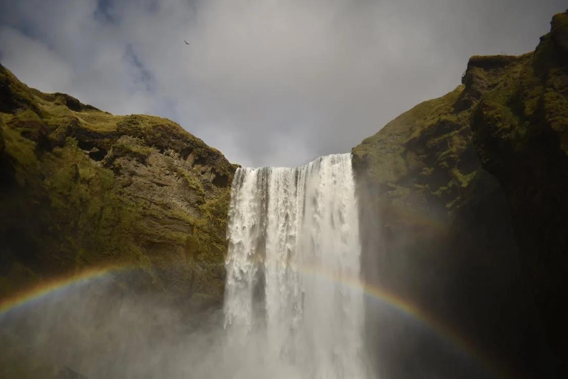
Skógafoss Waterfall (Pexels)
According to Icelandic mythology, the Viking settler Þrasi Þórólfsson is said to have hidden a chest filled with gold behind Skógafoss in a cave. Folklore recounts that a child found a metal ring from the chest, but the chest itself disappeared. It is rumored that the ring was later placed in the Skógar Museum.
Skógafoss holds an important place in Iceland’s intangible cultural heritage. It has frequently appeared as a thematic element in Icelandic folk music, poetry and contemporary visual art. It has also been prominently featured in numerous films and television series (e.g., The Secret Life of Walter Mitty, Game of Thrones).
The waterfall has become one of Iceland’s most popular tourist destinations. Located approximately 150 kilometres from Reykjavík and situated along the country’s main circular route, the “Ring Road (Þjóðvegur 1),” it is easily accessible. Staircases provide access to both the base and the top of the waterfall.
Under conservation policies implemented by the Icelandic Environment Agency (Umhverfisstofnun), the ecological balance around Skógafoss is preserved. Limiting tourist use and directing visitors along designated paths contributes to the sustainability of the natural environment in the area.
The natural structure of Skógafoss enables the formation of double rainbows directly in front of the waterfall, particularly on sunny days. This phenomenon occurs when abundant water mist refracts and reflects sunlight, making it not only a geological feature but also a measurable meteorological event.
Skógafoss has been the subject of numerous ecological and geomorphological studies on Icelandic waterfalls. The dynamics of its meltwater-driven flow regime are of particular importance in the context of global climate change. Furthermore, field studies on Iceland’s volcanic stratigraphy frequently use the lava layers at Skógafoss as reference points.
Drs. L. Malinconico and D. Sunderlin. "Iceland: Geology & Natural History of a Young Island."Lafayette Colllege. Accessed July 16, 2025.https://lafayette-sa.terradotta.com/_customtags/ct_FileRetrieve.cfm?File_ID=040471744F03050504700401731F04010D0F1B7B7608776B7400007273757701027270017A707300
Environment Agency of Iceland. "Access and Management: Skógafoss." Umhverfisstofnun. Accessed July 16, 2025.https://ust.is/english/visiting-iceland/protected-areas/south/skogafoss/access-and-management/
Helgason, H., & Nijssen, B. "LamaH-Ice: LArge-SaMple DAta for Hydrology and Environmental Sciences for Iceland." *Earth System Science Data*. Accessed July 16, 2025.https://essd.copernicus.org/articles/16/2741/2024/
ODYSSEY. "Lunar Landscapes and Geology in Iceland." Odyssey Traveller. Accessed July 16, 2025.https://www.odysseytraveller.com/articles/lunar-landscapes-geology-iceland/
Pexels. "Beyaz Bulutların Altında Yeşil Ve Kahverengi Dağda şelaleler." Pexels. Accessed July 16, 2025.https://www.pexels.com/tr-tr/fotograf/beyaz-bulutlarin-altinda-yesil-ve-kahverengi-dagda-selaleler-3751892/
Pexels. "Skógar, Island." Accessed July 16, 2025.https://www.pexels.com/tr-tr/fotograf/izlanda-peyzaj-manzara-doga-10399171/
Pexels. "Şelale." Accessed July 16, 2025.https://www.pexels.com/tr-tr/fotograf/selale-26586198/
USRA. "Skogafoss Waterfall." *Earth Science Picture of the Day*. Accessed July 16, 2025.https://epod.usra.edu/blog/2013/08/skogafoss-waterfall.html

(Generated by artificial intelligence)
Skógafoss Waterfall
Location | Southern Iceland Skógar Village | ||||||||
|---|---|---|---|---|---|---|---|---|---|
Elevation / Width | 62 m / 25 m | ||||||||
Water Source | Skógá River (Fed by Glacial Melt) | ||||||||
Geology | Basalt Lava Flows, Tuff Layers, Volcanic Rocks | ||||||||
Ecosystem | Moss, Lichen, Seabirds and Songbirds | ||||||||
Scientific Importance | Field Studies on Glacial Regime and Volcanic Layers | ||||||||
No Discussion Added Yet
Start discussion for "Skógafoss Waterfall" article
Geological Formation and Stratigraphic Structure
Hydrological Regime and Dynamics
Biodiversity and Ecosystem Characteristics
Archaeological and Cultural Layers
Tourism, Access and Conservation Policies
Atmospheric Phenomena
Academic Research and Scientific Significance