

This article was automatically translated from the original Turkish version.
+2 More
Location | Kuşdilli Neighborhood Kırşehir Center | ||||||||
|---|---|---|---|---|---|---|---|---|---|
Number of Wells | 12 | ||||||||
Water Temperature | 30.3°C – 57°C | ||||||||
Total Flow Rate | 349.8 L/s | ||||||||
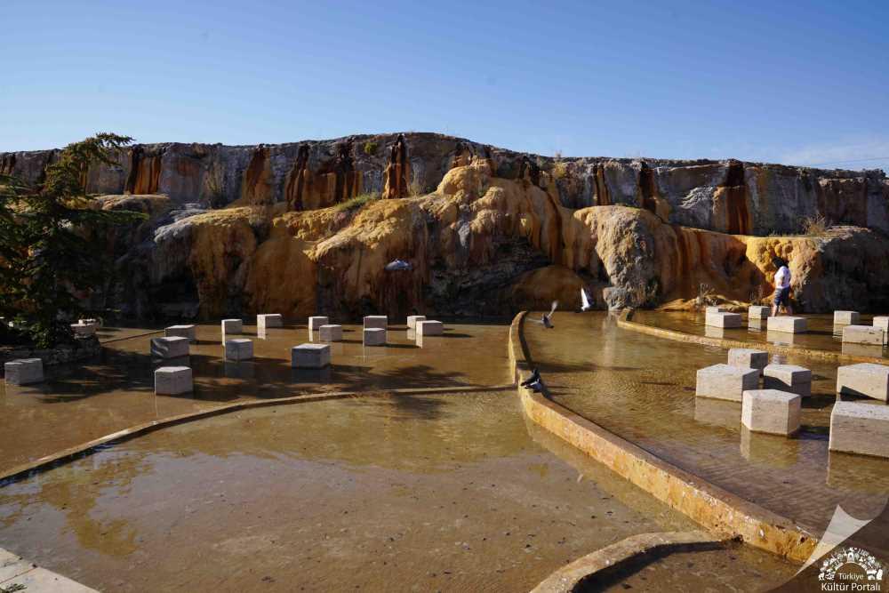
The Terme Hot Springs, located within the boundaries of Kuşdilli Neighborhood in the center of Kırşehir Province, is one of the region’s significant geothermal areas. Situated on the Kırşehir fault complex, this spring is one of the natural sources notable for its temperature and discharge values. The area is utilized for thermal tourism, greenhouse farming, and urban heating.
The Terme Hot Springs are approximately 1 kilometer from the center of Kırşehir city. The geothermal field lies along a fault line that runs through the central part of the province in a north-south direction. While various hot water springs occur along this fault, the highest concentration is found in the Terme Hot Springs area.
Since 1974, a total of 12 wells have been drilled in the area: nine by the General Directorate of Mineral Research and Exploration (MTA) and three by the private sector. Measurements taken on 11 October 2005 revealed water temperatures ranging from 30.3°C to 57°C and discharge rates between 5.2 L/s and 88.5 L/s in wells with depths varying from 92 to 500 meters. The combined discharge of the nine operational wells is 349.8 L/s.
The water from the Terme geothermal field is utilized in three areas:
Karacaer, Serap Serin. "Terme Kaplıcası." In N. Kozak (Ed.), *Online Türkiye Turizm Ansiklopedisi*. Accessed August 16, 2025. https://turkiyeturizmansiklopedisi.com/terme-kaplicasi
Ministry of Culture and Tourism. "Terme Kaplıcası." Kültür Portalı. Accessed August 16, 2025. https://www.kulturportali.gov.tr/turkiye/kirsehir/gezilecekyer/terme-kaplicasi-
T.C. Kırşehir Valiliği. "Kaplıcalar ve Şifalı Sularımız." Accessed August 16, 2025. http://www.kirsehir.gov.tr/kaplicalar-ve-sifali-sularimiz#:~:text=Termal%20Kaynaklar%20ile%20ilgili%20potansiyellerin,Kapl%C4%B1cas%C4%B1%20ve%20Mahmutlu%20Kapl%C4%B1cas%C4%B1%20bulunmaktad%C4%B1r.
Location | Kuşdilli Neighborhood Kırşehir Center | ||||||||
|---|---|---|---|---|---|---|---|---|---|
Number of Wells | 12 | ||||||||
Water Temperature | 30.3°C – 57°C | ||||||||
Total Flow Rate | 349.8 L/s | ||||||||
Geographical Location and Geological Characteristics
Uses