

This article was automatically translated from the original Turkish version.
+1 More
Şahin Kayası
Location | Keşap Türkiye Giresun | ||||||||
|---|---|---|---|---|---|---|---|---|---|
Protection Status | First-Degree Natural Site Area | ||||||||
Characteristic | Formation of the Natural Türkiye Map | ||||||||
Şahin Kayası is located within the boundaries of Armutdüzü Village, Karabulduk Township, in the province of Giresun, Black Sea Region, Türkiye. It is approximately 50 kilometres from the city centre of Giresun and 8–10 kilometres from the district centre of Keşap. Access is possible via public transportation and private vehicles.
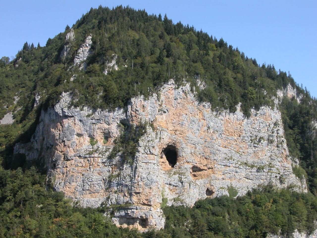
Şahin Kayası is a rock formation notable for its steep and rugged structure. The rocky outcrop, shaped naturally over time by the convergence of vegetation and trees, has acquired a visual resemblance identical to the map of Türkiye. Near the exact centre of this natural map, corresponding geographically to the location of Ankara, a large cave is situated.

Şahin Kayası, Natural Map of Türkiye - Türkiye Culture Portal
The vegetation covering Şahin Kayası has, over time, formed the shape of the map of Türkiye. This natural formation has developed entirely by chance and without human intervention. Due to its elevation and topography, the site hosts multiple micro-ecosystems.
Şahin Kayası was declared a First-Degree Natural Site by the Ministry of Culture and Tourism of the Republic of Türkiye in 2006 and placed under protection. In accordance with its protected status, any construction or environmental intervention within the area is prohibited. Conservation efforts are carried out by relevant public institutions.
Public transportation from the district centre of Keşap provides access to the site, and it is also easily reachable by private vehicle. It is particularly popular among nature enthusiasts and photographers. Visitors engage in activities such as observing the rock formation, photography, and nature walks. The site’s original natural appearance creates a strong visual and symbolic impact on those who visit.
Şahin Kayası and Surroundings Aerial Footage - Tunca, YouTube
Giresun İl Directorate of Culture and Tourism. "Şahin Kayası (Doğal Türkiye Haritasi)." Accessed June 27, 2025. https://giresun.ktb.gov.tr/TR-184101/sahin-kayasi-dogal-turkiye-haritasi.html
Keşap Kaymakamlığı Governorship. "Doğal Türkiye Haritası: Şahin Kayası." Accessed May 27, 2025. http://www.kesap.gov.tr/dogal-turkiye-haritasi-sahin-kayasi
Türkiye Kültür Portalı. "Şahin Kayası - Giresun." Accessed May 27, 2025. https://www.kulturportali.gov.tr/turkiye/giresun/gezilecekyer/sahan-kayasi-dogal-turkiye-haritasi-kesap-lcesi

Şahin Kayası
Location | Keşap Türkiye Giresun | ||||||||
|---|---|---|---|---|---|---|---|---|---|
Protection Status | First-Degree Natural Site Area | ||||||||
Characteristic | Formation of the Natural Türkiye Map | ||||||||
No Discussion Added Yet
Start discussion for "Şahin Kayası - Natural Türkiye Map" article
Physical Geography and Geological Structure
Ecosystem and Natural Formation
Protection Status and Management