


This article was automatically translated from the original Turkish version.
+2 More
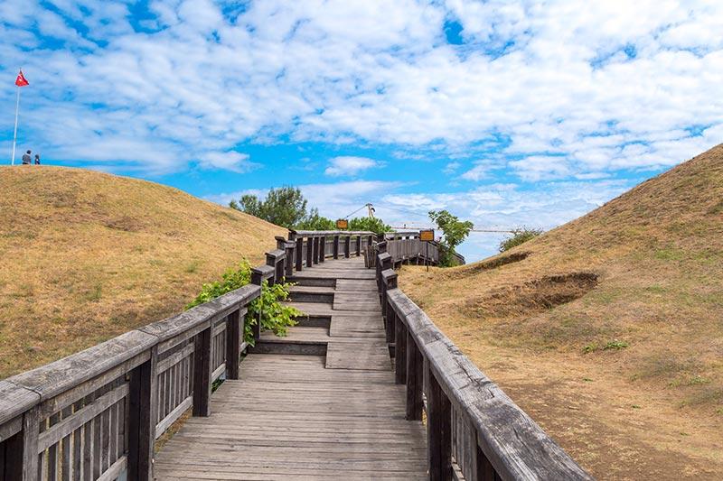
Amisos Hill
Historical Period | 6th century BCE – Byzantine Period | ||||||||
|---|---|---|---|---|---|---|---|---|---|
Founder(s) | Milesians (as a colony) | ||||||||
Settlement Type | Ancient city / Acropolis | ||||||||
Geographical Location(s) | Baruthane Neighborhood Samsun İlkadım District | ||||||||
Surface Feature | Toraman Hill and surrounding elevations | ||||||||
Archaeological Status | Open-air archaeological site | ||||||||
Excavation Start | 1995 (initial discovery) – 2004–2005 (official rescue excavations) | ||||||||
Findings | Tumulus graves, gold jewelry, glass-marble vessels, pottery, tomb architecture | ||||||||
Golden Age | Hellenistic Period (4th–1st centuries BCE) | ||||||||
Prominent Civilization | Kingdom of Pontus (especially the reign of Mithridates VI) | ||||||||
Amisos Tepe, located approximately four kilometers northwest of the city center of Samsun along the Samsun-Sinop highway, is a significant archaeological site that has been continuously inhabited since prehistoric times. In modern times, the area is also known as the “Baruthane Tumuli” and holds a special place in Samsun’s cultural heritage due to its funerary structures dating to the Hellenistic period, necropolis areas, and rich archaeological materials uncovered through excavations.

Amisos Tepe (Türkiye Culture Portal)
The history of Amisos can be divided into four main phases:
During this period, the Milesians constructed fortifications on Toraman Tepe and established upper and lower urban layouts, including religious and public structures.
The Upper City, built on Toraman Tepe, covered an area of approximately 44 hectares. Its elite inhabitants—rulers, priests, and merchants—resided here, while the Lower City to the east was distinguished by its commercial functions. The harbor played a fundamental role in the economic vitality of the settlement.
The burial grounds were located along the eastern, western, and southern slopes of the hill. Excavations have revealed tumuli, sarcophagi, urn graves, and chamber tombs. During road construction in 1995, a tomb was discovered and later excavated scientifically, yielding a large number of finely crafted gold ornaments now known as the Amisos Treasure.

Chamber Tomb (Türkiye Culture Portal)
Excavations initiated in 2004 uncovered Hellenistic-period (330–30 BCE) burial structures beneath two tumuli at the Baruthane site. The tombs, identified as belonging to the Mithridatic dynasty, consist of a three-chambered painted tomb beneath the northern mound and a two-chambered painted tomb beneath the southern mound. These tombs have been opened to the public under the supervision of the Ministry of Culture and Tourism, through a joint project of the Samsun Museum and Istanbul University.
Amisos experienced its golden age particularly during the reign of Mithridates VI, becoming a major center of culture, art, and economy. Coin mints and ceramic workshops from the period attest to the city’s wealth and cultural productivity. Symbols found in burial artifacts further illuminate the artistic and symbolic worldview of the era.
Today, Amisos Tepe has been developed as an open-air museum and enhanced with landscape design to become a tourist attraction. Visitors reach the summit via cable car or road, and can acquire historical knowledge while enjoying panoramic views of the city through amenities such as the Amisos Café and souvenir shops.
Although some chamber tombs remain closed to visitors due to collapse risks, the site remains one of the primary locations preserving Samsun’s historical identity through its archaeological and cultural significance.
Karadeniz Turizm Rehberi. "Amisos Antik Kenti ve Nekropol Alanı." Karadeniz.gov.tr. Accessed May 24, 2025. http://karadeniz.gov.tr/amisos-antik-kenti-ve-nekropol-alani/#prettyPhoto.
Ministry of Culture and Tourism of the Republic of Türkiye. "Amisos Tepesi." *Kültür Portalı*. Accessed May 24, 2025. https://www.kulturportali.gov.tr/turkiye/samsun/gezilecekyer/amisos-tepesi.
T.C.Samsun Büyükşehir Municipality. "Amisos Tepesi Tümülüs Mezarı ve Ziyaretçi Seyir Terası." *Samsun.bel.tr*. Accessed May 24, 2025. https://samsun.bel.tr/proje/amisos-tepesi-tumulus-mezari-ve-ziyaretci-seyir-terasi-130.
T.C.Samsun Valiliği Directorate of Culture and Tourism. "Amisos Tepesi." T.C. Samsun Governorship – Provincial Directorate of Culture and Tourism. Accessed May 24, 2025. https://samsun.ktb.gov.tr/TR-216747/amisos-tepesi.html.
T.C.Samsun Valiliği. "Amisos Tepesi Kral Mezarları." Samsun.gov.tr. Accessed May 24, 2025. http://www.samsun.gov.tr/amisos-tepesi-kral-mezarlari.
Türkiye Turizm Ansiklopedisi. "Amisos Tepesi." *TurkiyeTurizmAnsiklopedisi.com*. Accessed May 24, 2025. https://turkiyeturizmansiklopedisi.com/amisos-tepesi.

Amisos Hill
Historical Period | 6th century BCE – Byzantine Period | ||||||||
|---|---|---|---|---|---|---|---|---|---|
Founder(s) | Milesians (as a colony) | ||||||||
Settlement Type | Ancient city / Acropolis | ||||||||
Geographical Location(s) | Baruthane Neighborhood Samsun İlkadım District | ||||||||
Surface Feature | Toraman Hill and surrounding elevations | ||||||||
Archaeological Status | Open-air archaeological site | ||||||||
Excavation Start | 1995 (initial discovery) – 2004–2005 (official rescue excavations) | ||||||||
Findings | Tumulus graves, gold jewelry, glass-marble vessels, pottery, tomb architecture | ||||||||
Golden Age | Hellenistic Period (4th–1st centuries BCE) | ||||||||
Prominent Civilization | Kingdom of Pontus (especially the reign of Mithridates VI) | ||||||||
Historical Development
Urban Structure and Archaeological Finds
Baruthane Tumuli
Socio-Cultural and Economic Structure
Current Status