This article was automatically translated from the original Turkish version.
Front systems are defined as transition zones formed by the collision of air masses with different physical properties. In these zones, significant changes in meteorological variables such as temperature, humidity, density, and wind are observed over short distances. Fronts are among the primary determinants of atmospheric phenomena, especially in mid-latitudes.
The concept of fronts was developed within the framework of air mass theory and is one of the fundamental building blocks of synoptic meteorology. On surface analysis maps, fronts represent boundaries between air masses and enable the tracking of atmospheric circulation. Vertical motions developing along these boundaries play a critical role in the formation of weather events.
Fronts are three-dimensional structures that extend not only horizontally but also through the lower and upper levels of the atmosphere. Therefore, front systems are evaluated using surface data alongside upper-level wind and temperature analyses. This approach ensures a more accurate understanding of the true impact of fronts.
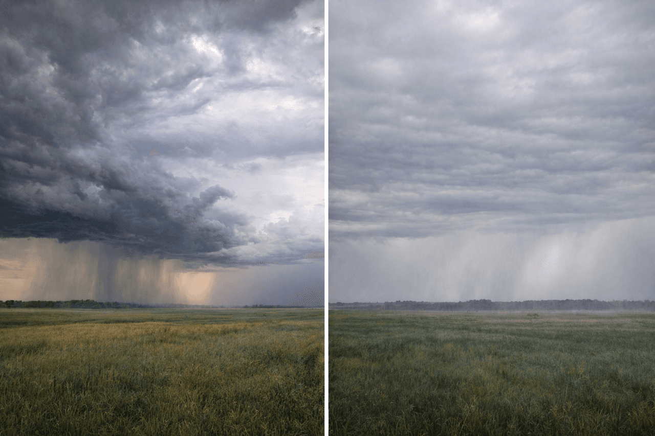
Front formation primarily arises from differences in density and temperature between air masses. The denser air mass forces the lighter air mass to rise, generating vertical air motions along the front line. These vertical motions initiate cloud formation and precipitation processes.
Air rising along the front line cools adiabatically and begins to condense once it reaches saturation. This process leads to more pronounced cloud development, particularly in air masses with high moisture content. The type of weather event caused by fronts depends on the rate of ascent and the prevailing moisture conditions.
Wind fields and pressure distributions are decisive factors in front development. Changes in the direction and speed of surface and upper-level winds can strengthen or weaken fronts. Therefore, front formation is regarded as a natural consequence of atmospheric circulation.

Intersection of air masses (Generated by artificial intelligence).
Cold fronts form when a cold air mass advances into a warmer air mass. The denser cold air rapidly forces the warm air upward, leading to the development of strong vertical motions. This characteristic is the key feature distinguishing cold fronts from other front types.
During cold front passage, abrupt drops in temperature, noticeable shifts in wind direction, and increases in pressure are observed. This front type is typically associated with short-lived but intense precipitation and storms. Convective clouds are the characteristic cloud type of cold fronts.
The impact of cold fronts is usually confined to a narrow area, but its effects are felt rapidly. After the front passes, the atmosphere tends to become more stable. This makes cold fronts distinctly identifiable in weather forecasting.
Warm fronts form when a warm air mass slowly rises over a colder and denser air mass. This upward motion produces widespread and prolonged cloudiness and precipitation. Warm fronts are generally associated with more tranquil atmospheric conditions.
Before a warm front arrives, cloudiness increases gradually from upper levels downward. Precipitation is typically light and can persist for extended periods. Temperature rise occurs slowly and steadily during the front passage.
This front type causes the development of layered cloud structures in the atmosphere. Warm fronts play a significant role in the formation of large-scale precipitation systems and are closely monitored in long-range weather forecasting.
Occluded fronts form when a cold front catches up with a warm front. In this scenario, the warm air mass is completely lifted off the surface, severing its contact with the ground. Occluded fronts are commonly observed during the mature stage of mid-latitude cyclones.
This front type can exhibit characteristics of both cold and warm fronts. Precipitation may spread over broad areas, creating complex atmospheric structures. Occluded fronts provide important clues in the analysis of synoptic-scale weather systems.
Stationary fronts occur when two air masses show little relative movement. This front type can remain over the same region for extended periods, causing continuous cloudiness and intermittent precipitation. Stationary fronts are among the primary causes of prolonged rainfall events.
Weather conditions: occluded and stationary boundaries (Generated by artificial intelligence).
Front systems directly influence precipitation patterns, temperature variations, and wind patterns. The position and speed of front movement are fundamental factors in determining regional weather conditions. These impacts extend from short-term weather events to seasonal systems.
Fronts are also regions where energy and moisture transport occur in the atmosphere. These transport processes are directly linked to the development of mid-latitude cyclones. Such synoptic-scale systems cannot form without front systems.
Front analysis is a fundamental method in meteorological forecasting. Accurate identification of fronts on surface and upper-level maps enhances the accuracy of weather forecasts. Therefore, front systems hold a central position in the applied fields of meteorology.
Bjerknes, J. “On the Structure of Moving Cyclones.” *Monthly Weather Review* 47, no. 2 (1919): 95–99. https://doi.org/10.1175/1520-0493(1919)47
Boutle, I. A., R. J. Beare, S. E. Belcher, A. R. Brown, and R. S. Plant. “The Moist Boundary Layer under a Mid-Latitude Weather System.” *Boundary-Layer Meteorology* 134 (2010): 367–386. https://doi.org/10.1007/s10546-009-9446-6
Holton, James R., and Gregory J. Hakim. *An Introduction to Dynamic Meteorology.* 5th ed. Amsterdam: Elsevier, 2013. https://books.google.com.tr/books?
Orlanski, I., B. Ross, L. Polinsky, and R. Shaginaw. “Advances in the Theory of Atmospheric Fronts.” *Advances in Geophysics* 28, Part B (1985): 223–252. https://doi.org/10.1016/S0065-2687(08)60190-9
Wallace, John M., and Peter V. Hobbs. *Atmospheric Science: An Introductory Survey.* 2nd ed. Amsterdam: Elsevier Academic Press, 2006. https://books.google.com.tr/books?hl=t
No Discussion Added Yet
Start discussion for "Front Systems (Meteorology)" article
Front Formation Mechanisms
Cold Front Systems
Warm Front Systems
Occluded and Stationary Fronts
Meteorological and Practical Impacts of Front Systems