This article was automatically translated from the original Turkish version.
Obruklar are sudden, typically circular depressions in the Earth’s crust formed as a result of karst processes. These natural phenomena develop through the interaction of numerous geological, hydrogeological, climatic, and anthropogenic factors. Obruklar are among the geological hazards that pose significant environmental and socio-economic risks. In Türkiye, particularly in regions such as the Konya Closed Basin that are vulnerable to excessive and irregular use of water resources, the formation of obruklar has increased markedly in recent years.
An obruk is a karst landform created when soluble rocks (limestone, dolomite, gypsum, etc.) dissolve through interaction with groundwater, leading over time to the collapse of voids. Karstification develops in response to multiple factors including lithology, structural geology, water chemistry, groundwater level, climatic conditions, and vegetation cover.
Ford and Williams (2007) explain the formation of karst depressions through three primary mechanisms: solution, collapse, and suffosion.
This type of obruk forms as groundwater chemically dissolves karstic rocks—particularly limestone, dolomite, and gypsum—over time. The pH, temperature, and dissolved carbon dioxide content of the water are the main factors enhancing dissolution. This process begins at the surface and leads to the enlargement of voids within the rock. Over time, the material covering these voids becomes thinner and more susceptible to collapse. It exhibits slow and superficial development.
Example: Common in carbonate-rich İnsuyu Formation deposits within the Konya Closed Basin.
This type occurs when the roof of a pre-existing cavity—formed by prior dissolution—collapses suddenly under the weight of the overlying rock or cover material. In areas with thick, cohesive (high clay content) cover layers, collapse obruklar can form without any surface warning signs.
Example: Collapse obruklar observed in İnoba Village, Konya-Karapınar, are representative of this type.
This mechanism operates through the gradual downward transport of unconsolidated cover material—such as sand or silt—into fractures and voids beneath the surface. Over time, this slow process results in surface depressions that gradually increase in diameter. This type of obruk is typically observable from the surface and can be monitored using early warning systems.
Example: Surface subsidence features observed between Kaşınhanı (Konya) and Çumra are of this type.
The Upper Miocene–Pliocene İnsuyu Formation in the Konya Closed Basin consists of karst-susceptible rocks such as limestone and dolomite. These rocks are prone to dissolution through groundwater movement, increasing the risk of collapse. Additionally, fault lines associated with the Neotectonic period explain the widespread occurrence of fracture and void systems that form the geological foundation for obruk formation.
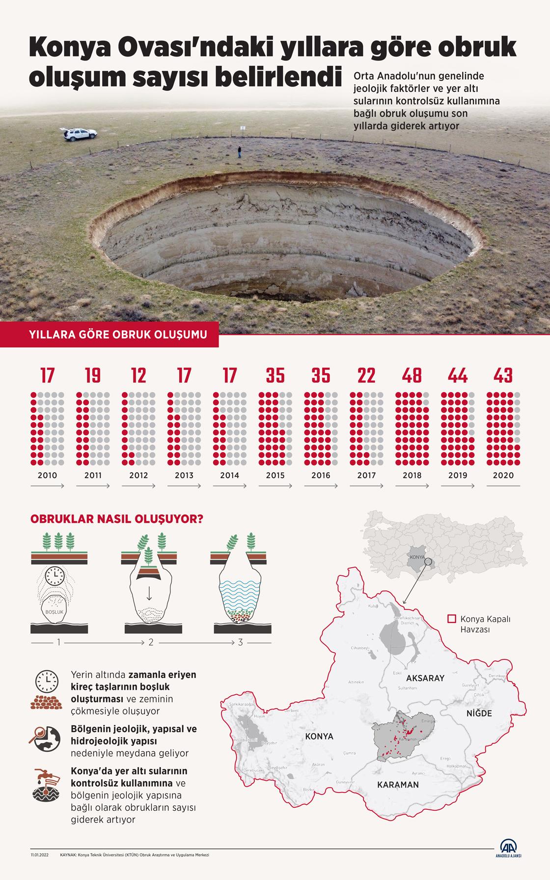
Figure: Number of Obruk Formations in the Konya Plain by Year (Anadolu Agency)
In Türkiye, obruklar are concentrated primarily in inland provinces such as Konya, Karaman, Aksaray, and Niğde. However, they also occur along the Mediterranean coast (Antalya, Mersin), the Aegean region (Denizli, Manisa), the southern part of the Eastern Black Sea region, and Southeastern Anatolia. The Konya Closed Basin (KKB) is one of the areas where obruk formation is most frequently observed, due to both its geological structure and excessive groundwater use.
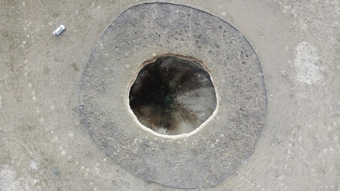
Example of an Obruk (Anadolu Agency)
Obruk formation is not limited to natural conditions. Excessive and uncontrolled groundwater extraction due to intensive agricultural activities has led to a decline in the water table. This situation facilitates the easier collapse of soluble rock layers.
Since the 2000s, there has been a dramatic increase in the number of obruklar identified in the region. As of 2021, over 700 obruklar with diameters exceeding one meter and approximately 1,850 shallow subsidence-type obruklar have been recorded in the vicinity of Konya.
Obruk formation in the Konya Plain was rare between the 1920s and 2000s. However, a significant increase has been observed since 2010. While a total of 95 obruklar were recorded between 1920 and 2009, this number rose to 309 during the single decade of 2010–2020. In 2020 alone, 1,742 previously undetected new obruklar were identified. Thus, the total number of obruklar documented in the Konya Closed Basin to date is 2,240.
In Türkiye, obruklar formed due to karstic structures are concentrated primarily in the Central Anatolia and Mediterranean regions. These landforms arise when groundwater dissolves soluble rocks such as limestone and gypsum, creating voids that eventually collapse. These natural structures are not only geologically significant but also carry environmental risks. The main obruklar in Türkiye are as follows:
Konya is the province in Türkiye with the highest concentration of obruk formation. Over 2,000 obruklar have been identified in the Konya Closed Basin and surrounding areas of Karapınar. Both natural processes and human-induced factors such as declining groundwater levels accelerate obruk formation in this region.
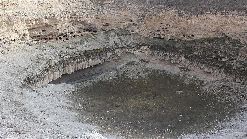
Çıralı Obruk (Anadolu Agency)
In the Mediterranean region, Mersin province features striking karstic obruklar formed by the dissolution of limestone.
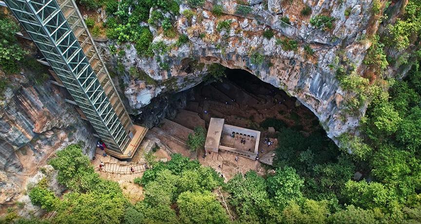
Cennet and Cehennem Obruklar (Anadolu Agency)
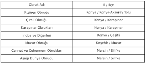
Table of Obruklar and Their Locations (Generated by Artificial Intelligence.)
Anadolu Ajansı. “Konya Ovası’ndaki Yıllara Göre Obruk Oluşum Sayısı Belirlendi.” *AA*, February 25, 2022. https://www.aa.com.tr/tr/cevre/konya-ovasindaki-yillara-gore-obruk-olusum-sayisi-belirlendi/2470651.
Anadolu Ajansı. “Tarihi ve Doğal Güzelliğin Buluştuğu Mekân: Obruk Hanı.” AA, February 25, 2018. https://www.aa.com.tr/tr/yasam/tarihi-ve-dogal-guzelligin-bulustugu-mekan-obruk-hani/1075931.
Ertek, T. Ahmet. "Obruk Platosu'nda Devam Eden Obruk Oluşumları." TÜBİTAK Bilim ve Teknik Dergisi 42, no. 644 (October 2009): 66–71. Accessed July 7, 2025. https://services.tubitak.gov.tr/edergi/yazi.pdf;jsessionid=4zJkp5TlfZ7q049nja680M66?dergiKodu=4&cilt=42&sayi=644&sayfa=66&yaziid=28442.
Konya Teknik University. "Jeoloji Mühendisliği Bölümü." Accessed July 4, 2025. https://www.ktun.edu.tr/tr/Birim/Index/?brm=LI4ZaR6VzKx3bmsGxi2H4w==.

Obruk and the Karstification Process
1. Solution Obruk
2. Collapse Obruk
3. Suffosion Obruk
Geological Basis of Obruklar in the Konya Closed Basin
Distribution of Obruklar in Türkiye
Anthropogenic Impacts and Increase in Obruk Formation
Increase in Obruk Formation in the Konya Plain Over Time
Main Obruklar in Türkiye and Their Locations
Konya
Kırşehir
Mersin