This article was automatically translated from the original Turkish version.
+1 More
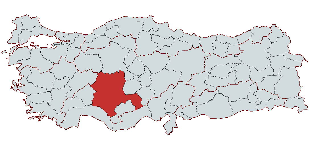
Konya (province)
Country | Türkiye | ||||||||
|---|---|---|---|---|---|---|---|---|---|
Region(s) | Central Anatolia Region | ||||||||
Population | 2,330,024 | ||||||||
Area(s) | 38 873 km² | ||||||||
Climate(s) | Continental Climate | ||||||||
Important Structure(s) | Aya Elenia Kilisesi Çatalhöyük Neolithic-Ancient City Rüstem Paşa Kervansarayı Mevlana Museum Şems-i Tebrizi Türbesi ve Camisi | ||||||||
Area Code(s) | 332 | ||||||||
License Plate Code | 42 | ||||||||
Governor(s) | İbrahim Akın | ||||||||
Konya, located in the Central Anatolia Region of Türkiye, has stood out throughout history as a place area that has been home to various civilizations house and important a city. Historical process has been one of Anatolia’s key cultural and administrative centers, geographically situated at the heart of Central Anatolia and historically serving as a vital crossroads. Konya’s history extends back to Neolithic Period, and during this period the city has preserved traces of numerous civilizations. Konya became an important cultural and political center as the capital of the Seljuk State of Anatolia and also left a profound cultural legacy through the influence of religious and intellectual figures such as Mevlâna Celâleddîn-i Rûmî like. The city bears witness to major historical transformations through its historical structures and cultural richness.

Konya’s history extends back to the Neolithic Era, and the city and its surroundings possess a rich archaeological heritage as one of the earliest settlement areas. The oldest settlement traces in the city have been uncovered at important mounds such as Çatalhöyük. Çatalhöyük, dated to the 7000s BCE and recognized as one of the world’s earliest settlements, has yielded significant findings in terms of early architecture and religious structures. During this period, Konya and its surroundings hosted Neolithic, Chalcolithic and Early Bronze Age settlements, and excavations in these areas have revealed important settlement remains.
Throughout history, Konya has come under the rule of many different civilizations. Around 2000 BCE, the Hittites captured Konya and constructed significant structures in the city. Following the Hittites, the Phrygians and Lydians gained control, with the Phrygian presence particularly strengthening the city’s cultural印记. In 546 BCE, the Persians took over Konya and its surroundings, and subsequently in 334 BCE the region came under the rule of Alexander the Great. After Alexander’s death, Konya changed hands between the Seleucid Empire, which inherited the legacy of the Alexander’s empire, and the Kingdom of Bergama. During the Roman Empire, the city entered a major phase of development and became an important cultural and commercial center within the expanding territories of Rome.
After the division of the Roman Empire, Konya became part of the Byzantine Empire and evolved into a significant military and religious center during the Byzantine period. From the 7th century onward, Arab raids led to Konya being captured by together and Umayyads and falling under short period Arab rule. However, following the Battle of Manzikert in 1071, the Seljuk Turks began settling in Anatolia and captured Konya in 1074. This conquest fundamentally transformed the city’s cultural, political and economic structure. When the Seljuk State moved its capital from İznik to Konya, the city became one of Anatolia’s most important capitals. During the Seljuk period, Konya experienced major cultural and scientific advancement and became a world scale culture center under the influence of great thinkers such as Mevlâna Celâleddîn-i Rûmî.
From the mid-13th century onward, due to the weakening of the Seljuk State and the Mongol invasions, Konya came under the control of the Ilkhanids. However, in 1327, Konya was captured by the Karamanids and came under the rule of a duration Karamanid dynasty. Ottoman rule began in 1466 with the incorporation of Konya into the Ottoman Empire. During the Ottoman period, Konya functioned as an important administrative center and a beylik capital and remained significant in cultural and religious activities. With the advent of the Republic, Konya continued its rapid development and became an important city both economically and culturally.
Konya’s geographical structure is rich and diverse in terms of both natural and geological features. Located in the interior of the Anatolian Peninsula, Konya is a region surrounded by high plateaus and is Türkiye’s largest province by area. The city lies in the southern part of the Central Anatolia Region, and its geographical relationships with neighboring provinces in this region are important factors influencing both climate and plant cover.
Konya is situated at 37.87° latitude and 32.50° longitude. The city borders Ankara and Afyonkarahisar and Eskişehir to the north, İçel, Karaman, Antalya to the south, and Niğde and Aksaray to the east. Thanks to this geographical location, Konya is one of the key junctions of black routes and has been historically an important settlement area.
Konya’s topography is largely defined by the elevated plateaus of Central Anatolia and the surrounding mountains. The city lies mostly in an area shaped by volcanic and tectonic influences. The Konya Plain is geologically interesting, featuring mountains formed by ancient volcanic activity, lake remnants and rivers. The southern part of the Taurus Mountains within Konya’s provincial boundaries is one of the most important volcanic areas in the region. High areas such as the Bozdağlar and Karacadağ mountains form the region’s characteristic elevations.
The soil structure of the Konya Plain is generally composed of alluvial soils, with sediment deposits from lake beds increasing the depth of the plain’s soils. In the city, rock units such as limestone, marl, claystone and volcanic tuff are commonly found as common.
The mountains in Konya’s geography generally extend in a east-west direction. The Bozdağlar and Sultan Mountains occupy significant positions along the northern and southern boundaries of the province. At the foothills of these mountains lie broad plateaus such as the Obruk and Cihanbeyli plateaus. These plateaus are large areas formed by volcanic activity and tectonic movements. The Obruk plateau is known for its karstic features developed on limestone layers, and its largest sinkhole is the Kızören Obruğu.
Within Konya’s provincial boundaries, various lakes and rivers are found. One of the best-known lakes is Salt Lake; it is Türkiye’s second-largest lake by surface area, with most of its water being saline and used economically for salt production. Beyşehir Lake is Türkiye’s largest freshwater sweet water lake and provides an important area for water sports and other activities.
In Konya, irrigation water sources and groundwater reserves, which exhibit characteristics typical of a desert climate, are of great importance. Groundwater is extensively used for irrigation on the plain and this situation enhances the productivity of agricultural lands.
Konya lies under the influence of a continental climate. Summers are hot and dry, while winters are cold and snowy. Precipitation generally occurs in spring in the form of convective rainfall, affecting the region’s irrigation needs. Konya is one of Türkiye’s least rainy provinces, with annual precipitation ranging between 285 mm and 731 mm. In higher mountainous areas, particularly in the Taurus Mountains, a more humid climate is observed.
Konya’s vegetation cover is weak and steppe-like due to the arid climate. In the plains, drought-resistant plants dominate, while shrubs and forested areas are found on mountain slopes. Additionally, some marsh and lake areas host water-loving plants. In mountainous regions, forests consisting of Juniperus excelsa and Quercus species are found at elevations of 1000–1300 meters.
Konya’s geography has been shaped by various climatic and geological factors and offers important areas for agriculture and livestock farming. The volcanic mountains, lakes and rivers in the region contribute to Konya’s ecological diversity.
Konya, located in Türkiye’s Central Anatolia Region, has a large economic structure in which agriculture, industry and the service sector are key components. According to 2017 data, 25.8% of employment in Konya is in agriculture, 28.3% in industry and 45.9% in services. Konya has a slightly lower per capita gross domestic product than the national average, with a per capita GDP of $9,594 recorded in 2014. This reflects the city’s economic size and sectoral distribution. The agricultural sector stands out primarily in cereal production, while row fruit and vegetable farming are also practiced. Konya has extensive agricultural land, and significant amounts of wheat, barley and sugar beet are produced on irrigated land. In addition, livestock farming is one of the city’s important livelihood sources.
Konya’s industrial sector is highly diverse, concentrating in areas such as automotive spare piece, agricultural machinery, plastic, food and metal industries. With nine organized industrial zones, 48 small industrial sites and 10 special industrial areas, its industrial infrastructure is strong and employs 121,611 people. The industrial sector holds a significant share in Konya’s economy and has considerable production capacity, particularly in food products and textiles. Additionally, mineral deposits contribute to the economy. Minerals such as aluminum, chromium, marble and coal are among the resources enhancing the province’s industrial potential.
Konya’s foreign trade is also a significant economic activity area. In 2017, exports amounted to approximately $1.5 billion, with a high export-to-import ratio. China and USA are among the main countries to which Konya exports, and trade volume with these countries increases annually. In addition, metal ores, aluminum and steel products are prominent sectors in Konya’s foreign trade.
Konya, located in Türkiye’s Central Anatolia Region, holds an important position not only as the country’s largest province by area but also in terms of population. With a population of approximately 2.2 million, Konya is Türkiye’s seventh most populous city. Its demographic structure reflects a dynamic contrast between urban and rural lifestyles. The urban center has a younger, more concentrated population influenced by industrial and educational opportunities, while the rural population maintains more traditional ways of life.
Konya’s demographic structure is also notable in terms of age and gender distribution. Half of the population is under 29.9 years of age, indicating a youthful demographic profile. In 2014, Konya’s median age was determined to be 29.9, compared to 30.7 for Türkiye as a whole. Additionally, Konya’s elderly population ratio rose to 8.3% in 2014, slightly below the national average.
Konya’s population is rapidly concentrating in city centers. The main reasons include developing industry, university opportunities and improved living standards. Urban centers attract young and skilled labor, while rural areas lag behind in many aspects and experience population loss. Particularly in the southern and western districts of Konya, the elderly population is higher and the youth population is declining rapidly.
Another important aspect of Konya’s demographic structure is migration. Konya both receives and sends migrants. Between 2013 and 2014, the largest number of migrants came to Konya from Ankara, Istanbul, Antalya and Karaman. The majority of migrants are young people, particularly those aged 20–24, who prefer Konya.
Population growth and change in the city are directly linked to investments in industry, agriculture, education and cultural activities. Konya’s advancement in industry and education has turned it into a gravity center attracting migrants and young populations. However, some rural areas in the city are losing their youth due to deficiencies in education and infrastructure, leading to population aging in these regions.

Mevlana Museum: One of Konya’s most important symbols, the Mevlana Museum houses the tomb of the great 13th-century Islamic thinker Mevlana Celaleddin Rumi. Mevlana’s teachings formed the foundation of the Mevlevi Order, and this museum displays many important artifacts and manuscripts related to his life. The building, bearing Seljuk architectural elements, has served for centuries as a religious and cultural center.
Aya Eleni Church: Located in Konya’s historic center, Aya Eleni Church is a significant structure from the Byzantine period. Converted into a mosque in the 19th century, the church preserves mosaics and frescoes that offer visitors insight into the region’s historical diversity. This structure stands out as a valuable historical heritage reflecting Konya’s multicultural past.
Ince Minareli Medrese: A Seljuk-era structure, the Ince Minareli Medrese is one of Konya’s most striking historical buildings. It is renowned for its intricate stone craftsmanship and elegant architecture. Today housing the Konya Stone and Carpet Museum, this medrese is an important site for those wishing to understand Seljuk art and science.
Sultan Selim Mosque: Built in the 15th century by Ottoman Sultan I. Selim, Sultan Selim Mosque is one of Konya’s important Ottoman structures. This mosque, an elegant example of Ottoman architecture, contains the sultan’s tomb. Its architecture and interior decorations reflect the artistic sensibilities of the period.
Alaaddin Hill and Castle: One of Konya’s highest points, Alaaddin Hill is both a historical castle and a vantage point offering panoramic views of the city. The Alaaddin Mosque and Alaaddin Tomb on the hill are among the important religious structures preserving Seljuk heritage. This hill provides a deep perspective on Konya’s history.
Çatalhöyük: Located within Konya’s provincial boundaries, Çatalhöyük is recognized as one of the world’s earliest settlements. This Neolithic-era ancient settlement was discovered in the 1960s. Excavations have revealed significant traces of prehistoric cultures in the region. Çatalhöyük holds great importance for researchers seeking to understand prehistoric civilizations.
Eflatun Pınar Monument: Located in Konya’s Karapınar district, the Eflatun Pınar Monument is an important historical structure belonging to the Phrygians. This monument houses a large rock sculpture offering key insights into the religious beliefs of the ancient Phrygian people. Eflatun Pınar is an impressive site both historically and in terms of its natural surroundings.
The active Governor of Konya is İbrahim Akın Appointed to the position of Konya Governor by Presidential Decree No. 2024/321 dated 18 September 2024, he began his duties in our province on 27 September 2024. The governors who have served in the city are as follows:
Accessed November 26, 2025.
Accessed November 26, 2025.
Accessed November 26, 2025.
Accessed November 26, 2025.
Accessed November 26, 2025.
Accessed November 26, 2025.
Accessed November 26, 2025.
Accessed November 26, 2025.
Accessed November 26, 2025.
Baykara, Tuncer. "Konya." Türkiye Diyanet Vakfı İslam Ansiklopedisi. Accessed February 11, 2025.
Bozyiğit, Recep and Şenay Güngör. "Konya Ovasının Toprakları ve Sorunları." Marmara Coğrafya Dergisi 24 (July 2011): 169-200. Accessed February 11, 2025.
Konya Ticaret Odası. "2024 Yılı Konya Ekonomik Göstergeleri." Konya Ticaret Odası. Accessed February 11, 2025.
Konya Valiliği. "Görev Yapmış Valiler." T.C. Konya Valiliği Resmî Web Sitesi. Accessed February 11, 2025.
Konya Valiliği. "Konya Tarihi." T.C. Konya Valiliği Resmî Web Sitesi. Accessed February 11, 2025.
Konya Valiliği. "Konya Valisi İbrahim Akın." T.C. Konya Valiliği Resmî Web Sitesi. Accessed February 11, 2025.
Mevlana Kalkınma Ajansı. Mevlana Analiz Raporu. 2016. Accessed February 11, 2025.
Milli Gazete. "Konya’nın Tarihi Yerleri." Milli Gazete. Accessed February 11, 2025.
Nüfusu.com. "Konya İlçeleri Nüfusu." Accessed February 11, 2025. https://www.nufusu.com/ilceleri/konya-ilceleri-nufusu.
T.C. Kültür ve Turizm Bakanlığı. "Konya Hakkında Genel Bilgiler." T.C. Kültür ve Turizm Bakanlığı Resmî Web Sitesi. Accessed February 11, 2025.
T.C. Kültür ve Turizm Bakanlığı. "Konya’nın Coğrafi Konumu." T.C. Kültür ve Turizm Bakanlığı Resmî Web Sitesi. Accessed February 11, 2025.
Turkish Museums. "Konya’da Görmeniz Gereken 5 Yer." Turkish Museums Blog. Accessed February 11, 2025.
Üniversiteler.net. "Konya’nın Demografik Yapısı." Üniversiteler.net Şehir Rehberi. Accessed February 11, 2025.
İçli, Hasan Hüseyin. Dünden Bugüne Konya. Graduation Thesis, Advisor Assoc. Prof. Dr. Bülent Yorulmaz. Near East University, Faculty of Arts and Sciences, Department of Turkish Language and Literature.

Konya (province)
Country | Türkiye | ||||||||
|---|---|---|---|---|---|---|---|---|---|
Region(s) | Central Anatolia Region | ||||||||
Population | 2,330,024 | ||||||||
Area(s) | 38 873 km² | ||||||||
Climate(s) | Continental Climate | ||||||||
Important Structure(s) | Aya Elenia Kilisesi Çatalhöyük Neolithic-Ancient City Rüstem Paşa Kervansarayı Mevlana Museum Şems-i Tebrizi Türbesi ve Camisi | ||||||||
Area Code(s) | 332 | ||||||||
License Plate Code | 42 | ||||||||
Governor(s) | İbrahim Akın | ||||||||
History
Geographical Structure
Geological Structure and Subsoil
Mountains and Plateaus
Lakes and Rivers
Climate Characteristics
Vegetation Cover
Economic Structure
Demographic Structure
Historical Structures
Local Administration
Governor
Districts