

This article was automatically translated from the original Turkish version.
+2 More
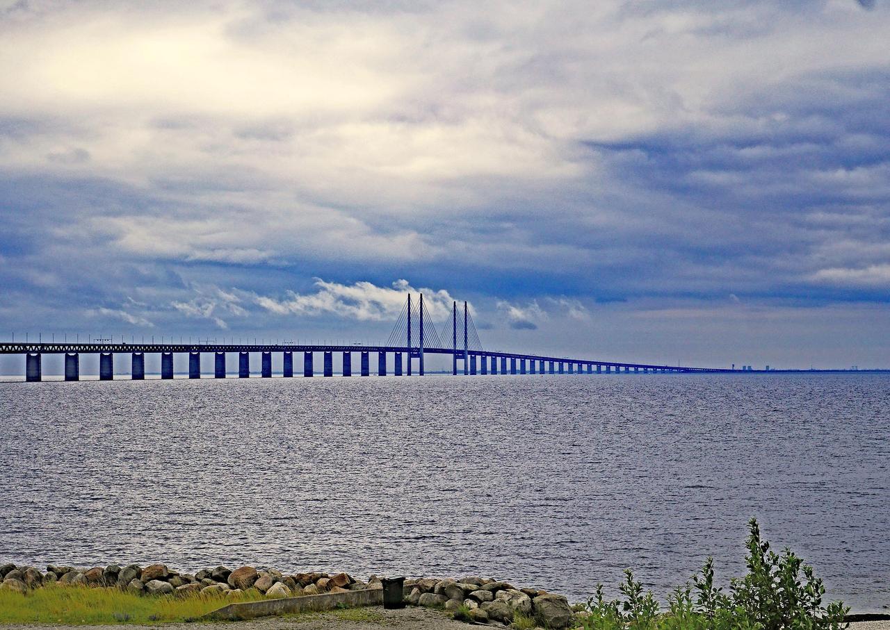
Öresund Bridge is a fixed transport link spanning the Öresund Strait between the city of Copenhagen in Denmark and the city of Malmö in Sweden, consisting of a bridge, tunnel and artificial island. The link begins with an underground tunnel on the Danish side, passes over the artificial island Peberholm, transitions into a bridge structure and extends to the Swedish side. The system features a dual-track railway and a four-lane motorway, integrating both road and rail transport on a single corridor.
Öresund Bridge (Flickr)
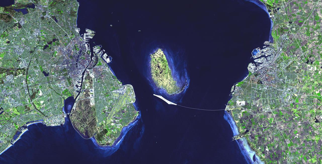
The Öresund Bridge forms a fixed transport link connecting Copenhagen in Denmark with Malmö in Sweden across the Öresund Strait. The connection system begins on the Danish side, continuing from the road and rail lines passing through Copenhagen Airport and Amager; the route then transitions into an underwater tunnel beneath the Öresund Strait starting at the Kastrup area. The tunnel emerges onto the artificial island of Peberholm, from which it connects to the bridge structure and reaches Lernacken near Malmö in Sweden’s Scania region. This integrated system was designed to provide seamless road and rail connectivity between Copenhagen and Malmö.
The planning process for the Öresund Bridge began with decisions to establish a permanent road and rail connection between Denmark and Sweden. In 1991, an agreement between the two countries formalized the construction of a fixed transport link across the Öresund Strait, and planning work for the land connections commenced.【1】 Land acquisition and expropriation processes were carried out in 1992, and draft plans for the route were made public the same year. In 1993, the project design and implementation conditions were approved, and construction work began on 16 September 1993 in the Kastrup area.【2】
Construction on the land section began in 1993, while marine works intensified in 1995. Approximately 1,500 people were directly involved in construction and engineering activities during the project, and around 4,000 person-years of labor were used for land connection construction between 1992 and 1998. The motorway section extending to Kastrup opened on 27 September 1997, and the railway line was commissioned on 27 September 1998. With the official opening of the Öresund Bridge on 1 July 2000, the marine section of the fixed link was completed and the integrated road, tunnel and bridge system entered full operation.【3】
The Öresund Bridge is an integrated transport system composed of three complementary structural components: a tunnel, an artificial island and a bridge. These components were combined to form a continuous road and rail link, taking into account the geographical and technical conditions of the Öresund Strait. The different sections of the structure were designed to ensure continuity between land and sea crossings, enabling the system to function as a unified whole.
Öresund Bridge (Flickr)
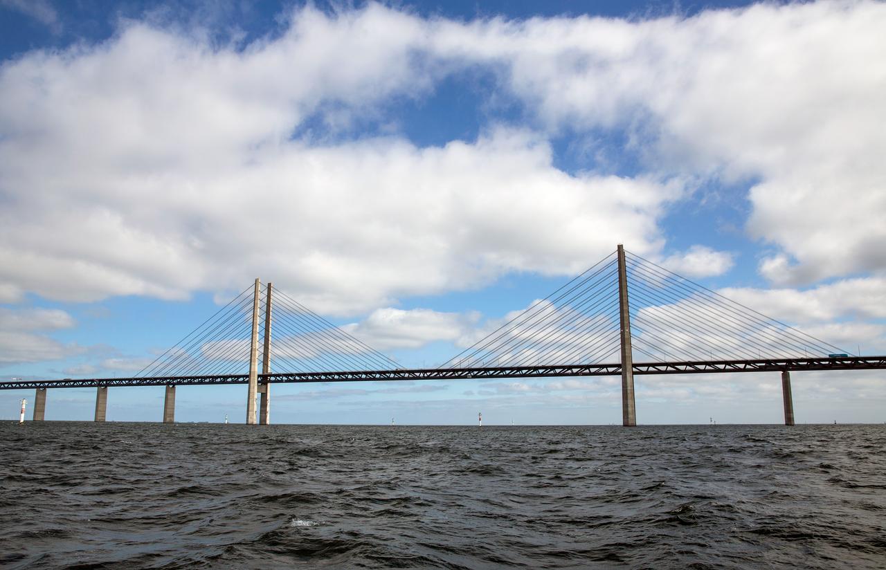
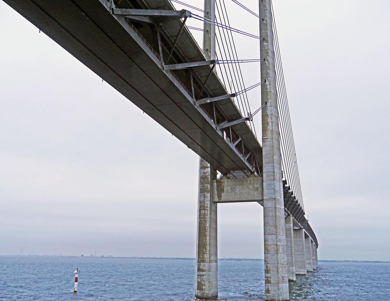
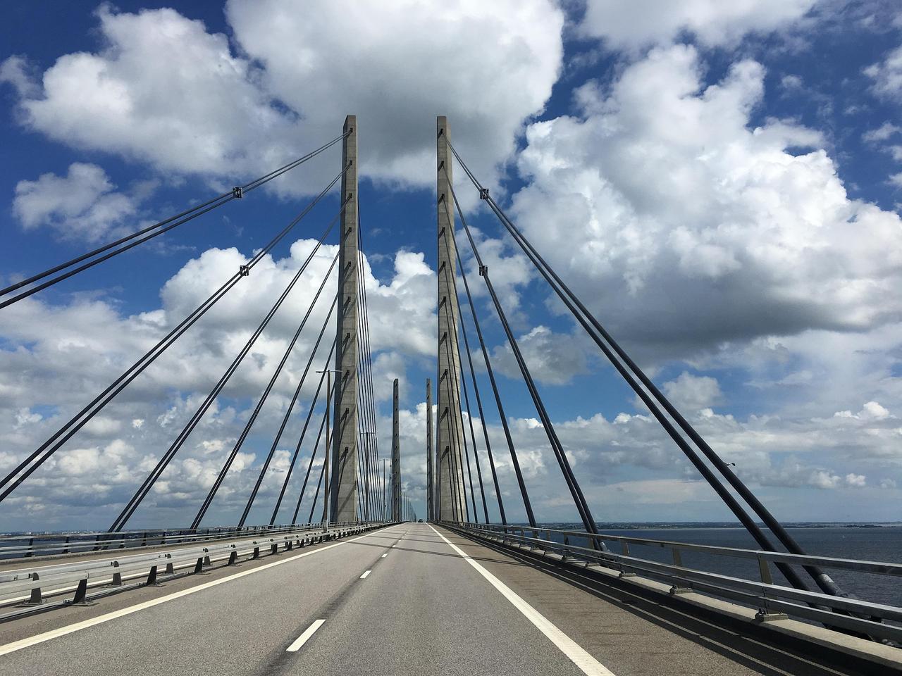
The bridge section of the Öresund Connection forms the marine portion of the fixed transport link between Denmark and Sweden across the Öresund Strait. It is part of an integrated structure providing uninterrupted road and rail connectivity between Malmö and Copenhagen. The bridge was designed to carry both a dual-track railway and a four-lane motorway on a single support system. Vehicle traffic passes on the upper deck, while the railway runs on the lower deck. The structure was built to provide a continuous passage corridor while maintaining clearance for maritime traffic.
Öresund Bridge (Pixabay)
The bridge section is approximately 7,845 meters long and constitutes the longest span of the Öresund fixed link.【4】 The main navigational clearance over the sea is 490 meters. The bridge’s primary support system rests on a composite beam structure made of steel and concrete. The bridge piers are supported by towers reaching a height of 203.5 meters, which are founded on limestone bedrock.【5】 The bridge was constructed by positioning and assembling prefabricated components at sea. A cable-supported carrying system was employed to ensure resistance against wind and water forces.
The Tårnby Tunnel, part of the Öresund Bridge project, was constructed to route the transport corridor underground through densely populated and developed areas, ensuring uninterrupted passage. The system encompasses an integrated arrangement in which both railway and road infrastructure continue through tunnel structures in specific sections. The tunnels allow the route to separate from the surface in areas with dense settlements, infrastructure corridors and environmental sensitivities, preserving the continuity of the connection. This structure creates a system in which different transport functions within the land section of the Öresund link are controlled and routed underground.
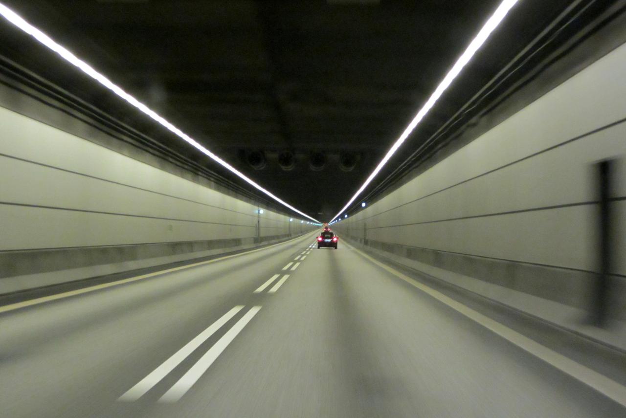
Interior of the Tårnby Tunnel (Flickr)
One of the most prominent tunnel sections is the approximately 1,600-meter-long railway tunnel beneath Sydhavnsgade.【6】 The cover structure in the Tårnby area is approximately 700 meters long and was constructed as a shared concrete structure for both road and rail.【7】 Around Copenhagen Airport, the railway line continues underground via the tunnel system, with a separate approximately 300-meter tunnel section designated for freight transport.【8】 Additionally, parts of the route continue through open and semi-open tunnel systems, with insulation and drainage systems supporting areas below sea level.
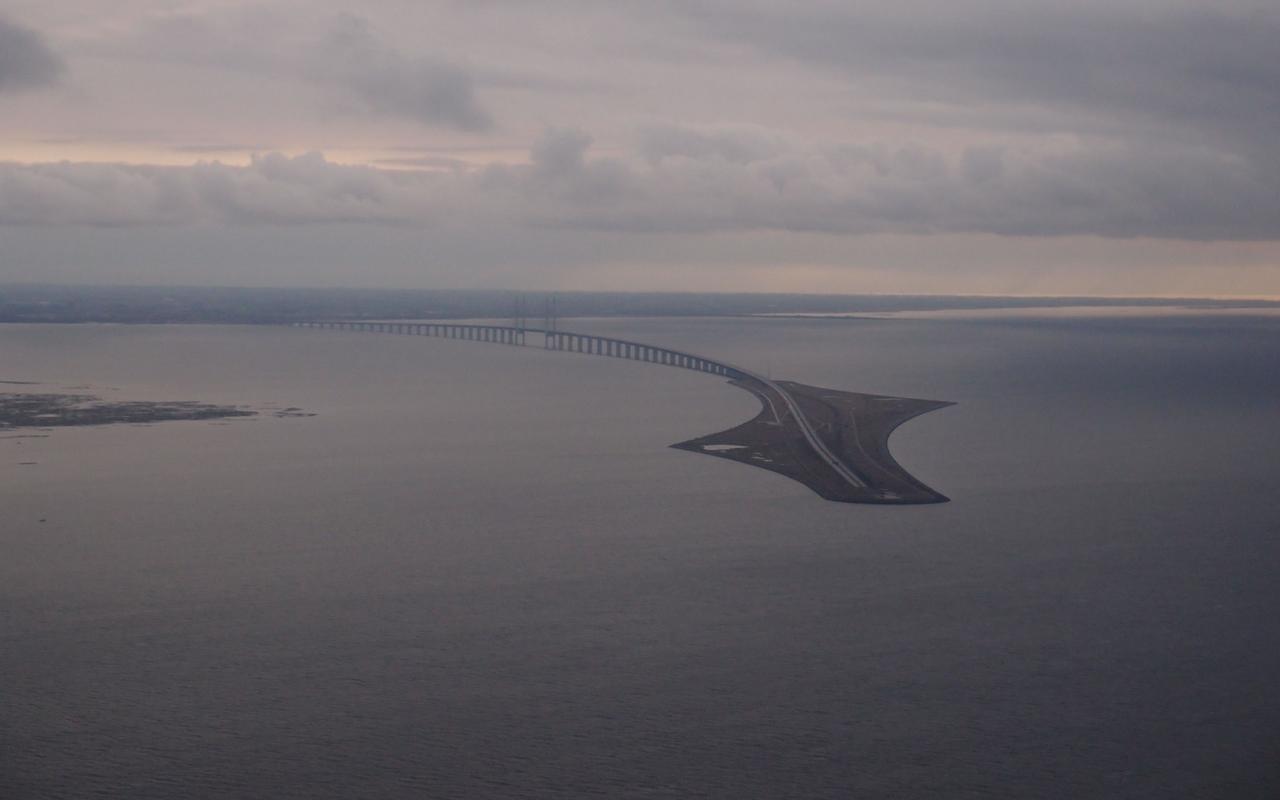
Peberholm Island (Flickr)
The Peberholm, part of the Öresund Bridge project, is an artificial island constructed to connect the tunnel section on the Danish side with the bridge structure on the Swedish side. The island serves as an integrated transition point for maritime traffic, road transport and railway alignment. Tracks exiting the tunnel are directed onto the artificial island and then onto the bridge system, enabling a seamless transition between underwater and above-water structures. The island is an engineered structure designed to facilitate directional change and ensure system integrity.
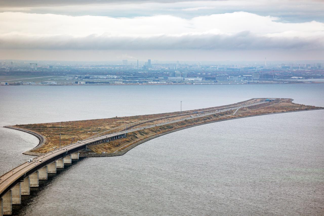
Peberholm Island (Flickr)
Peberholm is approximately four kilometers long and is an artificial landmass created by marine reclamation.【9】 The island functions as the starting point of the bridge structure and carries both the railway and road lines. During construction, an approach was adopted to preserve natural ecological balance, and over time, vegetation and natural habitats have developed on the island. Peberholm is positioned as a technical transition point between the tunnel and bridge sections of the Öresund link.
The Öresund Bridge is part of an integrated infrastructure that combines road and rail transport within a single system. The fixed link is built on a multi-component transport arrangement comprising bridge, tunnel and land connections. The system was designed to enable simultaneous use of different transport modes and structured as a technical transit network supporting regional and international mobility. Road and rail components serve as fundamental infrastructure elements within this integrated system.
Öresund Bridge (Pixabay)
The road system of the Öresund Bridge is based on a four-lane motorway infrastructure, continuing the E20 motorway on the Danish side. The road route begins in Western Amager, passes through Kastrup and reaches the Öresund Tunnel, supported by approximately nine kilometers of Öresund Motorway. Along the route, connections have been established at Ørestad, Tårnby, Airport West and Airport East, providing access points for both regional and transit traffic. In certain sections, connecting roads have been linked for safety, and infrastructure provisions were initially planned to allow future expansion to six lanes. In the Tårnby section, the road continues within the tunnel system, supported by lighting and operational equipment. The road route integrates Danish land connections with the bridge and tunnel systems to form the road transport component of the fixed link.【10】
The railway system of the Öresund Bridge consists of a dual-track, electrified infrastructure designed to serve both passenger and freight transport. The approximately 18-kilometer Öresund line includes a main railway for passenger trains and separate sections for freight transport.【11】 The passenger line extends over approximately 12 kilometers, while additional lines totaling approximately 6.2 kilometers serve freight transport between Vigerslev–Kalvebod and around the airport. Along the route, stations are located at Ørestad, Tårnby and Copenhagen Airport, and the line continues through tunnel and cut-and-cover sections in certain areas.【12】 The railway infrastructure is supported by a 25 kV 50 Hz alternating current electrification system, electronic signaling and technical equipment enabling bidirectional operation, and carries a significant portion of passenger and freight movement between Scandinavia and Europe.【13】
The operation and management structure of the Öresund Bridge is based on joint ownership and operational arrangements between Denmark and Sweden. The bridge is operated by Øresundsbro Konsortiet, whose ownership is shared between the two countries. The operation of the Danish road connection is managed by A/S Øresund, which also owns the Öresund railway. Responsibility for the operation and maintenance of the railway line was transferred from Banedanmark to A/S Øresund in 2015. A/S Øresund holds a 50 percent stake in Øresundsbro Konsortiet and operates under Sund & Bælt Holding A/S. Road section operations and maintenance are carried out by external contractors, with tunnels, pumping systems, signaling and other technical infrastructure managed under this framework. Railway traffic is monitored through electronic signaling and control systems and managed from a regional remote control center in Copenhagen.【14】
Border controls on the Öresund Bridge are based on a system in which passport and customs procedures have been largely eliminated under the European Union’s principle of free movement. While the bridge provides a direct physical connection between the two countries, temporary controls may be implemented during specific periods due to security and regulatory requirements. Border crossing occurs within a single transport corridor for both road and rail, ensuring uninterrupted movement of passengers and freight.
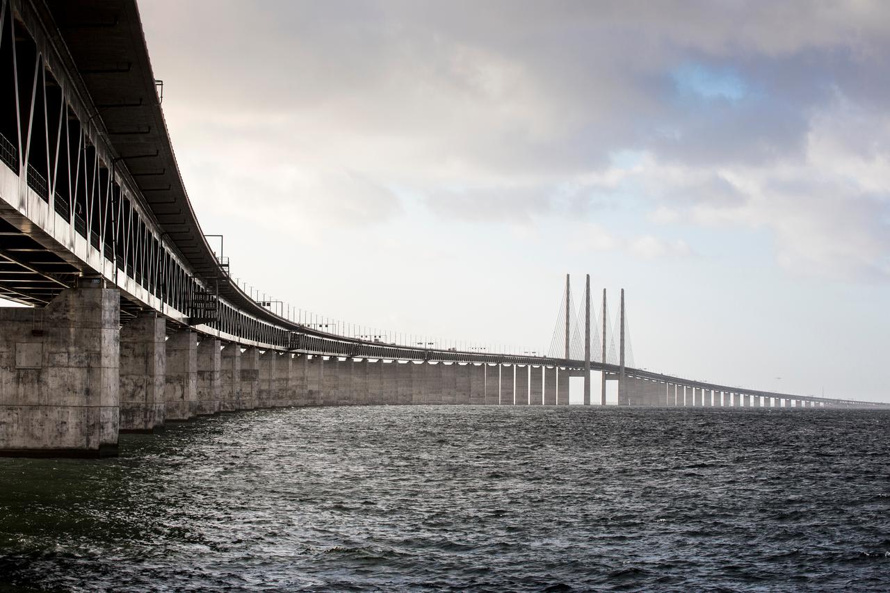
Öresund Bridge (Flickr)
The opening of the bridge has brought significant changes to regional transport networks. Reduced travel times and direct connectivity have increased mobility in both passenger transport and freight logistics. This has contributed to the reorganization of transport networks and strengthened the integration between road and rail transport. The bridge also functions as a strategic transit point within international transport corridors.
Beyond serving as a physical transport link between the two countries, the Öresund Bridge holds cultural importance as a structure that enhances regional interaction. The reduction in travel time and ease of crossing have influenced daily life practices, work patterns and social mobility, creating continuous human movement between different settlements. This has fostered increased cultural exchange and expanded regional interaction zones. Additionally, due to its position within international transport networks, the bridge is regarded as part of a pan-European integrated mobility framework and occupies a symbolic position among modern infrastructure projects.
Efraimstochter. “Öresund, Oresund köprüsü, Köprü görseli.” Pixabay. Accessed May 18, 2026. https://pixabay.com/tr/photos/%c3%b6resund-oresund-k%c3%b6pr%c3%bcs%c3%bc-k%c3%b6pr%c3%bc-havva-905584/
Government of Sweden. “Sweden and Denmark Adopt Declaration Marking 25th Anniversary of the Øresund Bridge.” Government.se. July 1, 2025. Accessed May 18, 2026. https://www.government.se/press-releases/2025/07/sweden-and-denmark-adopt-declaration-marking-25th-anniversary-of-the-oresund-bridge/
Hidy, Bobby. “Indenfor Øresundsbroens Tunnel.” Flickr. Accessed May 18, 2026. https://www.flickr.com/photos/mpd01605/6750907465/
Hpgruesen. “Oresund köprüsü, Baltık denizi, Deniz kapısı görseli.” Pixabay. Accessed May 18, 2026. https://pixabay.com/tr/photos/oresund-k%c3%b6pr%c3%bcs%c3%bc-balt%c4%b1k-denizi-2496408/
Hpgruesen. “Oresund köprüsü, İsveç, Danimarka görseli.” Pixabay. Accessed May 18, 2026. https://pixabay.com/tr/photos/oresund-k%c3%b6pr%c3%bcs%c3%bc-isve%c3%a7-danimarka-3222130/
Institution of Civil Engineers. “Øresund Bridge.” Institution of Civil Engineers. Accessed May 18, 2026. https://www.ice.org.uk/what-is-civil-engineering/infrastructure-projects/oresund-bridge
Lucdecleir. “Köprü, Danimarka, İsveç görseli.” Pixabay. Accessed May 18, 2026. https://pixabay.com/photos/bridge-denmark-sweden-oresund-sea-2472983/
NASA Earth Observatory. “Oresund Bridge.” NASA Science: Earth Observatory. Accessed May 18, 2026. https://science.nasa.gov/earth/earth-observatory/oresund-bridge-6325/
News Oresund. "Oresundsbron." Flickr. Accessed May 18, 2026. https://www.flickr.com/photos/newsoresund/22779706040/
News Oresund. "Oresundsbron." Flickr. Accessed May 18, 2026. https://www.flickr.com/photos/newsoresund/34288231833/
News Oresund. "Oresundsforbindelsen." Flickr. Accessed May 18, 2026. https://www.flickr.com/photos/newsoresund/49042522456/
Pingnews.com. “Released to Public: Oresund Bridge from Denmark to Sweden by Official Team (NASA).” Flickr. Accessed May 18, 2026. https://www.flickr.com/photos/pingnews/446809296/
Rasmussen, Nikolaj F. “Peberholm.” Flickr. Accessed May 18, 2026. https://www.flickr.com/photos/feldbech/8242980206/
Sund & Bælt. “Road and Rail to Øresund.” Sund & Bælt Publications, pp. 1-40. Accessed May 18, 2026. https://publications.sundogbaelt.dk/Oeresund/road-and-rail-to-oeresund/?page=1
Sund & Bælt. “Øresund Bridge.” Sund & Bælt. Accessed May 18, 2026. https://sundogbaelt.dk/en/road-and-rail-links/oresund/oresund-bridge/
[1]
Sund & Bælt, “History of the Øresund Bridge - The Øresund Bridge and its Region: 18 years,” in Øresund Bridge, p. 21, Last Access: 18 May 2026, https://sundogbaelt.dk/en/road-and-rail-links/oresund/oresund-bridge/
[2]
Sund & Bælt, “Road and Rail to Øresund,” Sund & Bælt Publications, p. 6, Last Access: 18 May 2026, https://publications.sundogbaelt.dk/Oeresund/road-and-rail-to-oeresund/?page=6
[3]
A.e., p. 7
[4]
NASA Earth Observatory, “Oresund Bridge,” NASA Science: Earth Observatory, Last Access: 18 May 2026, https://science.nasa.gov/earth/earth-observatory/oresund-bridge-6325/
[5]
Institution of Civil Engineers, “Øresund Bridge,” Institution of Civil Engineers, Last Access: 18 May 2026, https://www.ice.org.uk/what-is-civil-engineering/infrastructure-projects/oresund-bridge
[6]
Sund & Bælt, “Road and Rail to Øresund,” Sund & Bælt Publications, p. 18, Last Access: 18 May 2026, https://publications.sundogbaelt.dk/Oeresund/road-and-rail-to-oeresund/?page=18
[7]
A.e., p. 25
[8]
A.e., p. 22
[9]
Institution of Civil Engineers, “Øresund Bridge,” Institution of Civil Engineers, Last Access: 18 May 2026, https://www.ice.org.uk/what-is-civil-engineering/infrastructure-projects/oresund-bridge
[10]
Sund & Bælt, “Road and Rail to Øresund,” Sund & Bælt Publications, p. 5, Last Access: 18 May 2026, https://publications.sundogbaelt.dk/Oeresund/road-and-rail-to-oeresund/?page=4
[11]
A.e., p. 25
[12]
A.e., p. 16
[13]
A.e., p. 18
[14]
A.e., p. 2


Geographical Location and Connection System
Historical Development and Construction Process
Structural Components
Bridge Section
Tunnel Section
Artificial Island: Peberholm
Transport Infrastructure and Technical Features
Road System
Railway System
Operation and Management Structure
Border Controls and Impact on Transport
Cultural Significance