This article was automatically translated from the original Turkish version.
+1 More
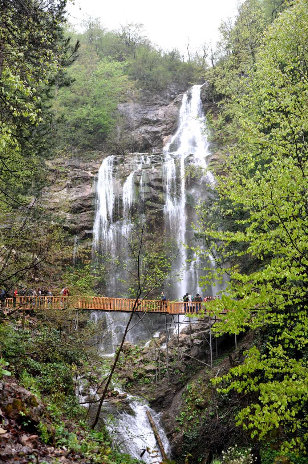
Saklı Kent Şelalesi (Düzce İl Kültür ve Turizm Müdürlüğü)
The walking trails in Yığılca district form a major tourism network connecting diverse natural attractions such as Hasanlar Dam Lake, Sarıkaya Cave, Saklıkent Waterfall, Yoğunpelit Waterfalls, and Yedigöller National Park. These routes are collectively designated as one of 23 trails and offer a wide geographical diversity ranging from forest footpaths to alpine meadows.
A moderately difficult 4 km walking route extends from Hasanlar Village to Hasanlar Dam Lake, distinguished by its poplar and valley-manzen landscape. The natural rock formations along the lakeshore provide ideal conditions for amateur angling. Rock climbing is also possible along the trail.
The 12 km walking trail from Yığılca to Sarıkaya Cave passes through pine forests and agricultural areas. Its easy difficulty level makes it suitable for family walkers and photo-safari enthusiasts. The cave, with its stalactites and stalagmites, is also a geologically significant research site.
This route, spanning a total of 35 km, traverses rock, mountain, valley, and forest ecosystems, enabling nature walking and camping activities. Along the path, which features poplar, hornbeam, oak, linden, dogwood, and pine trees, a rich fauna can be observed. It is of moderate difficulty and requires good physical condition.
This approximately 7 km trail connects forest paths and orchard gardens to Saklıkent Waterfall. It presents a moderate difficulty level and offers a natural ascent from sea level to higher elevations.

Saklıkent Waterfall (Düzce Provincial Directorate of Culture and Tourism)
The trails encompass the rich structure of Black Sea ecosystems based on trees such as Turkish pine, fir, poplar, oak, hornbeam, maple, and linden. Additionally, endemic plants like mountain strawberry contribute to the natural habitat fabric. Lakes and waterfalls add ecological depth to wetland ecosystems.
The walking trails offer a broad spectrum of tourism activities including trekking, camping, photo-safari, motorbiking, and angling. Waterfalls such as Saklıkent and Yoğunpelit attract canyon climbing enthusiasts, while routes connected to Yedigöller appeal to long-distance hikers.
The Düzce Walking Trails Guidebook classifies the Yığılca routes as suitable for walkers with moderate to good physical condition. Maps, GPS devices, and navigation equipment are recommended. Particular caution is advised on alpine and waterfall trails due to occasional lack of signage.
Ministry of Culture and Tourism of the Republic of Türkiye. "Doğa Yürüyüşü (Trekking) – Yığılca Yürüyüş Parkurları." Accessed June 29, 2025.
T.C.Düzce Yürüyüş Directorate of Culture and Tourism. *Düzce Walking Trails Information Brochure*. Accessed June 29, 2025. https://duzce.ktb.gov.tr/Eklenti/59104,duzce-yuruyus-12x22-tr-08-ocak-2018pdf.pdf?0
T.C.Düzce İl Directorate of Culture and Tourism. "Dağ ve Doğa Yürüyüşü." Accessed June 29, 2025. https://duzce.ktb.gov.tr/TR-211014/dag-ve-doga-yuruyusu.html
Saklı Kent Şelalesi (Düzce İl Kültür ve Turizm Müdürlüğü)
No Discussion Added Yet
Start discussion for "Yığılca Nature Walking Trails" article
Hasanlar Village – Hasanlar Dam Lake Trail and Amateur Fishing Experience
Yığılca – Sarıkaya Cave Trail and Short Loop Circuit
Yığılca – Karakaş – Mengen – Yaylatepe – Yedigöller Trail: Long-Distance Mountain Pass
Yığılca – Hebeler – Yağcılar – Saklıkent Waterfall Trail: Medium-Distance Waterfall Climb
Ecosystem Richness: Forest Typologies, Vegetation, and Water Resources
Recreational Opportunities, Photography, and Adventure Tourism
Signage Infrastructure, Difficulty Levels, and Safety Recommendations