+2 Daha

The Dulkadirli Underground City is located approximately 50 kilometers north of Kırşehir city center, along the Kırşehir–Akçakent highway. It lies within a plateau-like topography shaped by the tributaries of the Delice Stream, a branch of the Kızılırmak River. More specifically, it is situated on the left edge of a valley at the source region of the Manahözü Stream, within the Kılıçözü basin. The landscape was formed by Pleistocene-age rivers that cut through Pliocene erosion and fill surfaces.
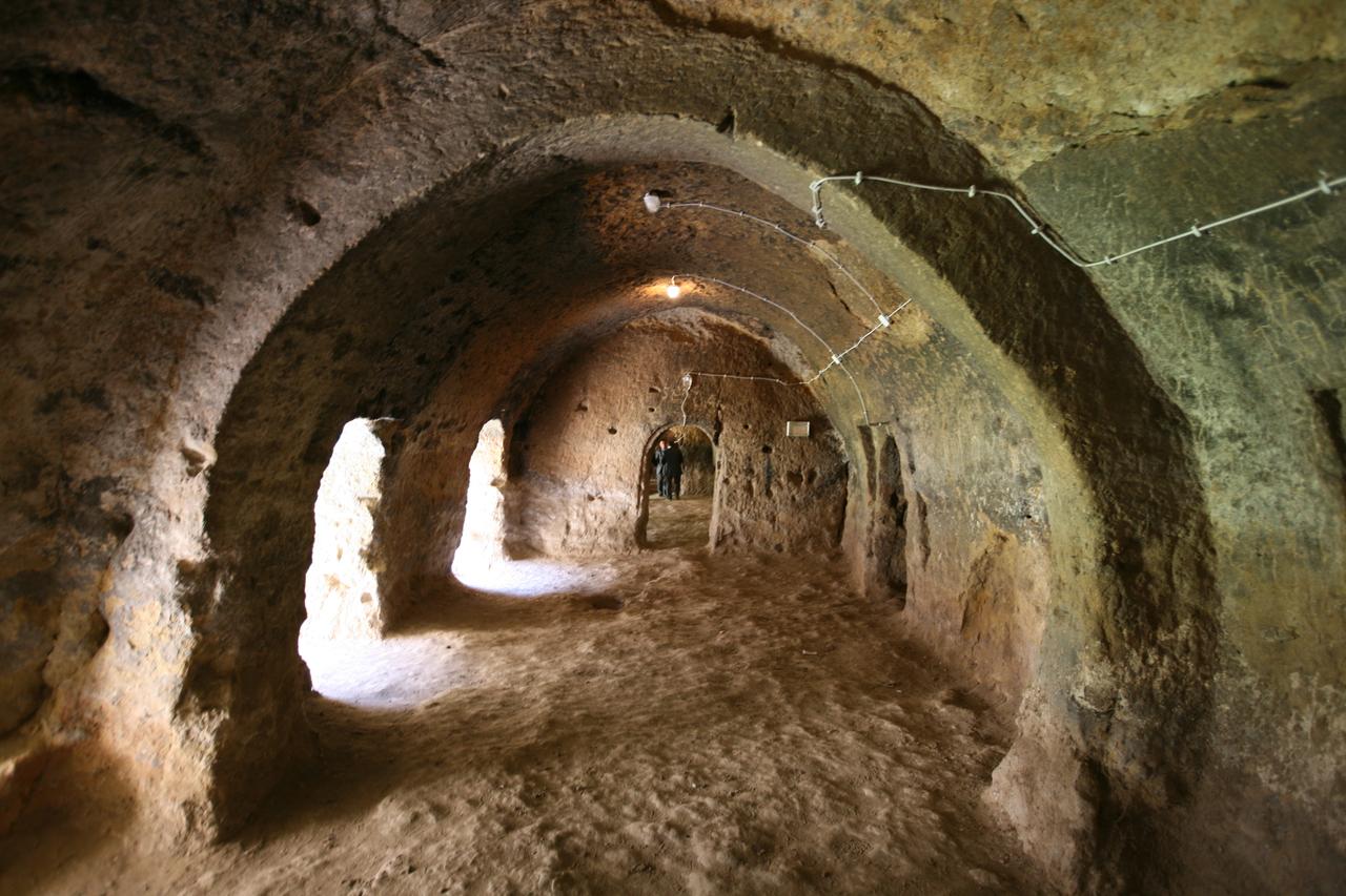
The Corridor on the Upper Floor of Dulkadirli Underground City (T.C. Kültür ve Turizm Bakanlığı)
The underground city is carved into the Arzılar Limestone Member of the Eocene-aged Çayraz Formation, which lies atop the Paleozoic metamorphic rocks of the Kırşehir Massif. This limestone member, ranging in thickness from 5 to 100 meters, is rich in nummulites and composed of sandy and silty limestone. Its soft and workable texture makes it ideal for carving.
Dulkadirli Underground City consists of a two-story layout with a total length of approximately 202 meters. The entrance corridor is 18 meters long, 2 meters wide, and 3 meters high, connecting the upper and lower corridors and rooms via small doorways. A central open-air courtyard measuring 15 by 41 meters lies in the middle of the complex. In total, there are twenty rooms—fifteen on the upper floor and five on the lower. The lower-level rooms and corridors are mostly filled with soil or water. On the eastern part of the upper floor, there are two water wells with depths ranging from 2 to 2.5 meters.
After the entrance, a 22-meter-long barrel-vaulted tunnel leads to an open courtyard measuring 30 by 50 meters and approximately 20 meters in height. On the east, west, and north sides of the courtyard, five rock-cut halls and eight rooms have been identified. Access to the lower floor is provided via a fan-shaped staircase in Room No. 5, which also contains a water well. In the gallery area, two large stone blocks—thought to be millstones—are found. At the end of the gallery, in a room with a well containing a small millstone and wall niches carved into the rock, there is a small chapel believed to have been used by Christians. Approximately 130 meters east of the underground city, there is another settlement area with two courtyards.
The structure is believed to date back to the Middle Byzantine period (700–900 CE) and is thought to have served as a rock-cut monastery. This interpretation is supported by its architectural similarities with the Üçayak Church in Taburoğlu Village, the ancient city of Hacıfakılı (Akçakent), and the Gümüşler Monastery. During the Byzantine era, the region was considered an important religious center.
Henüz Tartışma Girilmemiştir
"Dulkadirli Underground City " maddesi için tartışma başlatın
Geological Structure
Architectural Plan and Structural Features
Historical Period and Function
Bu madde yapay zeka desteği ile üretilmiştir.