Bu içerik Türkçe olarak yazılmış olup yapay zeka ile otomatik olarak İngilizceye çevrilmiştir.
+2 Daha
Zhangye National Geopark is a geological site located in Gansu province, China, renowned for its colorful sedimentary rock formations. The area contains layered rock structures formed through prolonged sedimentation processes and tectonic movements. The geopark is characterized by rock formations with distinct color transitions and geomorphological features. Its topography consists of sloping slopes, valleys, and sequential mountain ranges. These features make the area suitable for geological research and geotourism activities.
The formation of Zhangye National Geopark is directly linked to the geological movements and sedimentation processes in the region. The area was uplifted due to tectonic activity during the Mesozoic and Cenozoic eras and is characterized by red-colored sedimentary rock layers deposited over different periods. Geological processes spanning from the Triassic to the Neogene created diverse sedimentary environments including river floodplains, lake beds, deltas, and alluvial fans, which contributed to the region’s colorful rock formations. Particularly, sedimentary layers deposited during the Cretaceous period form the foundation of the geopark’s current multicolored appearance. The Himalayan Tectonics and ongoing crustal movements in the region have shaped the geopark’s morphological diversity and prominent layered structure.
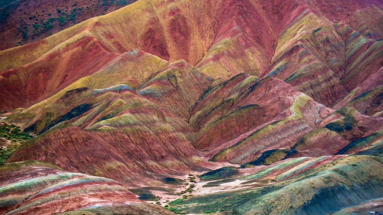
Zhangye National Geopark (Pixabay)
The emergence of the geopark’s current geographical structure has been significantly influenced by the region’s faults and fracture systems. Erosion along fault lines has exposed red rock layers and supported the formation of plateaus and valleys at varying elevations. Continuous crustal movements observed in central and western China have led to the development of distinct topographic levels within specific areas of the geopark. These processes have enabled the formation of the geopark’s complex geomorphological structure and the preservation of its colorful sedimentary layers.
The surface forms in Zhangye National Geopark consist of Danxia-type geomorphological features resulting from the formation of sedimentary rocks and tectonic activity. The geopark lies within a transitional zone between the Qinghai–Tibet Plateau and the Inner Mongolian Plateau, situated on the northern slope of the Qilian Mountains; this location has caused different sedimentary layers to emerge at various levels along faults and fracture lines. The Jiugequan ophiolite belt in the western part of the area contains components of an ancient oceanic crust dating back approximately 500 million years, forming the foundation of the geopark’s surface features alongside surrounding rocks. Colorful hills and layered ridges are formed by the physical weathering and erosion of sedimentary materials, creating distinct surface formations. The total area of the geopark is reported as 1 289.71 km²; this extensive area allows for the distribution of various geomorphological units.【1】
The distribution of the geomorphological structure is closely related to the natural weathering characteristics of the different sedimentary layers. Fluvial processes driven by rivers such as the Heihe River are observed within the geopark; this river is one of the primary hydrological elements contributing to the region’s morphological texture. Layered rocks in the Zhangye region have transformed into various surface compositions due to erosion and dissolution; these processes have created conditions for the prominent expression of slope gradients, valley cross-sections, and colorful layered surfaces. The geomorphological units observed in the area have been shaped by interactions between the physical properties of sedimentary rocks and regional geodynamic evolution, reflecting the fundamental characteristics of Zhangye National Geopark’s surface morphology.
Zhangye National Geopark features colorful rock layers formed by sedimentary materials deposited across different geological periods. The rock formations displaying red, orange, yellow and brown tones are the result of sedimentary deposits accumulated from the Triassic to the Neogene. Triassic red layers are found in the eastern parts of the region and the deeper sections of valleys, while Jurassic and Cretaceous layers extend across wide areas of the geopark. Cretaceous strata constitute approximately 57% of the total red bed deposits and define the geopark’s characteristic colorful stratigraphic structure.【2】 Paleogene and Neogene layers are found in more limited areas and along the margins of valleys. The composition of sedimentary materials influences the rate of weathering of different rock types and the formation of surface features.
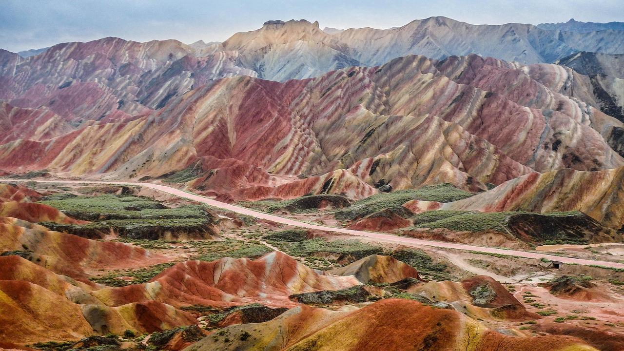
Zhangye National Geopark (Pixabay)
The structure of the geopark has been shaped by tectonic movements and fault systems in the region. Near fault lines, rock layers are more exposed and densely distributed, while layers farther from faults remain buried. This condition leads to the emergence of morphological diversity such as plateaus, valleys, and colorful banded rock formations. Crustal movements have caused uplift of sedimentary layers and differential weathering of rock types with varying resistance, determining the geomorphological characteristics of Zhangye National Geopark.
The geological formations in Zhangye National Geopark are characterized by their north–south and east–west distribution. Colorful rock ridges, plateau edges, and valley perimeters appear in varied configurations; this distribution has been shaped by the original horizontal deposition of sedimentary layers and long-term tectonic uplift combined with erosion. Hills, ridges, and valleys within the area reveal the geopark’s heterogeneous spatial structure and extend along prominent fault lines.
The spatial arrangement is directly related to the layered structure of sedimentary rocks and local tectonic movements. More horizontal layering is observed in the eastern sections, while steep, colorful ridges dominate the western and northern regions. Fluvial incision and surface erosion have separated formations at different elevations, creating natural spatial variation within the area. These spatial characteristics provide a structural basis that directly influences the geopark’s use for tourism, geological observation, and educational purposes.
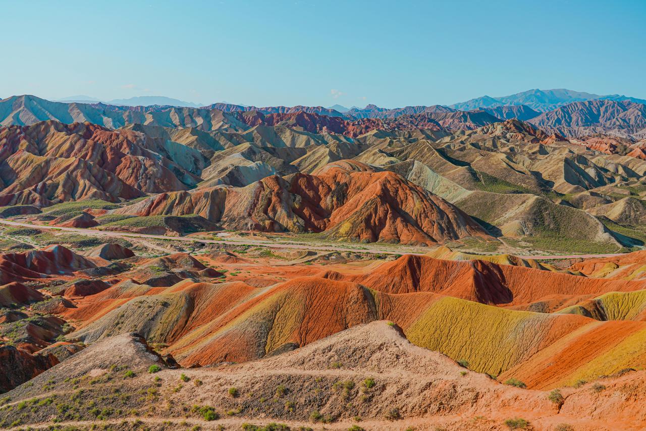
Zhangye National Geopark (Pexels)
Zhangye National Geopark is a site visited for tourism due to its colorful sedimentary rock formations and unique geomorphological structures. Visitor access is facilitated through walking trails, observation platforms, and informational panels. Direct intervention on sensitive formations during tourism activities is restricted, and visitor flow is controlled in specific areas. Educational and awareness programs conducted within the area provide information on landforms, rock formations, and geological processes, thereby supporting the preservation of geological heritage. Management plans encompass the operation of tourism infrastructure and the long-term conservation of the geological structure.
Zhangye National Geopark is not only significant from a geological perspective but also holds cultural importance. The region is regarded as part of China’s natural landscape culture and is one of the rare areas where traditional local lifestyles coexist with geological heritage. The geopark is protected at both national and international levels due to its cultural and touristic value and is recognized by UNESCO as part of the Global Geoparks Network. This status enables the region to function as an international reference site for scientific research, education, and cultural tourism. Planning and management practices within the geopark support the preservation of cultural heritage, economic participation of local communities, and sustainable utilization of the area’s educational value.
[1]
Zhangye UNESCO Global Geopark, ZHANGYE UNESCO GLOBAL GEOPARK Official Website, Last Accessed: 8 March 2026, https://www.zhangyegeopark.cn/en/
[2]
Luobin Yan, Hua Peng, Shaoyun Zhang, Ruoxi Zhang, Milica Kašanin‑Grubin, Kairong Lin ve Xinjun Tu, “The Spatial Patterns of Red Beds and Danxia Landforms: Implication for the Formation Factors–China,” Scientific Reports 9, no. 1961 (2019): 3, Last Accessed: 8 March 2026, https://www.researchgate.net/publication/331064526_The_Spatial_Patterns_of_Red_Beds_and_Danxia_Landforms_Implication_for_the_formation_factors-China
Henüz Tartışma Girilmemiştir
"Zhangye National Geopark" maddesi için tartışma başlatın
History
Surface Forms and Geomorphology
Geological Structure
Distribution and Spatial Characteristics
Tourism and Conservation
Cultural Significance
