This article was automatically translated from the original Turkish version.
+1 More
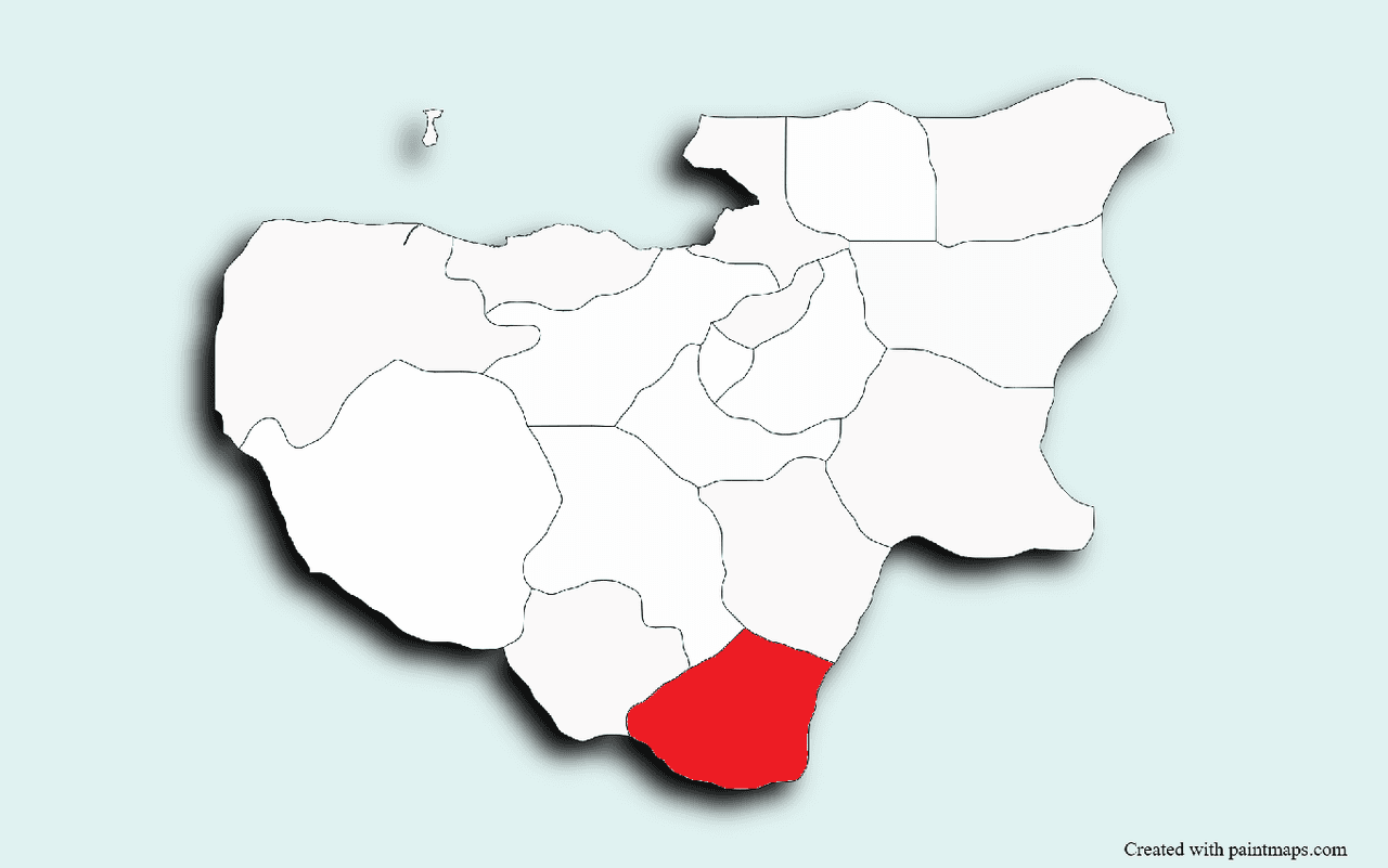
Harmancık (District)
Location | Bursa | ||||||||
|---|---|---|---|---|---|---|---|---|---|
Neighboring Districts | Domaniç, Tavşanlı (east); Gökçedağ Station, Dursunbey (west); Keles, Orhaneli (north); Simav (south) | ||||||||
Distance to Bursa | 96 km | ||||||||
Area(s) | 365 km² | ||||||||
District Governor | Sevde Nur MANTI | ||||||||
Mayor(s) | Haşim Ali ARIKAN | ||||||||
Harmancık is a district located at the intersection of the provinces of Kütahya, Bursa, and Balıkesir, under the administration of Bursa. With an area of 365 km², the district is situated 96 km from Bursa. It is bordered by Domaniç and Tavşanlı to the east, Gökçedağ Station and Dursunbey to the west, Keles and Orhaneli to the north, and Simav to the south.
The history of Harmancık dates back to the founding years of the Ottoman State. It took shape as a settlement unit following the conquest of Orhaneli (Adranos) in 1324–1325. The region lay within the boundaries of the city of Adranos, established by the Roman Emperor Hadrianus. Hadrianus used the area of present-day Orhaneli as a hunting ground and commissioned the construction of baths around the Ilıcaksu hot springs; remnants of these baths are still visible today. During the Ottoman period, Harmancık continued as a small village subordinate to Adranos and at times attained the status of a kaza. In 1869, Orhaneli was administered as a subdistrict under Harmancık. Liberated from Greek occupation on 6 September 1922, Harmancık attained district status on 19 June 1987 under Law No. 3392. The district, which became a municipality in 1973, is also known as “Çardı,” a name thought to derive from four nearby streams or hills. Archaeological findings, including beaked pottery dating to 3000 BCE, indicate that the district has a history of at least 5,000 years.
Harmancık is located in a basin between the southern slopes of Uludağ and the mountains of Asar Dağı and Küplü Dağı. The district features rugged and mountainous terrain. To its west flows the Şadırvan Stream, to its southeast the Eskici Stream, and to its south the Çardı Stream. These streams are used for irrigating agricultural land, and fishing is practiced in the Çardı Stream. The district covers an area of 365 km², with 13,220 hectares of agricultural land and 23,016 hectares of forest and shrubland.
A continental climate prevails in Harmancık, with hot summers and harsh winters. Prolonged frost and heavy snowfall and rainfall negatively affect vegetation. The annual average temperature is 13.37 °C. The vegetation cover consists of forested and maquis areas, with common tree species including oak, red pine, and juniper. Forests and shrublands constitute a major portion of the district’s natural landscape.
The social structure of Harmancık reflects a rural community character. Educational, health, and cultural activities in the district are limited, but traditional values remain prominent. The Harmancık Fair, held annually in August and continuing since 1947, attracts significant attention from surrounding provinces and districts, contributing to social and economic vitality. Intangible cultural heritage elements include danışık, tongurdaklı kaşık, wedding traditions, traditional Turkish archery, and rain prayers. In terms of education, 373 students are enrolled at the Harmancık Vocational School of Higher Education, affiliated with Uludağ University, in departments such as culinary arts, furniture and decoration, accounting, marketing, tourism, and hotel management. The district has one state hospital; according to 2020 data, the hospital with a capacity of 10 beds is staffed by 34 healthcare workers.
Harmancık’s economy is based on mining, agriculture, and animal husbandry. The district is rich in chromite deposits; chromite was first discovered in Turkey in 1848 in Harmancık. Chromite reserves have a potential capacity of 5–6 million tons with a Cr₂O₃ content of 10–40%. Magnesite, marble, and asbestos deposits are also present. Agricultural products include barley, wheat, chickpea, maize, sunflower, strawberry, sugar beet, and anise. However, due to limited agricultural land, farming is generally conducted to meet family needs. Animal husbandry is also a significant source of income. After the mining crisis of 1994, chromite and marble mines closed, increasing unemployment; local residents turned to employment in coal mines in Tunçbilek and Orhaneli. Gökçedağ Train Station facilitates access to Bursa, Balıkesir, İzmir, Eskişehir, and Ankara, contributing to economic activity.
Harmancık holds potential for thermal and eco-tourism. The Ilıcaksu Hot Springs, dating to the Byzantine period, are known for their therapeutic effects on rheumatic and other painful conditions and attract visitors from neighboring provinces during summer months. The spring water temperature ranges from 35.5 to 45.5 °C and is used to heat the spa facilities at a flow rate of 3 liters per second. Karacaköy Reservoir, Cevce Spring, Ilıcaksu Baths, the area around Akkuş Dede, and Asar Tepe serve as recreational and leisure areas. The historic Karaveyisoğlu Mansions are among the district’s important cultural heritage sites. The August fair enhances tourism activity. However, the district currently has no licensed tourism accommodation facilities; the only facility with a municipal license operates at a 38.72% occupancy rate.
As of 2021, 6,016 people live in Harmancık; 51.2% are female and 48.8% are male. The population pyramid indicates an aging population, with the 65–69 age group representing the highest proportion at 9.92%. The district comprises 22 villages and 9 neighborhoods. The villages are: Akpınar, Alutça, Balatdanişmend, Bekdemirler, Çakmak, Çatalsöğüt, Dedebali, Delicegüney, Dutluca, Gedikören, Gökçeler, Gülözü, Harmancıkakalan, Hopandanişmend, Ilıcaksu, İsaklar, Kışmanlar, Kocapınar, Kozluca, Nalbant, Okçula, and Yeşilyurt. The central neighborhoods are: Merkez, Ece, Çamoğlu, Saçaklı, Kılavuzlar, Kepekdere, Yayabaşı, Balısaray, and Karaca. In terms of socio-economic development ranking, Harmancık is ranked 533rd in Türkiye and 15th in Bursa, placing it in the fourth category of districts.
Bursa Valiliği. “Harmancık.” Accessed April 20, 2025. http://www.bursa.gov.tr/harmancik.
Harmancık Kaymakamlığı. “Tarım-Ekonomi.” Accessed April 20, 2025. http://www.harmancik.gov.tr/tarim-ekonomi.
Harmancık Kaymakamlığı. “İlçemizin Konum.” Accessed April 20, 2025. http://www.harmancik.gov.tr/ilcemizin-konum.
Kalkınma Kütüphanesi. “Harmancık İlçe Raporu.” Accessed April 20, 2025. https://www.kalkinmakutuphanesi.gov.tr/assets/upload/dosyalar/harmancik_ilce_raporu.pdf.

Harmancık (District)
Location | Bursa | ||||||||
|---|---|---|---|---|---|---|---|---|---|
Neighboring Districts | Domaniç, Tavşanlı (east); Gökçedağ Station, Dursunbey (west); Keles, Orhaneli (north); Simav (south) | ||||||||
Distance to Bursa | 96 km | ||||||||
Area(s) | 365 km² | ||||||||
District Governor | Sevde Nur MANTI | ||||||||
Mayor(s) | Haşim Ali ARIKAN | ||||||||
No Discussion Added Yet
Start discussion for "Harmancık (District)" article
History
Geographical Structure
Climate and Vegetation
Social Structure
Economic Structure
Tourism Potential
Demographic Structure