This article was automatically translated from the original Turkish version.
+2 More
Official Name | Republic of Korea | ||||||||
|---|---|---|---|---|---|---|---|---|---|
Form of Government | Unitary constitutional republic governed by a presidential system | ||||||||
Date of Independence | 15 Ağustos 1945 | ||||||||
Capital | Seoul | ||||||||
Head of State | Lee Jae-myung | ||||||||
Official Language | Korean | ||||||||
Common Languages | Vietnamese English Chinese | ||||||||
National Day | August 15 – Gwangbokjeol (Day of the Restoration of Light / Liberation Day) | ||||||||
Area | Approximately 99,720 km² | ||||||||
Total Population | Approximately 51.8 million people | ||||||||
Climate | Generally a temperate climate zone More continental in the interior More humid and temperate in the south Cold and dry winters Hot and rainy summers (monsoon-influenced) | ||||||||
GDP | Approximately $1.8 trillion US dollars | ||||||||
GDP per Capita | Approximately $35,000 US dollars | ||||||||
Ethnic Groups | Vietnam Koreans (≈ 95%) Foreign Nationals (≈ 5%) China Thailand Philippines | ||||||||
Religious Affiliation | Catholics (≈ 8%) Protestant Christians (≈ 20%) Buddhists (≈ 16%) Those affiliated with no religion (≈ 56%) | ||||||||
Telephone Code | +82 | ||||||||
Internet Domain Code | .kr (Latin Alphabet) .한국 (Korean Alphabet) | ||||||||
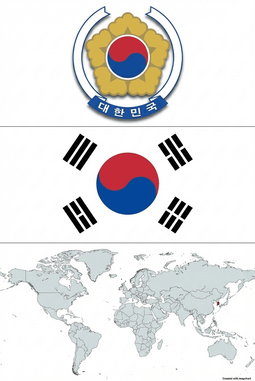
South Korea (Republic of Korea) is a republic with a presidential system, located in the southern part of the Korean Peninsula in East Asia, highly industrialized, and with a population of approximately 51.8 million. 【1】 Its capital is Seoul, which historically served as the center of various dynasties and has become one of East Asia’s largest metropolitan areas by population. The official language is Korean, and the Hangul alphabet, with its phoneme-based structure, is recognized as one of the modern writing systems. The national flag, the Taegeukgi, emphasizes change, harmony, and peace through the central taegeuk symbol representing yin-yang balance and its surrounding trigrams; the national flower, Mugunghwa (Rose of Sharon), symbolizes the people’s ideals of continuity and resilience.

Gate of Gyeongbokgung Palace (Flickr)
The Korean Peninsula is a landmass extending into the eastern edge of the Eurasian continent along the western coast of the Pacific Ocean, largely surrounded by seas. It opens to the East Sea on the east, the Yellow Sea on the west, is separated from the Japanese islands by the Korea Strait to the south, and shares a land border with China and Russia to the north. Its location between approximately 33 and 43 degrees north latitude gives it a temperate climate characterized by hot, humid summers and cold, relatively dry winters. Korea has developed a national identity over thousands of years around a shared language, culture, and history; this identity has persisted despite changes in dynasties, regional power balances, and foreign interventions.
In the modern era, Korea has taken on the appearance of a divided peninsula following critical events such as Japanese colonial rule, the division after World War II, and the 1950–1953 Korean War. After the war, the Republic of Korea, established in the southern part of the peninsula, was a country with a per capita income below $100, devastated infrastructure, and severe poverty. Within approximately sixty years, however, it rose to become one of the world’s leading “economic powerhouses.” Particularly from the 1960s onward, export-led development strategies, state-guided industrialization policies, and gradual integration into the global economy brought about rapid transformation in its industrial and service sectors.

A Statue of Emperor Sejong (Flickr)
Politically, the Republic of Korea is a republic operating under a presidential system institutionalized by the 1987 Constitution, following a democratization process driven by mass movements after periods of authoritarian rule. The President is directly elected by popular vote for a single five-year term, serving as both head of state and head of government; the legislative body, the National Assembly, consists of members elected through general elections. Although debates and occasional calls for constitutional amendments continue, the country has been able to manage serious political crises, including presidential impeachment, within the framework of constitutional procedures.
Socioeconomic indicators show that the Republic of Korea has achieved the status of a “developed country” half a century after its founding and has reached a highly educated societal structure. The increase in average life expectancy from 52.4 years in 1960 to 81.4 years in 2012, the near-elimination of illiteracy, and the fact that approximately 70 percent of the population continues to higher education are quantitative reflections of this transformation.【2】
The country has pursued policies to strengthen this structure through national health insurance and various social assistance programs; it has also taken steps to partially ease centralization in public administration by expanding local government autonomy. The global popularity of Korean culture through cinema, television dramas, popular music, and cuisine has become a significant factor in enhancing the country’s soft power capacity.
The historical background of the Republic of Korea rests on a multi-layered cultural accumulation extending far beyond the modern state, encompassing the Korean Peninsula and Manchuria. Traditional chronology traces the beginning of Korean history to Gojoseon, a state traditionally believed to have been founded in 2333 BCE; this political entity lasted approximately two millennia and disappeared from the historical stage around 108 BCE.
Following Gojoseon, the states of Buyeo, Dongye, Okjeo, and the Samhan confederacies composed of Mahan, Jinhan, and Byeonhan emerged; this period is known in literature as the Proto-Three Kingdoms era. These political entities were distributed across the northern, central, and southern regions of the Korean Peninsula and Manchuria, shaping the early political map of Korea.

Ancient Period Korea Map (WorldHistory)
From the 1st century BCE onward, the successors of the Proto-Three Kingdoms structures—Goguryeo, Baekje, Silla, and the Gaya confederation—emerged, marking the beginning of the Three Kingdoms period in Korean history. Goguryeo controlled the northern part of the peninsula and Manchuria; Baekje dominated the southwestern region; and Silla held the southeastern region. During this period, Korea’s political geography expanded to encompass a vast territory stretching from Manchuria to the Korea Strait.
In the 7th century, Silla successively defeated Goguryeo and Baekje, establishing political unity over the inland peninsula from the Daedong River to Wonsan Bay; thus, the “Unified Silla” structure emerged. At the end of the same century, the Balhae Kingdom, founded in 698 under the leadership of former Goguryeo nobles, appeared on the historical stage as a new political power center in Manchuria and the northern peninsula.
In the 10th century, the fragmented structure following the Three Kingdoms was replaced by the Goryeo Dynasty, established in 918. Goryeo successfully repelled the first attack by the Khitan-led Qidan forces in 933 and maintained control over six coastal provinces along the eastern coast (Gangdong Yuk Ju). From 1033 onward, the Cheolli Jangseong (Great Wall of Cheolli), constructed along the northern frontier, became a major defensive line demarcating the boundary between Goryeo and the Khitan/Qidan states; as a result, Goryeo’s northern border extended from Sinuiju in present-day North Korea to the Hamheung region.

Historical Timeline from Antiquity (National Atlas of Korea)
Throughout the Goryeo and subsequent Joseon periods, expansionist and border security policies toward the north were pursued; fortresses and garrisons established in the Amnokgang (Yalu) and Dumangang (Tumen) river basins effectively established the main contours of today’s Korea–China border.
The Joseon Dynasty, founded in 1392, stands out as one of the defining political structures in Korean history due to its continuity and institutional stability. Throughout its rule, centralized authority was supported by a Confucian moral framework, a bureaucratic system operating through examination-based civil service, and a hierarchical social organization based on lineage, status, and gender. The capital, Hanseong (present-day Seoul), was organized into an inner city divided into five districts (Hanseong 5 Bu) surrounded by outer zones (Seongjeosimni), enclosed by city walls; thus, the spatial embodiment of centralized authority took the form of a settlement structure preserved intact until the end of the dynasty. By the late 19th century, the expansion of Seoul’s boundaries through the construction of railways and tram lines, combined with population growth and new residential areas, transformed the capital into the central space of the modernization process spanning from the Joseon order to the Japanese colonial period.

A Market from the Joseon Period (Flickr)
The Joseon administration continued the northern policy inherited from the preceding Goryeo Dynasty, playing an active role in the gradual stabilization of the Korean Peninsula’s historical boundaries. The northern territorial security policy initiated during the Goryeo period was institutionalized in the 11th century through the construction of a 400-kilometer-long defensive wall (Cheolli Jangseong) against the Khitai-Chidan; this established the northern border zone extending from present-day Sinuiju to Hamheung.
This line was extended during the Joseon period in the 15th century through the establishment of four fortresses in the Amnokgang (Yalu) basin and six garrisons in the Dumangang (Tumen) basin; these fortresses and garrisons formed the practical and administrative foundations of the border with China. This “four fortresses and six garrisons” system reinforced the Amnokgang and Dumangang axis, now recognized as one of the primary geographical backbones of the current border between North Korea and China; the successive expansion and border protection policies of Goryeo and Joseon historically solidified the territorial integrity of Korea from its southern tip to the river line in the north.

A Portrait of King Taejo (Flickr)
The erection of the Baekdusan National Border Monument in the 18th century marked a distinct turning point in the formal recording of the border arrangement between Joseon and the Qing Dynasty. The boundary marker transformed the mountain ridge around the Baekdusan crater lake into both a natural and political indicator of the northeastern border; thus, in historical geography, Baekdusan acquired meaning not only as the starting point of mountain ranges but also as a national symbol and border marker. The traditional Korean geographical perception of the Baekdudaegan ridge, stretching from Baekdusan to Jirisan, as the main watershed dividing the country’s ten major river basins reflects a unique spatial conception in Joseon that integrated border and internal geography. This approach comprehended the national geography’s internal and external boundaries within a unified framework, emphasizing both the continuity of mountain ranges and the integrity of river basins.
The Joseon Dynasty’s political and administrative organization linked central authority to the periphery through a provincial (do) system. Administrative maps of the period show that provinces such as Hamgyeong, Pyeongan, Hwanghae, Gyeongsang, Jeolla, Chungcheong, and Gyeonggi were evenly distributed along the coasts of the East and Yellow Seas, inland plateaus, and mountainous regions; thus, a hierarchical administrative network extended from the capital Seoul to all provinces. When this administrative division merged with the Confucian bureaucratic examination system, it produced a long-lasting political order shaped by the tension between meritocratic claims and lineage-based hierarchy. The reflection of social life in settlement patterns is also evident in this context: in historical villages such as Hahoe and Yangdong, which have survived from the Joseon period to the present, the spatial arrangement of aristocratic family homes, educational institutions (seowon), and commoners’ dwellings clearly reveals a spatial order based on social classes.

19th Century Seoul Map (Diverse Locations and a Long History)
Joseon’s policy of fortifying the capital and its surroundings produced a continuous defensive architecture aimed at both internal security and defense against external threats. The Namhansanseong fortress near Seoul played a crucial role in protecting the capital from attacks coming from the east, due to its steep topography; during its defense against the Manchu Qing army, it acquired symbolic importance as a refuge for the king and his court. The Hwaseong Fortress in Suwon was constructed as a fortification designed to strengthen Seoul’s southern defense and serve as a military base for royal guards. The harmonious layout of Changdeokgung Palace with its natural surroundings and the spaces dedicated in Jongmyo to Confucian rituals honoring royal ancestors concretely demonstrate how Joseon’s political order was institutionalized through palace architecture, ritual practices, and Confucian legitimacy.
Viewed holistically, the Joseon Dynasty period can be regarded as the historical stage during which the geographical boundaries of the Korean Peninsula, still valid today, were solidified. The successive northward expansion and border protection policies of Goryeo and Joseon permanently established the northern border line extending to the Amnokgang and Dumangang rivers; the Baekdusan boundary monument ensured that this line was internationally recognized as a border framework in relation to the Qing Empire. In historical territorial maps, Joseon occupies the final dynastic phase immediately preceding the Korean Empire, Japanese colonial rule, and ultimately the Republic of Korea, demonstrating that the geographical integrity of the peninsula—from its southern tip to the Amnokgang and Dumangang line—was politically, administratively, and symbolically reinforced during this period.
The second half of the 19th century was a period during which the Joseon order began to unravel due to both internal structural problems and foreign interventions. For a long time part of a tributary and alliance system centered on China, Korea became the focal point of competition among Western powers and Japan in East Asia from the 1860s onward.
During this period, Heungseon Daewongun, who effectively held power within the royal court, took some centralizing steps in taxation and administration; however, he also adopted a stern stance against Christian missionary activities and foreign influence. This policy aimed at preserving the traditional order strengthened central authority in the short term but failed to remove the structural limitations that, in the face of increasing external pressure, gradually forced the country to open up.

A Visual from Inside the Old Palace of Korea (Library of Congress)
The 1876 Ganghwa Treaty forced Korea into a system of “unequal treaties” with Japan, granting Japan privileges over ports, customs, and judicial authority. This was followed in the 1880s by similar treaties signed with the United States and European states; thus, while Korea gained broader international recognition in formal diplomacy, it became more vulnerable to economic and legal interventions.
During this period, struggles between reformist and conservative factions within the court led to short-lived but impactful political crises such as the 1884 Gapsin Coup; the military presence of China and Japan increasingly influenced court politics. The Donghak Rebellion of 1894, sparked by rural tax burdens, arbitrary local administration, and resistance to foreign influence, both questioned the central government’s social legitimacy and provided a pretext for military intervention by China and Japan.
Chinese and Japanese forces entering Korea under the pretext of suppressing the Donghak Rebellion soon became embroiled in the First Sino-Japanese War (1894–1895). Japan’s victory and the formal withdrawal of the Qing Dynasty from its “paramount state” position over Korea under the Treaty of Shimonoseki created a rupture in Korea’s international status. This development simultaneously confirmed Korea’s legal status as an independent state while opening the path for de facto Japanese dominance.

One of Seoul's City Gates (Library of Congress)
Under the Gabo Reforms implemented immediately after the war, comprehensive changes were made in central administration, the tax system, the judiciary, and social arrangements (such as the abolition of social status distinctions and the creation of a modern bureaucracy); however, these reforms were shaped under external pressure and could not be implemented stably due to power struggles within the court. The 1895 assassination of Queen Min (Empress Myeongseong), linked to pro-Japanese factions, shook court balances; King Gojong’s 1896 refuge in the Russian legation, effectively separating him from the court, revealed the regime’s fragility.
In this context, after returning to the court in 1897, Gojong declared Korea an imperial monarchy to strengthen the state’s status, adopting the name “Daehan Jeguk” (Korean Empire). The transition to the title of “Emperor” aimed to emphasize the effective end of the Sinocentric hierarchical order and to position Korea as an equal sovereign state within the international system.
During this period, known as the Gwangmu era, various initiatives were implemented, including the modernization of the central bureaucracy, the reorganization of the military with new organizational structures, the construction of railways and telegraph lines, the improvement of urban infrastructure, and the opening of modern educational institutions. However, these steps followed an intermittent and unbalanced course due to limited financial resources, court factional struggles, and especially interference from Japan and other foreign powers.

Two Koreans in Seoul at the Beginning of the 20th Century (Library of Congress)
By the beginning of the 20th century, the Korean Empire had become one of the central arenas of competition between Russia and Japan. The 1904–1905 Russo-Japanese War, fought along the Korean and Manchurian axes, further weakened Korea’s geopolitical position. Japan’s victory led to arrangements that designated Korea as Japan’s “sphere of interest”; shortly thereafter, the 1905 Eulsa Treaty effectively placed Korea under Japanese control in foreign affairs.
With this treaty, Korea’s diplomatic powers were largely eliminated; the establishment of a Governor-General office in Seoul laid the institutional foundations of Japanese administration. The forced abdication of King Gojong in 1907, the disbanding of a significant portion of the Korean army, and the increasing control of Japanese civilian-military administrators over the administrative machinery demonstrated the gradual erosion of the Korean Empire’s de facto sovereignty.
Throughout this period, diplomatic initiatives within the court and various forms of resistance—through volunteer armed groups and “patriotic associations”—emerged against the annexation process; however, these efforts remained limited in the face of Japan’s military, financial, and diplomatic superiority.
Finally, with the annexation treaty signed in 1910 (Japan–Korea Annexation Treaty), the Korean Empire legally ceased to exist; Korean territory was restructured administratively under the name “Chōsen” as a colony directly governed by Japan. The period from this point onward constituted a new phase in Korean history shaped around colonial rule, repression, and resistance.
The Japanese colonial period from 1910 to 1945 is one of the most intense phases in Korean history, marked by severe political repression, cultural assimilation efforts, and organized resistance movements. The imperial administration reorganized its administrative structure to transform Korea into a source of resources and labor for Japan; local governance, the education system, and the economic structure were reconfigured accordingly.

Korean Peninsula (NASA)
In response, Korean intellectuals, students, workers, and religious communities developed organized resistance movements, raising independence demands both within the country and abroad. With Japan’s defeat in World War II in 1945, the Korean Peninsula broke free from approximately thirty-five years of colonial rule; however, it simultaneously entered a new phase of division.
Under postwar arrangements, Korean territory was placed under the military administration of the Soviet Union and the United States, divided along the 38th parallel. Soviet and American military governments exercised de facto control from 1945 to 1948; this period laid the groundwork for the emergence of two separate states.

South-North Korea Map (CIA Maps)
In 1948, elections were held under the supervision of the United Nations in the southern part of the 38th parallel; the parliament formed as a result adopted the first constitution and established the Republic of Korea (South Korea). In the same year, a separate state structure emerged in the north, resulting in two distinct regimes on the Korean Peninsula.
The Korean War is an armed conflict that emerged in the second half of the 20th century and affected not only the Korean Peninsula but also global politics. The war officially began on 25 June 1950 when the Democratic People’s Republic of Korea (North Korea) launched a comprehensive attack across the 38th parallel into the territory of the Republic of Korea (South Korea); it quickly evolved from an internal conflict between the two Koreas into a multinational intervention led by the United Nations and a global proxy war with the participation of the People’s Republic of China. In this regard, the Korean War is regarded as the first hot conflict of the Cold War and the first major military manifestation of U.S.–Soviet rivalry.

Infographic on the Korean War (Anadolu Ajansı)
The bipolar world order emerging after World War II formed the international backdrop of the Korean War. By the war’s end, Germany and Japan’s defeat was definitive, Europe had suffered heavy destruction, and a power vacuum emerged in regions previously under Japanese occupation in Asia. The United States, aiming to establish a system based on liberal democracy and free-market economics, provided support through programs such as the Marshall Plan in Europe; the Soviet Union expanded its sphere of influence by supporting socialist regimes in Eastern Europe.
The 1947 Truman Doctrine and the establishment of NATO in 1949 indicated that this rivalry had entered a phase of institutionalized bloc alignment. Meanwhile, the establishment of communist rule in China under Mao Zedong in 1949 strengthened the socialist bloc’s weight in Asia; together with U.S. influence in Japan and other allied regions, the Asia-Pacific region became a new front of the Cold War.

A South Korean Girl Carrying Her Brother on Her Back During the Korean War (Flickr)
The groundwork for war on the Korean Peninsula was laid with the end of Japanese dominance. Japan’s unconditional surrender on 15 August 1945 ended its control over Korea; the temporary division of Korea into two occupation zones was agreed upon during the Yalta Conference and subsequent negotiations. Accordingly, the area north of the 38th parallel was placed under Soviet occupation, and the area south under U.S. occupation.
Initially, it was anticipated that this arrangement would be temporary and that a unified, independent Korean state would be established; however, the ideological and strategic interests of the two superpowers prevented this scenario from materializing. In 1948, the Republic of Korea was established in the south and the Democratic People’s Republic of Korea in the north; both administrations claimed legitimacy over the entire peninsula. Increasing border violations, propaganda activities, and small-scale clashes along the 38th parallel by 1950 had created the infrastructure for a large-scale war.
On the morning of 25 June 1950, the North Korean People’s Army, supported by Soviet-made heavy weapons and armored units, crossed the 38th parallel and launched a sudden and comprehensive attack on South Korea. The South Korean army, due to numerical inadequacy and lack of heavy weapons and air support, was quickly forced to retreat; Seoul fell within three days, on 28 June. The Republic of Korea government withdrew southward and appealed for assistance from the United States and other allies.

A Military Convoy Passing Through a City During the Korean War (Flickr)
North Korea’s attack was evaluated by the United Nations as an open threat to international peace and security and a violation of its Charter. The Security Council, in its resolution of 26 June 1950, demanded the cessation of the attack and the withdrawal of forces behind the 38th parallel; when this call went unheeded, it appealed to member states on 27 June to provide military assistance to South Korea. The Soviet Union’s boycott of Security Council sessions due to the issue of China’s representation enabled these resolutions to be adopted without veto. On 7 July 1950, it was decided that command of the United Nations forces to be sent to South Korea would be assumed by the United States; thus, a multinational force comprising contributions from 16 countries in land, air, and naval elements was formed.
In the initial phase of the war, North Korean forces continued their rapid advance, forcing South Korean and UN troops to retreat into a narrow area around Busan, known as the “Busan Perimeter.” This line served as the final defensive barrier preventing the complete occupation of South Korea. The defense of this line, supported by intense artillery and air support, bought time for UN forces to prepare for a counteroffensive. During this period, Turkey decided to send a brigade-sized unit in response to the UN call, and the Turkish Brigade later entered the front as part of the UN forces.
In September 1950, UN forces under General Douglas MacArthur carried out the Incheon Landing, which fundamentally altered the course of the war. The amphibious operation at this port west of Seoul severed North Korean supply lines, led to the rapid recapture of the capital, and enabled the forces defending around Busan to unite in launching a general counteroffensive. Within a short time, UN and South Korean forces crossed the 38th parallel, advanced northward, captured Pyongyang, and approached the Yalu (Amnok) River line, i.e., the Chinese border. At this stage, the scenario of the complete collapse of the North Korean regime and the unification of the peninsula under South Korean administration became a serious possibility.

While the War in Seoul Continues, U.S. Commanders Study Maps and Communicate via Radio (Flickr)
The advance of United Nations forces to the Chinese border was viewed by the People’s Republic of China as a direct security threat. The Beijing regime, fearing that a regime change in Korea would later endanger its own security, secretly deployed a large force under the name “Volunteer People’s Army” to North Korea. The Chinese offensives beginning at the end of October 1950 and early November 1950 caught UN forces unprepared; particularly due to the harsh winter conditions, these operations forced United Nations troops to retreat. Seoul fell for the second time in early 1951, and the front line shifted back southward.
China’s entry into the war transformed the nature of the conflict. Now, on the battlefield, it was not merely Korean parties but United Nations forces led by the United States and the People’s Republic of China that faced each other directly; the Soviet Union became an indirect party to the conflict by providing weapons and logistical support to the North without sending troops. This situation positioned the Korean War as a typical Cold War proxy war. In U.S. domestic politics, President Truman’s rejection of General MacArthur’s proposal to expand the war into Chinese territory and his subsequent dismissal of MacArthur generated significant debate regarding civil-military relations and the limits of war.
From early 1951 onward, the front settled into a static, position-based war rather than large-scale offensives; the front line stabilized once again around the 38th parallel. This period was characterized by limited offensives, artillery fire, trench warfare, and reconnaissance operations focused on specific hills and strategic positions. While there were no major changes in the military front line, the parties faced heavy human losses and exhausting logistical costs. Millions of civilians were displaced, cities changed hands multiple times, and infrastructure was largely destroyed.
The prolonged war and static front line equilibrium forced the parties toward a diplomatic solution. Armistice negotiations began in Panmunjom in July 1951; however, the talks lasted as long as the war itself. Issues such as the repatriation of prisoners of war, the details of the new border line, and control and monitoring mechanisms became points of deadlock. Particularly, the question of whether prisoners would be repatriated forcibly or voluntarily created a prolonged disagreement between the parties. Nevertheless, the military and political costs of three years of fighting increasingly made an armistice inevitable.

Soldiers Taking Cover Behind a Sipere from a Dropped Bomb (Library of Congress)
On 27 July 1953, the Armistice Agreement signed in Panmunjom ended active hostilities, and a Demilitarized Zone (DMZ) approximately 240 kilometers long and 4 kilometers wide was established based on the de facto front line. This line continues to serve as the de facto border between the Republic of Korea and the Democratic People’s Republic of Korea today. An important point is that the 1953 agreement was not a peace treaty but merely an armistice; therefore, the state of war on the Korean Peninsula has not legally ended.
The Korean War produced multidimensional consequences for the Republic of Korea. Population losses, infrastructure destruction, and displacement processes defined the framework of the postwar reconstruction period. South Korea based its security largely on bilateral defense agreements with the United States and the presence of American troops stationed in Korea, shaping its defense and foreign policy doctrine around this alliance. Economically, the postwar foreign aid programs and planned development policies created the preconditions for the rapid industrialization process later known as the “Korean Miracle.”
Internationally, the Korean War marked the first major crisis in which the United Nations’ collective security mechanism was practically applied, a turning point in the importance of NATO and other security organizations, and recorded as the military instrument of the “containment policy” aimed at limiting the spread of communism in Asia. The war, in which many countries including Turkey contributed land, air, and naval forces, permanently influenced the foreign policy orientations and alliance preferences of these states. The political and social ties between the Republic of Korea and the countries that sent troops during the war were strengthened on the basis of “war brotherhood” after the conflict; South Korea’s current foreign relations and security perception are closely linked to this historical framework.
In the postwar period, South Korea’s domestic politics followed a process shaped by authoritarian tendencies, gradually balanced by growing societal opposition. The First Republic, established in 1948, was characterized by a strong presidential system and a politically dominant single-party structure. The first general election was held only in the southern part of the 38th parallel; thus, parliamentary institutions emerged within the context of a divided peninsula.
During this period, although the legislature had the authority to elect the president and vice president as stipulated by the constitution, political competition was primarily centered around the executive branch. Electoral fraud and authoritarian governance methods in 1960 triggered large-scale student and public demonstrations; this process culminated in the mass movements known as the April Revolution, bringing an end to the First Republic.
The military coup led by General Park Chung-hee in 1961 directly intervened in the political process following the brief experiment of the Second Republic; ordinary political activities were suspended, and a military administration period of approximately two and a half years began. During this period, a new constitution prepared and approved by referendum in 1962 established a strong presidential system in which the president was elected by popular vote; thus, the Third Republic era began.
The regulation allowing the president to serve a maximum of two terms quickly became a new area of debate; after the 1967 elections, the Park administration began seeking constitutional amendments to extend its term. The financing of election campaigns, interference by public officials in electoral processes, and pressure on voters were notable features of this period.

The Year Yuşin Died, Korean Streets (Jeon Min Jo)
In 1972, Park Chung-hee declared martial law, dissolved the legislature, and, following the adoption of the Yuşin Constitution, established a regime for the fourth time. Under the Yuşin system, the president gained de facto indefinite power through indirect election mechanisms; the legislature’s power to appoint one-third of its members, appoint high judicial officials, and exercise emergency powers resulted in the concentration of legislative, executive, and judicial authority largely in the presidency.
During this period, freedom of expression, the right to assemble, and the right to organize were significantly restricted; however, opposition from various segments of society—particularly students, workers, and urban middle classes—grew stronger. The assassination of Park Chung-hee by a close associate in 1979 abruptly ended the Yuşin regime; however, this situation heralded not a democratic transition but a new military intervention in the short term.
In the uncertainty following Park’s death, a military group led by Chun Doo-hwan carried out another coup and reasserted control over the political process; thus, the Fifth Republic era began. During this period, the constitution was revised again; the president was to be indirectly elected for a single seven-year term, and although some formal adjustments were made, a significant portion of the authoritarian mechanisms inherited from the Yuşin period were preserved.
Political parties, including satellite opposition parties created by the ruling regime, operated largely under centralized control. Simultaneously, the harsh crackdown on social movements in Gwangju and widespread human rights violations became one of the critical turning points that fueled the democratization process in subsequent years.

A Frame from the 1987 Performances (Jeon-Min Jo)
Throughout the 1980s, students, unions, religious groups, and various civil society organizations formed increasingly broad coalitions around the demand for democratization; the strong representation of opposition leaders in the legislature following the 1985 general elections marked a turning point in the political balance.
The death of a university student under torture in 1987 made the already rising demand for democracy even more visible; as a result of the nationwide mass demonstrations of June 1987 known as the Democratization Uprising, the regime was forced to announce the 29 June Declaration, which foresaw direct presidential elections and comprehensive constitutional reforms. In the elections held the same year, the ruling candidate Roh Tae-woo was elected president due to the fragmentation of votes between two main opposition leaders; however, this process ensured the implementation of a new constitutional order under the oversight of a military-originated leadership.
The 1987 Constitution served as the foundational text that defined the legal framework for South Korea’s transition from an authoritarian developmental era to constitutional democracy based on elected governments. The constitution, prepared as a result of intense mass protests, common demands of opposition parties, and internal regime negotiations during 1987, foresaw the direct election of the president by popular vote for a single five-year term; while preserving the powers of the executive branch, it aimed to strengthen balance and oversight mechanisms over the legislature and judiciary.
Within this framework, institutions such as the Constitutional Court, the National Human Rights Commission, independent bodies overseeing electoral processes, and the re-establishment of local autonomous administrations played a crucial role in redefining the state structure. Particularly, the Constitutional Court, which began operations in 1988, became one of the institutional pillars of the new era through its powers to review the constitutionality of laws, adjudicate individual complaints regarding fundamental rights violations, dissolve political parties, and conduct impeachment trials of senior state officials.

2008 All Korean State Presidents (Flickr)
In the post-1987 period, political competition shifted from the previous axis of “military rule versus democratic opposition movements” to a multi-party structure shaped primarily between roughly “conservative” and “progressive” blocs. Throughout the 1990s, military-originated politicians and former opposition movement representatives competed within the same political arena, while major party mergers, regional-based party fragmentation, and internal party factionalism frequently led to restructuring.
The 1997 Asian financial crisis marked a turning point in economic policy, accelerating market-oriented reforms and financial restructuring; agreements with international financial institutions left lasting impacts on labor markets, social policy, and corporate structures. The “Sunshine Policy,” initiated in 1998 and prioritizing mutual engagement, humanitarian aid, and summit diplomacy with North Korea, enabled state-level talks between the two Koreas in the early 2000s; it added a new negotiation dimension to the security equation on the peninsula.

A Recent Photograph of Seoul (Flickr)
By the 21st century, South Korean politics is defined by a structure in which the preservation of the constitutional framework coexists with intense political polarization. Corruption investigations involving the president and government officials, including the unsuccessful impeachment process in 2004 and the successful removal of Park Geun-hye in 2016–2017, highlighted the Constitutional Court’s oversight function over the executive. During the same period, mass demonstrations, particularly concentrated in major cities, demonstrated the institutionalization of peaceful protest as a form of political expression; street mobilization became as influential as election results in shaping the political agenda.
Generational value differences, regional voting patterns, gender debates, and divergent expectations regarding economic inequality have become the main axes determining party competition in the 2020s. Thus, the institutional structure established by the 1987 Constitution continues to outline a dynamic political field intertwined with the legacy of military rule, rapid economic transformation, security challenges on the Korean Peninsula, and societal mobilization.
The official national anthem of the Republic of Korea is “Aegukga.” In Korean, the term “aegukga” generally means “a song expressing love for the homeland”; over time, this general expression became identified specifically with the national anthem of the Republic of Korea. Today, when “Aegukga” is mentioned, it most often refers to the official anthem of the Republic of Korea; however, historically, the same term was used for various patriotic songs used in different periods on the Korean Peninsula.
During the “awakening” and “reform” years of late Joseon, particularly from the 1890s onward, numerous patriotic songs emerged aiming to mobilize the people around modernization, independence, and national consciousness. Various national song lyrics appeared in the first issues of the Dongnip Sinmun (The Independent) newspaper, published in 1896; however, the melodies with which these lyrics were sung were not always clearly recorded.
Records indicate that a march titled “Daehan Jeguk Aegukga” was composed in 1902 and performed by a Western-style military band during state ceremonies in the Korean Empire period.【3】 The lyrics of the current Republic of Korea national anthem were composed around 1907; these lyrics aimed to strengthen the sense of independence, patriotism, and loyalty amid the external intervention and pressure the country faced at the time.
The lyrics of “Aegukga” were initially set to various melodies by different composers and gradually evolved into the present four-stanza and refrain form. During this process, the anthem was long sung to the melody of the Scottish folk song “Auld Lang Syne.” Thus, the widespread national anthem form used in Korea from the early 20th century until the end of World War II was a structure combining Korean lyrics with a Western-originated folk tune. Sources mention Yun Ch’i-ho and An Chang-ho as the authors of the lyrics; it is understood that the lyrics can be attributed to either or both figures, but no single author’s name has gained general acceptance.
During the 1920s and 1930s, as pressure on national symbols intensified under Japanese colonial rule, the anthems used by patriotic circles became politicized. In this context, Korean composer Ahn Eak-tai, who studied abroad, found it inappropriate that Korea’s national anthem was based on a foreign melody; in 1935, he adapted the final section of his symphonic work “Symphonic Fantasy Korea” as an original melody for “Aegukga.” The provisional government of Korea adopted Ahn Eak-tai’s composition as the national anthem; thus, the anthem became part of the political and cultural symbols of the Korean independence movement. However, this new melody was recognized mainly among political circles and the diaspora abroad; in Korea, the practice of singing the lyrics to the “Auld Lang Syne” melody continued significantly until the late 1940s.
Korean National Anthem (VocalNationalAnthems)
With the end of Japanese rule in 1945 and the establishment of the Republic of Korea in 1948, the form and official status of the national anthem were redefined. After the proclamation of the Republic of Korea on 15 August 1948, the lyrics of “Aegukga” sung to the melody composed by Ahn Eak-tai began to be performed at the new state’s official ceremonies and were gradually included in school textbooks. Thus, the anthem was embraced by broad segments of society through both official state ceremonies and the education system, quickly becoming the de facto and legal national anthem of the Republic of Korea. During the same period, the Democratic People’s Republic of Korea (North Korea) adopted a separate national anthem also named “Aegukga,” but with different lyrics and melody; this situation demonstrates that the name “Aegukga” retains its historical and symbolic continuity on the Korean Peninsula, despite content-based divergences.
The currently used “Aegukga” consists of four stanzas and a refrain repeated after each stanza. The first stanza begins with mythological and distant future references such as the waters of the East Sea drying up and Mount Baekdusan eroding away; these two geographical elements highlight the sea on the peninsula’s eastern edge and the mountain on its northern border as symbols of the country’s permanence and historical boundaries. It then continues with a prayer addressing God to protect and preserve the nation; in this way, the stanza unites geographical symbols with the plea for divine protection. The refrain’s phrase “magnificent rivers and mountains stretching for three thousand ri” reflects a traditional concept of distance that emphasizes the country’s vastness and continuity; the reference to the national flower Mugunghwa aims to reinforce the theme of resilience and perseverance through the image of the “everlasting flower.”
In the second stanza, the pine tree on the slopes of Namsan Mountain near Seoul is portrayed as a figure standing firm against wind and frost, like a soldier clad in armor; this metaphor symbolizes the determination and resilience of individuals and society despite changing conditions. The third stanza uses the image of a clear, cloudless autumn sky and a bright moon to convey an undivided, steadfast, and loyal mindset; the metaphors of sky and moon serve as poetic tools for expressing individual and collective consciousness. The fourth stanza brings together previous themes, calling for loyalty to the homeland through all suffering and joy with “this spirit and this mind”; thus, the poetic structure expresses patriotism, loyalty, and a sense of shared destiny as a whole. The Turkish translation of “Aegukga” is as follows;
1. Until the waters of the East Sea dry up and Mount Baekdusan erodes away, may God protect and preserve our nation; Long live Korea.
2. As the pine tree on the mountain near us stands firm against wind and frost, unchanging like a soldier clad in armor, so shall our unshakable spirit remain.
3. The autumn sky is vast and clear, high and cloudless; the bright moon is our undivided and loyal heart.
4. With this spirit and this mind, give all your loyalty to your homeland, whether in sorrow or joy.
Refrain: Magnificent rivers and mountains stretching for three thousand ri are covered with Mugunghwa flowers. The noble Korean people remain faithful to the great Korean path!
“Aegukga” is one of the fundamental national symbols used in official state ceremonies, national holidays, specific official events in schools, and international platforms including sports competitions. When considered together with the Taegeukgi (national flag) and Mugunghwa (national flower), the anthem reveals the musical expression of the symbolic framework constituting the national identity of the Republic of Korea. By combining geographical references, historical boundaries, religious elements, and natural imagery, a text-music composition has emerged that emphasizes both the country’s physical space and its associated historical memory. In this regard, “Aegukga” is regarded as a symbolic text closely linked to the political ruptures, colonial experience, and independence struggle of the Republic of Korea during its formation as a modern state.
The national flag of the Republic of Korea, the Taegeukgi, has become one of the fundamental symbols of state sovereignty and national identity since the late 19th century. The idea of creating a modern national flag emerged during the process of signing the 1882 Korea–United States Treaty; the issue of a “Korean flag” to be used at the signing ceremony highlighted the need to visually express the state’s recognition in international relations. Although there is no definitive record of the flag’s form used at the signing ceremony, assessments suggest that the Korean banner depicted in the U.S. Navy Bureau of Navigation’s publication Flags of Maritime Nations, which resurfaced in 2004, resembles this first example.
The diary of Park Yeong-hyo, titled Sahwagiryak, kept as “Special Envoy with Full Powers” sent by King Gojong to Japan in 1882, is one of the key references regarding the early formation of the Taegeukgi. Park recorded in this diary that while traveling to Japan in September 1882, he designed a flag with a taegeuk (the red–blue circle symbolizing the harmony of opposing principles) at its center and four trigrams (gwae) surrounding it.【4】 This design proposed a structure closer to the current four-trigram composition, differing from the previously used eight-stick (eight-trigram) arrangement. According to Park’s reports, this flag began to be used practically from 25 September 1882 and was reported to the court on 3 October 1882.
On 6 March 1883, King Gojong’s royal decree officially proclaimed this design—featuring a taegeuk circle at the center and four trigrams around it—as the national flag, making it the official symbol of the state under the name Taegeukgi. However, at this stage, detailed standards regarding the flag’s proportions, the size of the taegeuk circle, the exact positions of the trigrams, and line thicknesses were not established, resulting in formal variations among Taegeukgi examples used by different institutions and individuals.
During the Japanese colonial period (1910–1945), the Taegeukgi continued to be used by independence movements and provisional governance structures as a symbol of Korean national identity. The flag style guide published by the Provisional Government of Korea on 29 June 1942 aimed to reproduce the Taegeukgi according to a certain standard among the diaspora and resistance circles; however, due to occupation conditions and communication restrictions, this guide reached only limited segments of the population on the Korean Peninsula.

Flag of South Korea (Kore İç İşleri ve Güvenlik Bakanlığı)
After Japan’s surrender on 15 August 1945 and Korea’s liberation, the Taegeukgi became identified in the collective memory of Korean society with liberation and rebirth; its status as the national flag was formally reinforced with the establishment of the Republic of Korea on 15 August 1948. The republican government quickly recognized the need to standardize the flag’s design; the National Flag Revision Committee, established in January 1949, announced the “Guidelines for the Manufacture of the National Flag” on 15 October 1949, specifying the Taegeukgi’s measurements, proportions, and layout details. In the following period, more detailed technical standards were developed regarding color scales (the tone of red and blue), the white background, flag proportions (e.g., the 2:3 ratio), and the placement of the trigrams.
By the 21st century, the legal framework governing the use and protection of the Taegeukgi had been systematically formalized through a series of laws and administrative regulations. The “Act on the National Flag of the Republic of Korea” was enacted in January 2007, its implementing regulations in July 2007, and the “Regulations on the Display, Management, and Promotion of the National Flag” by prime ministerial directive in September 2009.
These regulations defined the principles for using the flag in official institutions, schools, public ceremonies, and special days; they specified what constitutes disrespect toward the flag and how public information and promotion campaigns should be conducted. The public visibility of the national flag increases particularly on specific commemorative and celebration days such as Independence Day (1 March), Liberation Day (15 August), and National Flag Day; educational activities regarding the meaning of the Taegeukgi are organized in schools and public institutions.
The Taegeukgi consists of a white background, a central red–blue taegeuk circle, and four black trigrams (geon, gon, gam, ri – 건, 곤, 감, 리) placed in the four corners. The flag’s fundamental elements are not merely a visual arrangement but a symbolic composition of historically established Korean cosmology, nature philosophy, and social values.
When considered together, these elements emphasize the harmonious unity of dualistic concepts such as heaven–earth, fire–water, yin–yang, movement–stillness. The placement relationship between the central taegeuk circle and the trigrams in the corners implies a concept of perpetual balance at the center of the universe, with directions, seasons, and natural phenomena organized around it.
During the republic era, the Taegeukgi transcended its role as merely an official symbol raised on government buildings; it became a visible identity symbol in daily life through practices such as lowering the flag on national mourning days, its use in sporting events, display in school ceremonies, and exhibition in overseas diplomatic missions. The flag has acquired a place in collective memory as a symbol associated with resistance, reconstruction, and political transformation throughout the historical sequence from the Korean War (1950–1953) to the economic development process and democratization periods.
South Korea is a country occupying the southern part of the Korean Peninsula, composed of mountainous masses interspersed with valleys and coastal plains. While the total area of the peninsula is approximately 223,000 km², the official statistics of the Republic of Korea (South Korea) give its land area as 99,720 km²; other sources round this value to 100,000 km².【5】 Approximately two-thirds of the country’s topography consists of mountainous areas; settlement, agriculture, and industrial activities are concentrated primarily in river valleys and the western and southern coastal plains.

The Geography of South Korea (CIA Factbook)
South Korea shares a land border along the Korean Demilitarized Zone (DMZ), a military-secured buffer zone approximately 4 km wide that separates the Republic of Korea from the Democratic People’s Republic of Korea. To the east lies the East Sea (in Korean terminology, “Donghae”), to the west the Yellow Sea, to the south the Korea Strait and the East China Sea; its maritime neighbors are the People’s Republic of China to the west, and Japan to the east and southeast. In addition to the mainland, the country’s territory includes islands such as Jeju Island, Ulleungdo and its surrounding islets, and numerous coastal islands in the Yellow Sea.
South Korea is located between 33° and 38° north latitude and 124° and 131° east longitude; thus, it lies within both the temperate zone and the East Asian monsoon system. The northern land border follows the de facto DMZ line, reflecting the political division of the Korean Peninsula. Although demilitarized, this line is considered one of the most militarized border regions in the world due to intense surveillance and military fortifications.

Korea and Its Neighbors (Flickr)
To the west, across the Yellow Sea, South Korea shares maritime jurisdictional boundaries with the People’s Republic of China. To the east, across the East Sea, it shares boundaries with Japan; to the south, through the Korea Strait and the East China Sea, it shares maritime boundaries and exclusive economic zones with Japan and partially with China. The country has a highly indented coastline consisting of the mainland shore and thousands of small islands and islets; this situation has facilitated the concentration of fishing, maritime transport, and port activities, especially along the western and southern coasts.
The Korean Peninsula generally has a mountainous structure, and in South Korean territory, this structure is marked by mountain systems extending in a northeast–southwest direction. The main mountain range, known as the Baekdudaegan, begins in the high plateaus of the peninsula’s north and branches into numerous sub-ranges toward the south; among these, the Taebaeksan range along the eastern coast and the Sobaeksan and Noryeongsan ranges in the interior stand out.

Namsan Dağı (CIA Factbook)
On the South Korean mainland, Jirisan, with an elevation exceeding 1,915 meters, is one of the most prominent peaks; alongside this, Namsan and Hallasan on Jeju Island, with an elevation of 1,950 meters, are recognized as the country’s highest point.【6】
Valleys nestled between mountain masses and low-lying plains along the western and southern coasts constitute the country’s primary agricultural and settlement areas. Erosion basins developed on granite rock formations have gradually lowered over time to form wide, flat valleys and plains; these areas have become the most intensive agricultural zones today, primarily for rice cultivation. The Hangang basin, which hosts the Seoul metropolitan area, and the Nakdonggang delta near Busan are strategically important for both agricultural activities and urban and industrial settlements.
South Korea’s hydrography is defined by numerous short rivers flowing east–west and several major rivers extending from the interior of the peninsula toward the western and southern coasts. The Hangang forms a wide basin in the northwest of the country, flowing through Seoul into the Yellow Sea and historically serving as one of the main arteries connecting the interior with the coast. The Nakdonggang originates in the mountainous interior to the south and reaches the Korea Strait through a wide delta near Busan; the Geumgang, Yeongsangang, and Seomjingang form significant alluvial plains along the western and southwestern coasts.

Han River Mouth (CIA Factbook)
Natural lakes in the country are limited, but numerous dam reservoirs have been constructed for irrigation, drinking water supply, and flood control. Extensive estuaries, wetlands, and tidal flats (particularly along the western coast) form important aquatic ecosystems for ecological diversity and coastal fishing.
South Korea is generally under the influence of a temperate monsoon climate. In winter, cold and dry northwesterly winds prevail due to the Siberian high-pressure system; in summer, hot and humid Pacific air masses dominate the country. This seasonality results in cold and relatively dry winters and hot, rainy summers. Spring and autumn are relatively short, mild transition seasons in terms of temperature and precipitation. The summer rains (changma) from late June to mid-July provide a significant portion of the annual rainfall and are critical for agricultural activities.

The summit of Seoraksan National Park in Korea, Daecheongbong (CIA Factbook)
Temperature and precipitation vary according to the north–south direction and the difference between coastal and inland areas. Winters are milder and summers longer and more humid in the south and coastal areas; winters are colder and snowfall more common in inland and high mountainous areas. Long-term data show an upward trend in average annual temperatures since the end of the 20th century and seasonal redistribution of precipitation patterns.
Vegetation reflects the combined effects of climate and topography. Forests cover approximately 63 percent of South Korea’s land area, making it one of the countries with high forest coverage. According to 2010 data, 63.2 percent of the country’s 100,266 km² area is covered by forests.【7】 As a result of reforestation programs conducted on previously deforested slopes during the mid-20th century, many areas have transitioned from barren rock and degraded forests to mixed deciduous and coniferous forests. Lowland areas are occupied by agricultural fields, rice paddies, and settlements; coastal strips feature tidal flats, salt marshes, and coastal wetlands as other elements diversifying the vegetation.
Although the Korean Peninsula is geologically endowed with various mineral resources, a significant portion of these are limited in economic viability. Various metallic (e.g., iron, some rare metals) and non-metallic (limestone, feldspar, etc.) minerals have been identified in different regions of the peninsula; however, reserve sizes, ore grades, and geographical conditions make the intensive exploitation of some of these resources difficult today.

Biryong (Flying Dragon) Falls in South Korea's Seoraksan National Park (CIA Factbook)
Natural resources based on vegetation have historically been important in the form of firewood, forest products, and herbal plants used in traditional medicine. In the modern era, forests have become more prominent for their functions as water production areas, erosion control, recreation, and carbon sinks. Tidal flats and estuaries along the coastal regions, and alluvial plains in the interior, are the primary natural resource areas for fishing and shellfish production and agricultural production (particularly rice, vegetables, and fruits), respectively.
South Korea is a country with limited fossil fuel reserves and obtains the majority of its primary energy sources through imports. National and international energy statistics show that the country’s dependence on imports for primary energy sources such as oil, coal, and natural gas exceeds 90 percent.【8】 Electricity generation is dominated by thermal power plants (coal and liquefied natural gas) and nuclear power plants; hydropower and new/renewable energy sources (wind, solar, biomass, etc.) have a more limited share in total production. Power generation facilities are concentrated along the western and southern coasts near major ports and industrial centers due to the need for cooling water and fuel supply.
The country’s transportation system, despite the challenging topography of mountainous terrain, consists of advanced road, rail, air, and sea networks connecting densely populated corridors. The highway network includes numerous routes connecting the capital region to major cities in the north–south and east–west directions, with the Gyeongbu Highway, following the Seoul–Busan axis, being the most prominent; highways cross mountain ranges through tunnels and viaducts, following river valleys and coastal plains. The high-speed rail network (KTX and connecting lines) has shortened internal travel times and contributed to strengthening regional development corridors by connecting Seoul to metropolises such as Busan, Gwangju, and Mokpo.

Seoul's Metro Network (Flickr)
Maritime transport is strategically important due to South Korea’s geographical location. Busan Port, one of the largest container ports in East Asia, handles a significant portion of the country’s foreign trade; ports such as Incheon, Gwangyang (Yeosu), Ulsan, and Masan also serve as gateways for industrial products and energy raw materials. In air transport, Incheon International Airport near Seoul functions as a regional hub, while Gimpo, Gimhae (Busan), Jeju, and other regional airports serve as important nodes for domestic and nearby international flights. Thus, the transportation and logistics infrastructure, vital for an economy dependent on energy imports and export-oriented, has transformed South Korea’s geographical position into a global maritime and air transport junction.
The Republic of Korea is among the industrialized economies in terms of gross domestic product (GDP), foreign trade volume, and per capita income indicators from the early 2020s. According to OECD and international financial institution data, the country’s GDP is approximately $1.83 trillion in current prices and 2.3 quadrillion won in national currency. The five-year average real growth rate is around 2.4 percent, and per capita income indicators correspond to the “high-income” group according to World Bank classifications.【9】

Busan Gwangyang Container Port (DVIDS)
Price stability and monetary policy data show that as of mid-2024, the annual consumer price inflation rate is approximately 3 percent. The central bank’s policy interest rate is around 3.5 percent.【10】 The unemployment rate is below 3 percent, and the employment rate exceeds 62 percent.【11】 The proportion of the population aged 25–64 with higher education exceeds 50 percent, indicating that a significant portion of the labor force has received post-secondary education.【12】
In terms of external balance, the shares of goods and services exports and imports in GDP are each approximately 45 percent. These figures demonstrate the economy’s high level of integration into foreign trade. The current account balance as a percentage of GDP is positive (in the 1–1.5 percent range), and the net international investment position is positive; this reflects the country’s general orientation toward a net creditor position in its external economic relations.【13】
Agriculture, forestry, and fishing, which historically held a major place on the Korean Peninsula, have declined in their share of national income since the second half of the 20th century. In the 1950s, the primary sector’s share of national income approached 40 percent; due to rapid industrialization, urbanization, and structural transformation, this share fell below 3 percent by the 2000s. According to current data, the share of agriculture, forestry, and fishing activities in GDP is approximately 1.8 percent.【14】

Mandarin Orchards Located South of Jeju Island (Flickr)
This transformation has also affected employment structure. The rural population has decreased, and the share of those employed in agriculture in the total labor force has declined; alongside mechanization, input usage, and changes in land scale, the nature of agricultural production has diversified. Government policies continue to support agricultural production around food security, rural income levels, and environmental sustainability. Rice, vegetable and fruit production, and coastal fishing and aquaculture are among the main components of primary sector activities.
The industrial sector has played a decisive role in the economic growth process since the 1960s. In the 1950s, manufacturing’s share in GDP was around 12 percent; by the 2000s, it approached 27 percent; in the 2010s, manufacturing’s share remained above 24 percent.【15】 Heavy and chemical industries, including steel, shipbuilding, automobiles, petrochemicals, and information and communication technologies, emerged as leading production sectors during this period.

Pohang Port and Iron and Steel Facility (NASA)
Electronic components (particularly memory chips), flat-panel displays, televisions, and other consumer electronics, ships, and automobiles hold significant shares in both production volume and export composition. Korean-based companies hold high market shares globally in fields such as semiconductors, display technologies, and shipbuilding. The share of research and development (R&D) expenditures in GDP is approximately 5 percent, indicating the significant role of technology-intensive activities in the industrial structure.
In the advanced stage of structural transformation, the service sector has become the largest sector in both production and employment. As agriculture’s share declined and industry reached a certain weight, service areas such as banking and finance, insurance, logistics, information and communication, education, health, culture, and tourism expanded. By the mid-2010s, the service sector’s share in GDP exceeded 60 percent, and its share in employment surpassed this level.【16】

Myeongdong Shopping District (Flickr)
The financial system is a key component of this service structure. Seoul functions as a regional financial center in terms of banking and capital markets. Banks, insurance companies, and securities markets are fundamental institutional structures for channeling domestic savings into the economy and accessing international capital flows.
In recent years, mobile banking, electronic payment systems, and financial technology startups have diversified the delivery methods of financial services. Information and communication technology (ICT)-based services also form a broad sub-sector within the service sector, driven by both domestic demand and export-oriented activities; ICT product exports reached $144 billion in 2023.【17】
The Korean economy’s growth model is closely linked to foreign trade. The shares of goods and services exports and imports in GDP are each approximately 45 percent; this indicates the economy’s high level of openness to external markets.【18】
Analyzing the export composition, machinery and electronic products account for approximately 41.5 percent of total merchandise exports; transportation equipment (automobiles, ships, etc.) accounts for 14 percent, and chemical products account for approximately 10 percent.【19】 In imports, fuels (oil, natural gas, coal) constitute approximately 30 percent of total imports, machinery and electronic products 27 percent, and chemical materials approximately 9 percent.【20】
Geographically, China, the United States, Japan, Singapore, Vietnam, and European Union countries are the main trading partners. Exports to China, which were $3.8 billion in 1989 (6 percent of total exports), rose to $173.6 billion by 2013, exceeding one-third of total exports.【21】 Similarly, exports to Vietnam increased in parallel with Korean companies’ production and investment activities in that country.

Busan Container Port (Flickr)
Historically, the trade balance occasionally showed deficits in the 1980s and early 1990s; however, from the mid-1990s onward, export-led growth models generated persistent trade surpluses. For the period 2001–2013, the average annual trade surplus was $22.3 billion, and in 2013, it reached $44 billion.【22】 From the early 2020s, South Korea has ranked among the world’s top ten export nations; in the first three quarters of 2024, total exports exceeded $500 billion.【23】
Among export goods, semiconductors, flat-panel displays, automobiles, ships, petrochemical products, and lithium-ion batteries stand out. The production and export performance of these products reflect South Korea’s position in global value chains.
The Republic of Korea is both a recipient of and an investor in foreign direct investment (FDI). Financial liberalization and opening-up policies implemented since the late 1980s, combined with structural reforms after the 1997–1998 Asian Financial Crisis, established a market-oriented framework for economic policy. In foreign economic policy, free trade agreements, participation in international economic organizations, and legal frameworks regulating the investment environment play significant roles.
In the sectoral distribution of FDI into the country between 2020 and 2024, the service sector has gained prominence. The service sector’s share in total FDI was approximately 54 percent in 2020 and rose to 69 percent in 2024; manufacturing’s share has remained between 36 and 42 percent.【24】 Finance, insurance, logistics, information technology, professional services, and R&D activities are among the service sub-sectors attracting investment. Japan, China, the United States, Singapore, and some European Union countries (particularly the Netherlands and Germany) are the main investor countries.

A Trade Delegation Arriving in Korea (Flickr)
Korean outward investments are also significant. As of the mid-2010s, approximately 36 percent of outward FDI has been directed toward manufacturing. Electronics components, computers, radios, televisions, and communication equipment manufacturing account for about one-third of manufacturing-related FDI; motor vehicles, trailers, and semi-trailers manufacturing account for approximately 14 percent.【25】 Geographically, China and the United States lead, while Vietnam, India, and Central European countries are other key destinations for production and assembly investments.
R&D expenditures as a share of GDP are approximately 5 percent, placing South Korea among the top ranks in the OECD.【26】 Numerous support programs for small and medium-sized enterprises (SMEs), administered by central and local governments, are implemented. These programs focus on digital transformation, export readiness, access to finance, modernization of production processes, and scaling up, and have increased both in number and allocated resources throughout the 2010s.
Taken together, these indicators show that the Republic of Korea’s economy, as of the first quarter of the 21st century, exhibits a structure dominated by industry and services, with intense interaction through foreign trade and investment flows.
According to the 2024 Population and Housing Census results, the population of the Republic of Korea is approximately 51.8 million. Nearly 49.8 million are Korean citizens, and approximately 2 million are foreign nationals; the foreign population accounts for approximately 3.9 percent of the total population. Total households number 23.7 million, with an average household size of 2.19 persons; single-person households account for 36.1 percent, and households of one or two persons account for over 65 percent.【27】

Korean Population Distribution (CIA Factbook)
The spatial distribution of the population shows a pronounced central concentration. According to national statistics, the Seoul Metropolitan Area, encompassing Seoul, Incheon, and Gyeonggi-do, houses approximately half of the country’s population; in 2010, this region’s share was around 49 percent. In contrast, Gangwon-do, Jeju, and the Honam and Chungcheong regions have relatively low population densities. In the past two decades, internal migration toward suburban areas surrounding the capital, especially Gyeonggi-do, has increased both the total population and the number of school-age children in these regions.
Population decline and aging in rural areas are more pronounced, creating a separate agenda regarding the sustainability of local services and infrastructure planning. The decline in rural population directly affects the economies of scale of public services, particularly education and healthcare, as well as school and hospital capacities, transportation infrastructure, and local government financial structures.
Ethnically, the population is overwhelmingly of Korean origin. Foreign nationals and multicultural households are concentrated primarily in the capital region and industrialized cities (e.g., metropolitan areas of Gyeonggi-do and Gyeongsang regions). According to 2024 data, the number of multicultural households is approximately 439,000, corresponding to about 1.9 percent of total households. These households include various categories such as foreign nationals, those who migrated through marriage, and naturalized citizens.【28】
The increase in multicultural households has brought language support programs, integration education, and cultural diversity measures in school curricula to the agenda. Particularly in the capital region, support programs for multilingual student populations in elementary and middle schools are addressed as a distinct issue by local governments and education authorities.
Religious structure has undergone long-term changes. The 2005 census data showed that approximately 52.9 percent of the population identified with a religious tradition; among them, Christianity (Protestantism and Catholicism combined) accounted for approximately 29.2 percent and Buddhism for approximately 22.8 percent. The same data revealed a high proportion of those who do not identify with any religion, with this proportion showing an increasing trend, especially among younger generations.【29】

A Buddhist Temple in Korea (Flickr)
Alongside religious institutions, Confucian heritage continues to influence social norms, family relationships, and educational approaches, despite lacking official religious status. The influence of this heritage is visible in areas such as family hierarchy, respect for age, the importance placed on examination success, and public morality.
Age structure clearly reflects a rapid aging trend. According to 2024 data, the population aged 0–14 constitutes approximately 10.5 percent, the population aged 15–64 approximately 70 percent, and those aged 65 and over approximately 19.5 percent. The “aging index” (the ratio of the population aged 65+ to the population aged 0–14) has reached 186.7, indicating that the elderly population is nearly twice the size of the child population. The combination of low fertility and rising life expectancy leads population projections to indicate a declining total population in the medium and long term and a further increase in the elderly population ratio.
The demographic transition can be observed particularly through the decline in the child population. According to OECD data, the number of children aged 0–4 decreased by 40 percent between 2013 and 2023, and a further 6 percent decline is projected for this age group between 2023 and 2033. This trend indicates the persistence of declining fertility and affects medium-term calculations across many areas, from education planning to the labor market.【30】
In terms of migration dynamics, internal migration is directed toward the capital region and industrial centers; external migration is dominated by foreign labor and marriage-based settlement. Internal migration increases the population of suburban areas around the capital while contributing to the rise in the elderly population ratio in rural areas; this situation is decisive in terms of regional inequalities and local government service delivery capacities.
In the Korean education system, literacy levels are very high in quantitative terms; the breadth of compulsory education and widespread access to educational institutions have ensured that basic literacy has become nearly universal. When combined with high rates of upper secondary and higher education completion, this demonstrates the inclusiveness of the education system.
According to OECD’s Education at a Glance 2025 country note, as of 2024, the proportion of the population aged 25–34 who have not completed upper secondary education is 1 percent, the lowest level in the OECD. In the same age group, the proportion of higher education graduates is 71 percent, significantly above the OECD average (48 percent).【31】

Korean Education System (Flickr)
The average wage difference between higher education graduates and those with only upper secondary education is approximately 31 percent. While access to higher education among young adults is increasing, the proportion with master’s or doctoral degrees remains limited; in the 25–34 age group, this proportion is around 3 percent.
Adult skill levels, alongside quantitative expansion in education, provide insights into qualitative dimensions. According to OECD’s Survey of Adult Skills (PIAAC), approximately 33 percent of adults aged 25–64 fall at literacy level 1 or below, a rate above the OECD average.【32】
Average literacy scores have declined between 2014 and 2023 for both higher education graduates and adults with less than upper secondary education. This situation indicates that while educational levels have risen, skill distribution has widened and lifelong learning policies have gained importance.
The Korean education system is based on a 6–3–3 structure: six years of elementary school, three years of middle school, and three years of high school. The nine-year compulsory education framework covers elementary and middle school; upper secondary education includes both general and vocational high schools. After high school, a multi-layered higher education structure includes two-year vocational colleges, four-year universities, and graduate programs.
According to national education statistics, transition rates from elementary to middle school and from middle to high school have remained above 95 percent for a long time, and transition rates to higher education have shown consistent growth since the 1980s. In the 1980s, the admission rate to undergraduate programs was around 30 percent; by the 2000s and beyond, this rate approached 70 percent, making undergraduate education a widespread educational level.
2014 data show that the majority of school-age students are concentrated in urban centers and surrounding suburbs; this situation increases the operating costs of schools with low student numbers in rural areas and leads to regional disparities in teacher–student ratios.【33】

1964 in Korea, a High School (Flickr)
Educational participation is not limited to the formal school system. A significant portion of students in middle and high school attend supplementary education institutions such as private academies and tutoring centers after school hours. This sector has become an independent industry supporting preparation for university entrance exams and entrance exams for public officials and large corporations. Thus, intense academic competition and extended study hours exist outside the official school system.
During compulsory education, annual mandatory class hours are 655 in elementary school and 842 in middle school; these figures are below OECD averages. In contrast, students’ out-of-school study hours are high, leading to an increase in total study time. The average class size at the elementary level decreased to 21.6 students in 2023, a reduction of approximately 2.4 students since 2013. These indicators demonstrate that declining fertility and decreasing student numbers have directly affected school organization and resource allocation.【34】
In conclusion, demographic trends in the Republic of Korea (population aging, shrinking child population and household size, increasing multicultural households) and educational indicators (high completion rates, widespread higher education, skill-level differentiation) form a complementary framework. The transformation in population structure decisively affects the scale and geographical distribution of educational institutions as well as curricula, skill objectives, and adult education policies.
Korean society’s cultural structure has been shaped historically around Confucian hierarchy, family relationships, and emphasis on education. The family serves as the fundamental unit of socio-economic solidarity and intergenerational cultural transmission. Traditional forms of address within the family, expressions of respect varying according to age and status, and the distinction between informal and formal language in daily life demonstrate how social hierarchy is reflected in everyday communication.
Seasonal cycles, official holidays, and traditional festivals structure the cultural calendar. Seollal (Lunar New Year) and Chuseok (Autumn Harvest Festival), celebrated according to the lunar calendar, are the main traditional festivals involving family visits, ancestral respect rituals, and special meals. During these days, the use of traditional clothing, the hanbok, increases; although modern clothing is preferred in daily life, the hanbok continues to serve as a symbolic identity element during ceremonies and commemorative occasions.

Korean Group at the Traditional Shitennōji Wasso Festival Celebrated in Japan (Flickr)
In urban areas, high population density has popularized apartment-type housing and urban life based on public transportation. In Seoul and other major cities, the intensive use of metro and bus networks is a key element of daily mobility. The daily rhythm centered on work and school organizes leisure time around shopping malls, parks, cultural centers, and cafes.
Korean culture exhibits a structure where local traditions and modern urban culture are intertwined. Regional distinctions on the peninsula—north–south, coastal–interior—have produced regional differences in dialects, culinary habits, and local festivals. Regional dialects and culinary traditions in Gyeongsang, Jeolla, Chungcheong, and Gangwon have become nationally recognized cultural elements.
Internationally, Korean popular culture has undergone a diffusion process since the early 21st century known as the “Hallyu” (Korean Wave). K-pop music, Korean television dramas (K-dramas), cinema, and online content have reached a wide global audience, particularly in East and Southeast Asia. This process has transformed the entertainment sector into a significant cultural industry in the country through music companies, drama/film producers, online platforms, and fan communities.

Ssireum (Korean Wrestling) Image (Korean Cultural Centre)
Taekwondo, a martial art of Korean origin, is positioned as both a sport and a cultural heritage. Institutionalized globally through international federations and competitions, taekwondo also serves as a cultural representation of Korea’s international image.
Traditional music (gugak), pansori (narrative-singing tradition), masked dances, and folk performances are supported by festivals, performing arts institutions, and educational programs; thus, modern and traditional forms of expression coexist within the same cultural field.
Korean literature possesses a multi-layered accumulation extending from the classical to the modern period. During the Joseon period, historical, poetic, and essay genres written in Classical Chinese (hanmun) and vernacular poetic forms such as hyangga and sijo were foundational elements of a literary tradition connected to the court and scholarly circles. In the 18th and 19th centuries, folk narratives, long narrative prose (soseol) dealing with moral and social themes, and texts linked to oral storytelling traditions became widespread.
At the beginning of the 20th century, the colonial period transformed literature both in content and form. Under Japanese colonial rule, modern novels and poetry emerged; themes of identity, modernization, colonialism, and resistance were explored. After 1945, experiences of division, war, and rapid industrialization led to frequent treatment of themes such as internal migration, urbanization, class differences, and authoritarian politics in novels and short stories. From the 1980s onward, the democratization process brought greater diversity to themes of individual experience, women’s narratives, generational conflicts, and globalization in literature.
In the contemporary period, alongside printed novels, poetry, and essays, web novels and graphic online narratives (e.g., webtoon format) have become important sub-genres of literature. Some of these texts interact with visual culture through television series and film adaptations. The literary field accommodates a transitional space between major publishing houses and literary magazines and popular genres; university departments, creative writing programs, and translation support enable national literature to circulate internationally.
Performing arts constitute an area where traditional performance forms coexist with modern and popular genres. Traditional music (gugak) encompasses vocal and instrumental genres performed with stringed instruments such as the kayagum and wind instruments such as the piri. The narrative-singing tradition of pansori stands out as a performance in which a single narrator conveys a long story through song, speech, and gestures; in the modern era, it has been reinterpreted through stage productions and film and television adaptations. Masked dances and folk performances are staged at regional festivals and cultural centers, sustaining the connection between traditional rituals and contemporary culture.
In the field of modern performing arts, theater, musicals, and contemporary dance companies operate primarily centered in Seoul and other major metropolises. Alongside state-supported national stages, private theaters and small venues program both classical plays and works by contemporary Korean playwrights.
Popular music and performance arts have become visible globally since the early 21st century through the “Hallyu” (Korean Wave) process.

A Scene from a K-Pop Concert (Flickr)
K-pop groups, with intense choreography, visual stage design, and fan communities developed through digital platforms, constitute a significant part of the music industry. Television dramas (K-dramas) and online content platforms have increased the fluidity between performing arts and screen culture; connections between dramas, music, and tourism have contributed to specific filming locations becoming cultural tourism destinations.
Taekwondo, as a martial art, also generates a performance area intersecting with performing arts through ceremonies, demonstration teams, and international competitions. National and international championships, opening ceremonies, and special performances position taekwondo as both a sport and a cultural representation.
In the field of visual arts, historical tradition and contemporary production are intertwined. Traditional Korean painting (minhwa and court painting) produced compositions imbued with both aesthetic and moral content through depictions of nature, calligraphy-integrated text-image wholes, and scenes of daily life. Ink and brush techniques placed calligraphy at the intersection of literary and visual culture; the importance given to calligraphy became part of education and bureaucratic tradition.
Ceramic and porcelain production, particularly during the Joseon period, established a standard aesthetic through white porcelain for state rituals and everyday utensils. Today, traditional ceramic and craft production continues under the banner of cultural heritage through local markets and museum exhibitions.

Pavilion by The Lake Tablosu - Joseon Dynasty (Metropolitan Museum)
In contemporary art, painting, sculpture, installation, media art, and photography are organized around galleries, art biennales, and museums in Seoul and other major cities. Museums supported by the state and local governments, along with private galleries, run mixed programs exhibiting works by both Korean and international artists. Urban public art practices, murals, and thematic cultural streets enhance the visibility of visual arts in daily urban life.
Online content production, graphic design, and graphic storytelling formats (particularly webtoon format) have created new intersection areas between visual arts and publishing and entertainment industries. These productions have become one of the main content sources circulating throughout the cultural industries alongside television series and film adaptations.
Korean cuisine is organized around a meal system based on rice, vegetables, fermented products, and soups/stews. Kimchi, a staple side dish consumed nearly every meal, is prepared by fermenting various vegetables, primarily cabbage. Meals typically consist of rice (bap), soup or stew, and numerous side dishes (banchan), forming the characteristic multi-dish Korean meal.
Bibimbap (a mixed dish of various vegetables, meat, and egg on rice), bulgogi (marinated thinly sliced meat), jjigae-type stews (e.g., doenjang-jjigae, kimchi-jjigae), and seafood are among the core food groups of the cuisine. Regional differences are evident; for example, the variety of side dishes in Jeolla region, the prominence of fish and seafood in coastal areas, and the widespread consumption of seaweed and seafood on Jeju Island.

A Table Representing Korean Culinary Culture (Flickr)
Special dishes prepared during traditional festivals and rituals form the ceremonial dimension of the cuisine. During Seollal, rice cake soup (tteokguk), and during Chuseok, rice cake varieties (songpyeon) and various meat/vegetable dishes occupy the center of the family table. Meal tables prepared for ancestral respect rituals are arranged according to a specific hierarchy and spatial order; this arrangement persists as part of ritual practice and cultural memory.
The opening of Korean restaurants within and outside the country has contributed to the international visibility of culinary culture. The cuisine, highlighting fermented products, vegetable-based dishes, and spicy flavors, is an essential component of both daily nutrition and special occasions such as festivals, weddings, commemorations, and ancestral respect rituals. Thus, cuisine has become an element that serves both as part of local daily life and as a representative in cultural diplomacy and tourism.
The Republic of Korea has numerous cultural and natural heritage sites listed on the UNESCO World Heritage List. These sites are geographically distributed particularly in the central region around Seoul and in Gyeongsangbuk-do, Jeollabuk-do, Jeollanam-do, Gyeongsangnam-do, Incheon, and Jeju Special Self-Governing Province.
In the capital region, the Changdeokgung Palace Complex, Jongmyo Confucian Shrine, and Joseon Dynasty Royal Tombs are located. Hwaseong Fortress (Suwon) and Namhansanseong near Seoul are two military heritage sites connected to the historical defense system of the capital. In Gyeongsangbuk-do, the Seokguram Grotto and Bulguksa Temple in Gyeongju, along with the Gyeongju Historic Areas, provide examples of early Buddhist architecture and urban planning.

Changdeokgung Sarayı (Flickr)
In terms of rural settlement patterns, the historical villages of Hahoe in Andong and Yangdong in Gyeongju display the spatial organization, housing architecture, and social stratification of Joseon-era aristocratic family structures. The Gochang, Hwasun, and Ganghwa Dolmen Sites are among the areas documenting prehistoric stone monuments and Bronze Age burial traditions.
In Jeju Special Self-Governing Province, “Jeju Volcanic Island and Lava Tubes” is the sole natural World Heritage site, consisting of components including Hallasan Nature Reserve, Geomunoreum Lava Tube System, and Seongsan Ilchulbong Tuff Cone. This ensemble constitutes a geological diversity area featuring crater structures, parasitic cones, lava tubes, and coastal forms.
Outside the UNESCO-designated areas, numerous historical buildings, fortresses, palaces, and archaeological sites are spread across the country. The Gyeongbokgung, Changdeokgung, and other palace complexes in Seoul’s historic center concretely illustrate Joseon-era palace architecture and the spatial organization of palace administration, rituals, and royal life.
Among military defense structures, fortresses around Ganghwa and Gaeseong are parts of the historical western and northern defense belt of the capital. Hwaseong Fortress in Gyeonggi-do and Namhansanseong in Gwangju served to defend the capital’s southern and eastern directions and can be read as examples where topography was integrated with military strategy.

Jongmyo Shrine (Flickr)
The Daereungwon tumulus area in Gyeongju reveals Silla-era burial traditions through royal and aristocratic tomb structures. The Seokguram Grotto and Bulguksa Temple contain important examples of early Buddhist art with stone carvings, Buddhist architectural elements, and spatial arrangements. In the villages of Hahoe and Yangdong around Andong and Gyeongju, residential types, educational institutions such as seowon, and living arrangements allow the physical traces of Joseon-era rural elite life to be traced.
Cities such as Gyeongju, Andong, and Jeonju are centers of cultural heritage tourism, characterized by preserved historical urban fabric, temples, and village settlements. In these cities, historical street patterns, traditional houses, markets, and local festivals draw attention as elements reflecting the historical continuity of settlements.
In Korea, numerous museums, art galleries, and cultural centers operate at national, regional, and local levels. The National Museum in Seoul is one of the main institutions bringing together archaeological artifacts, art objects, and ethnographic collections related to the country’s history. National contemporary art museums, private galleries, and public culture-art centers include both historical collections and modern and contemporary productions.
Regional and city museums organize permanent and temporary exhibitions on local history, industry, maritime affairs, agriculture, and regional culture, making visible the spatial diversity of cultural heritage. Statistics on cultural infrastructure show an overall increase in the number of public libraries, museums, art galleries, and culture-art centers between 2005 and 2013; this increase indicates that public investments have supported access to cultural activities in different regions.

A Square from the National Museum of Korea (Flickr)
Festivals are also an important component of cultural life. Over a thousand local festivals are held annually across the country; these events use local cuisine, performing arts, historical events, or natural features as themes. The Ministry of Culture, Sports and Tourism classifies certain festivals each year as “representative” or “recommended”; thus, a framework has emerged to guide local governments in tourism promotion and cultural programming.
Major cities such as Seoul, Busan, Incheon, Daegu, and Gwangju are primary cultural attractions for both domestic and international tourism, with museums, cultural institutions, performance venues, large-scale festivals, and convention centers. Jeju Island, linked to its natural heritage status, is a region where nature-based tourism as well as culture and convention tourism are conducted.
The Korean tourism sector exhibits a multidimensional structure in terms of both international visitors and domestic travel. International tourists primarily come from East Asia, Southeast Asia, and North America. Japan, the People’s Republic of China, Taiwan, Hong Kong,
Atlı, Altay. *Türkiye ve Güney Kore Kan Kardeşliğini Daha Güçlü Bir Ekonomik Ortaklığa Dönüştürmek İçin Öneriler.* Istanbul: Dış Ekonomik İlişkiler Kurulu (DEİK). Accessed November 28, 2025.https://www.deik.org.tr/uploads/guney-kore-raporu-2.pdf
Barth, Daniel, Marte Ericsson Ryste, and Geir Helgesen. “Sør-Korea.” *Store norske leksikon.* Accessed November 28, 2025.https://snl.no/S%C3%B8r-Korea
Buzo, Adrian. *The Making of Modern Korea.* London and New York: Routledge. Accessed November 28, 2025.http://ndl.ethernet.edu.et/bitstream/123456789/2723/1/45.pdf.pdf
Central Intelligence Agency (CIA). "South Korea Administrative." The World Factbook. Accessed November 28, 2025.https://www.cia.gov/static/242fe306c06640dd52bcf19e555966b3/SouthKorea_Administrative.jpg.
Central Intelligence Agency (CIA). “Korea Gangwha Do Han River.” The World Factbook. Accessed November 28, 2025.https://www.cia.gov/the-world-factbook/static/a26bea88f384afa591d7afe9374c21be/Korea_Gangwha_Do_Han_River_DPRK2.JPG.
Central Intelligence Agency (CIA). “Korea Namsan.” The World Factbook. Accessed November 28, 2025.https://www.cia.gov/the-world-factbook/static/c65a816d3e9a734d60ecb0c250179842/Korea_Namsan_Mtn.JPG.
Central Intelligence Agency (CIA). “Korea Seorak Mountains.” The World Factbook. Accessed November 28, 2025.https://www.cia.gov/the-world-factbook/static/1aef1933fe0037b7dc9eb495f6d96639/Korea_Seorak_Mountains9.JPG.
Central Intelligence Agency (CIA). “Korea Seorak Mountains.” The World Factbook. Accessed November 28, 2025.https://www.cia.gov/the-world-factbook/static/540d8849d6e22a58ce5bd976272ed07c/Korea_Seorak_Mountains4.JPG.
Central Intelligence Agency (CIA). “Korea, South Factsheet.” The World Factbook. Accessed November 28, 2025.https://www.cia.gov/the-world-factbook/countries/korea-south/factsheets/.
Central Intelligence Agency (CIA). “South Korea: Map.” The World Factbook. Accessed November 28, 2025.https://www.cia.gov/the-world-factbook/countries/korea-south/map/.
CountryReports. "Korea, South – Economy." CountryReports. Accessed November 28, 2025.https://www.countryreports.org/country/koreasouth/economy.htm.
CountryReports. "Korea, South – Geography." Accessed November 28, 2025.https://www.countryreports.org/country/koreasouth/geography.htm.
CountryReports. "Korea, South – Government and Politics." CountryReports. Accessed November 28, 2025.https://www.countryreports.org/country/koreasouth/government.htm.
CountryReports. "Korea, South – National Symbols." CountryReports. Accessed November 28, 2025.https://www.countryreports.org/country/koreasouth/nationalsymbols.htm.
CountryReports. "Korea, South – Overview." Accessed November 28, 2025.https://www.countryreports.org/country/KoreaSouth.htm.
CountryReports. "Korea, South – Population and Demographics." CountryReports. Accessed November 28, 2025.https://www.countryreports.org/country/koreasouth/population.htm.
Cumings, Bruce. *Korea’s Place in the Sun: A Modern History.* New York: W. W. Norton & Company, 2005. Accessed November 28, 2025.https://archive.org/details/KoreasPlaceInTheSunBruceCumings.
Defense Visual Information Distribution Service. “Guang Yang Port.” DVIDS. Accessed November 28, 2025.https://www.dvidshub.net/image/1190935/mefex-2014.
Durant, M. Sarah, and others. “Diverse Locations and a Long History: Historical Context for Urban Leopards (Panthera pardus) in the Early Anthropocene From Seoul, Korea.” *Frontiers in Conservation Science.* Accessed November 28, 2025.https://www.researchgate.net/publication/356208602_Diverse_Locations_and_a_Long_History_Historical_Context_for_Urban_Leopards_Panthera_pardus_in_the_Early_Anthropocene_From_Seoul_Korea.
Dış Ekonomik İlişkiler Kurulu (DEİK). *Güney Kore Ülke Bülteni (2011).* Istanbul: Dış Ekonomik İlişkiler Kurulu, 2011. Accessed November 28, 2025.https://www.deik.org.tr/ulke-bultenleri-guney-kore-ulke-bulteni
Dış Ekonomik İlişkiler Kurulu (DEİK). *Güney Kore Ülke Bülteni (2014).* Istanbul: Dış Ekonomik İlişkiler Kurulu, 2014. Accessed November 28, 2025.https://www.deik.org.tr/uploads/kore-ulke-bulteni-2014.pdf
Food and Agriculture Organization of the United Nations (FAO). *AQUASTAT Country Profile – Democratic People's Republic of Korea.* Rome: Food and Agriculture Organization of the United Nations, 2011. Accessed November 28, 2025.https://openknowledge.fao.org/server/api/core/bitstreams/b3696064-d3b2-43a1-b1b7-5fbc1f176a45/content.
Girginer, Mahmut. *Kore Savaşı ve Türkiye'nin Kuzey Atlantik Antlaşması'na Kabulündeki Etkisi*. Master's thesis, İstanbul Gedik Üniversitesi, Lisansüstü Eğitim Enstitüsü, Siyaset Bilimi ve Kamu Yönetimi Tezli Yüksek Lisans Programı, 2024. Accessed November 28, 2025.https://tez.yok.gov.tr/UlusalTezMerkezi/TezGoster?key=usXiZIM9Lp0wk-YzRoaT-11mATXMFEDnFpmPHQc58GnI68NGowMqRSjQ_kDpokjc
Global Firepower. "2025 South Korea Military Strength." Global Firepower. Accessed November 28, 2025.https://www.globalfirepower.com/country-military-strength-detail.php?country_id=South-Korea.
Government of the Republic of Korea. *2024 Progress Report of the ROK’s Indo-Pacific Strategy.* Seoul: Government of the Republic of Korea, 2024. Accessed November 28, 2025.https://www.mofa.go.kr/cntntsDown.do?path=www&physic=2024%20Progress%20Report%20of%20the%20ROK%27s%20Indo-Pacific%20Strategy.pdf&real=2024%20Progress%20Report%20of%20the%20ROK%27s%20Indo-Pacific%20Strategy.pdf
Guineapig33. “The gates of Gyeongbokgung Palace.” Flickr. Accessed November 28, 2025.https://www.flickr.com/photos/gunman47/49764437247/in/photostream/.
Gül, Emre. *Periyodik İstihbarat Raporları Çerçevesinde Kore Savaşı’nda Türk Silahlı Kuvvetleri*. Master's thesis, Tokat Gaziosmanpaşa Üniversitesi, Lisansüstü Eğitim Enstitüsü, Tarih Anabilim Dalı, 2024. Accessed November 28, 2025.https://tez.yok.gov.tr/UlusalTezMerkezi/TezGoster?key=UjlM15wKZGQW6TLC0pvCt6a7wosvd9tmkHy0BBn5hs2gKuMFRzWSyWJZlb1RrqjF
Han, JeongHun, Ramon Pacheco Pardo, and Youngho Cho, ed. *The Oxford Handbook of South Korean Politics*. Oxford: Oxford University Press, 2023. Accessed November 28, 2025.https://doi.org/10.1093/oxfordhb/9780192894045.001.0001
Hedberg, Abigail. “Kpop Concert 2023.” Flickr. Accessed November 28, 2025.https://www.flickr.com/photos/199935754@N07/53499472584/.
International Energy Agency (IEA). “Korea – Electricity.” IEA – Countries & Regions. Accessed November 28, 2025.https://www.iea.org/countries/korea/electricity.
International Energy Agency (IEA). “Korea – Energy Mix.” IEA – Countries & Regions. Accessed November 28, 2025.https://www.iea.org/countries/korea/energy-mix.
International Monetary Fund (IMF). “Republic of Korea and the IMF.” International Monetary Fund. Accessed November 28, 2025.https://www.imf.org/en/countries/kor#ataglance.
Jamiefrater. “Korean BBQ with Side Dishes.” Flickr. Accessed November 28, 2025.https://www.flickr.com/photos/jfrater/5741623653/in/album-72157625803106143.
Jang, Cheol-wun. *Assessment of the Possibility of North Korea’s Military Provocations against South Korea.* CO 24-02. Seoul: Korea Institute for National Unification (KINU). Accessed November 28, 2025.https://repo.kinu.or.kr/bitstream/2015.oak/15125/1/CO24-02%20%28%EC%98%81%EB%AC%B8%20%EC%B5%9C%EC%A2%85%EB%B3%B8%29.pdf
Jean-Pierre Dalbéra. “Conteneurs sur le port de Busan.” Flickr. Accessed November 28, 2025.https://www.flickr.com/photos/dalbera/49023154553/
Jeong, Ji-hwan. *South Korea’s Multifaceted Response to China’s Goal of Reunification With Taiwan.* JCSP 50 – Exercise Solo Flight. Toronto: Canadian Forces College, 2024. Accessed November 28, 2025.https://www.cfc.forces.gc.ca/259/290/950/305/Jeong.pdf
Kim, Jungsoo. “Success without Design: Hallyu, Korean Wave and Its Implications for Cultural Policy.” *The Korean Journal of Policy Studies* 31, no. 3 (December 2016). Accessed November 28, 2025.https://www.researchgate.net/publication/355308260_Success_without_Design_Hallyu_Korean_Wave_and_Its_Implications_for_Cultural_Policy
Korea Trade-Investment Promotion Agency. *Korea Market Day. KOTRA.* Accessed November 28, 2025.https://vm.ee/sites/default/files/documents/2025-10/KOTRA%20presentation_2025%20Korea%20Market%20Day.pdf.
Korean Cultural Centre. "Traditional Arts." Accessed November 28, 2025.https://kccuk.org.uk/en/about-korea/culture-and-arts/traditional-arts/.
Kurtuluş, Rıza, and Hee Soo (Cemil) Lee. “Kore Cumhuriyeti.” *Diyanet İslâm Ansiklopedisi.* Accessed November 28, 2025.https://islamansiklopedisi.org.tr/kore-cumhuriyeti.
Laurie Nevay. “Seoul at Night.” Flickr. Accessed November 28, 2025.https://www.flickr.com/photos/laurienevay/27667209002/in/photolist-J9RFjS-Gm7k3h-FRWCJC-GbV6z7-G8iXNU-FDTco5-G1P5CQ-G2AJKv-FVJ6ic-G2yREM-G2vi8t-G2vvvp-F59WpJ-FVmRtF-F3EuuD-FVAXuq-FS2nSV-F3BQu4-FXSvha-F1yasK-ES4SPQ-EShyVX-Zn3L4R-EGqsWg-FQFjh5-FSFhBD-FoUw56-FmBfd3-Gbn2g7-CWjWfY-BnWrPm-ASy4x9-A9rsxH-yUyPqY-tcgFsJ-t9zeiV-sMM294-tEsRAj-Qbdn3p-r9BbG7-rJmxoW-BnWpQ1-BiJumE-APACBg-A7cSvp-J8tVWw-J8tWru-yGvEzB-ykrSBR-yLh1xN/.
Lee, Joyce. “South Korea to Become 4th-Largest Global Defence Power, President Lee Says.” *Reuters*. Accessed November 28, 2025.https://www.reuters.com/world/asia-pacific/south-korea-seeks-become-4th-largest-global-defence-power-president-lee-says-2025-10-20/.
Library of Congress. “Korea - Old palace.” Prints & Photographs Online Catalog. Accessed November 28, 2025.https://www.loc.gov/pictures/item/2023641138/resource/
Library of Congress. “Korea - Seoul - Y.M.C.A. boys.” Prints & Photographs Online Catalog. Accessed November 28, 2025.https://www.loc.gov/pictures/resource/cph.3b26961/
Library of Congress. “Korea - Seoul city gates.” Prints & Photographs Online Catalog. Accessed November 28, 2025.https://www.loc.gov/pictures/item/2023641127/resource/
Library of Congress. “Korean Conflict. Men of the 3rd Battalion, 34th Infantry Regiment, 35th Infantry Division, covering up behind rocks to shield themselves from exploding mortar shells, near the Hantan River in central Korea.” Prints & Photographs Online Catalog. Accessed November 28, 2025.https://www.loc.gov/resource/cph.3b19774/.
M-louis. “Mai-hime.” Flickr. Accessed November 28, 2025.https://www.flickr.com/photos/m-louis/293188321/.
Mark D. "Myeong-dong Night Market." Flickr. Accessed November 28, 2025.https://www.flickr.com/photos/md111/47056824432/.
Min Lee. “The Great King Sejong (세종대왕), inventor of Korean alphabet and many other goodies.” Flickr. Accessed November 28, 2025.https://www.flickr.com/photos/mlee/4129848171/in/photostream/.
Ministry of Data and Statistics (MODS). “2023 Population and Housing Census (Register-based Census).” *Basın bülteni.* Accessed November 28, 2025.https://mods.go.kr/board.es?mid=a20108010000&bid=11747&act=view&list_no=432395.
Ministry of Data and Statistics (MODS). “2024 Population and Housing Census (Register-based Census).” *Basın bülteni.* Accessed November 28, 2025.https://mods.go.kr/boardDownload.es?bid=11747&list_no=439064&seq=1.
Ministry of Economy and Finance, Republic of Korea. “Open Fiscal Data.” OpenFiscalData. Accessed November 28, 2025.https://www.openfiscaldata.go.kr/op/en/index.
Ministry of Education, Republic of Korea. “Statistics – Overview.” Ministry of Education – Statistics & Documents. Accessed November 28, 2025.https://english.moe.go.kr/sub/infoRenewal.do?m=050101&page=050101&s=english
Ministry of Foreign Affairs of the Republic of Turkey. "South Korea – Country Profile." Ministry of Foreign Affairs of the Republic of Turkey Official Website. Accessed November 28, 2025.https://www.mfa.gov.tr/guney-kore-kunyesi.tr.mfa.
Ministry of Foreign Affairs of the Republic of Turkey. "Turkey – South Korea Political Relations." Ministry of Foreign Affairs of the Republic of Turkey Official Website. Accessed November 28, 2025.https://www.mfa.gov.tr/turkiye-guney-kore-siyasi-iliskileri.tr.mfa.
Ministry of Foreign Affairs of the Republic of Türkiye. "Güney Kore’nin Ekonomisi." Ministry of Foreign Affairs of the Republic of Türkiye Official Website. Accessed November 28, 2025.https://www.mfa.gov.tr/guney-kore_ekonomisi.tr.mfa.
Ministry of Foreign Affairs of the Republic of Türkiye. "Güney Kore’nin Siyasi Görünümü." *T.C. Dışişleri Bakanlığı Resmî Sitesi.* Accessed November 28, 2025.https://www.mfa.gov.tr/guney-kore-siyasi-gorunumu.tr.mfa.
Ministry of Foreign Affairs, Republic of Korea. “Overview.” Ministry of Foreign Affairs, Republic of Korea. Accessed November 28, 2025.https://www.mofa.go.kr/eng/wpge/m_5648/contents.do.
Ministry of the Interior and Safety, Republic of Korea. “The National Anthem – Aegukga.” Ministry of the Interior and Safety. Accessed November 28, 2025.https://www.mois.go.kr/eng/sub/a03/nationalSymbol_2/screen.do.
Ministry of the Interior and Safety, Republic of Korea. “The National Flag – Taegeukgi.” Ministry of the Interior and Safety. Accessed November 28, 2025.https://www.mois.go.kr/eng/sub/a03/nationalSymbol/screen.do.
Morning Calm Weekly Newspaper. "Korean War - HD-SN-99-03144." Flickr. Accessed November 28, 2025.https://www.flickr.com/photos/imcomkorea/2919551783/in/set-72157607808414225/.
Morning Calm Weekly Newspaper. “Korean War - 111-SC-355216 Co. A, 32nd RCT, 7th Division.” Flickr. Accessed November 28, 2025.https://www.flickr.com/photos/imcomkorea/3199204086/.
National Aeronautics and Space Administration (NASA). "Korean Peninsula." NASA Visible Earth. Accessed November 28, 2025.https://visibleearth.nasa.gov/images/54693/korean-peninsula/54695l.
National Aeronautics and Space Administration (NASA). “Pohang, South Korea.” NASA Earth Observatory. Accessed November 28, 2025.https://earthobservatory.nasa.gov/images/39547/pohang-south-korea.
National Geographic Information Institute (NGII). "Coloring Map." *The National Atlas of Korea: Comprehensive Edition.* Accessed November 28, 2025.http://nationalatlas.ngii.go.kr/pages/download.php?dir=/nationalatlas/us_hi/pdf&file=hi-6(148-172)_comprehensive.pdf.
National Geographic Information Institute (NGII). *The National Atlas of Korea: Comprehensive Edition.* Accessed November 28, 2025.http://nationalatlas.ngii.go.kr/pages/download.php?dir=/nationalatlas/us_hi/pdf&file=hi-0(1-21)_comprehensive.pdf.
National Geographic Information Institute (NGII). “Challenges and Responses.” *The National Atlas of Korea.* Accessed November 28, 2025.http://nationalatlas.ngii.go.kr/pages/download.php?dir=/nationalatlas/us_c/pdf&file=ch-4(54-69)_children.pdf.
National Geographic Information Institute (NGII). “Environment, Ecology, and Protection.” *The National Atlas of Korea: Comprehensive Edition.* Accessed November 28, 2025.http://nationalatlas.ngii.go.kr/pages/download.php?dir=/nationalatlas/us_hi/pdf&file=hi-4(116-137)_comprehensive.pdf.
National Geographic Information Institute (NGII). “Global Connections.” The National Atlas of Korea. Accessed November 28, 2025.http://nationalatlas.ngii.go.kr/pages/download.php?dir=/nationalatlas/us_c/pdf&file=ch-5(70-83)_children.pdf.
National Geographic Information Institute (NGII). “Global Korea.” *The National Atlas of Korea: Comprehensive Edition.* Accessed November 28, 2025.http://nationalatlas.ngii.go.kr/pages/download.php?dir=/nationalatlas/us_hi/pdf&file=hi-5_(138-147)_comprehensive.pdf.
National Geographic Information Institute (NGII). “Human Activities.” *The National Atlas of Korea: Comprehensive Edition.* Accessed November 28, 2025.http://nationalatlas.ngii.go.kr/pages/download.php?dir=/nationalatlas/us_hi/pdf&file=hi-3(068-115)_comprehensive.pdf.
National Geographic Information Institute (NGII). “Korea in Context.” *The National Atlas of Korea.* Accessed November 28, 2025.http://nationalatlas.ngii.go.kr/pages/download.php?dir=/nationalatlas/us_c/pdf&file=ch-1(10-17)_children.pdf.
National Geographic Information Institute (NGII). “Korea: A Story in Maps.” *The National Atlas of Korea.* Accessed November 28, 2025.http://nationalatlas.ngii.go.kr/pages/download.php?dir=/nationalatlas/us_c/pdf&file=ch-6(84-108)_children.pdf.
National Geographic Information Institute (NGII). “Natural Setting.” The National Atlas of Korea. Accessed November 28, 2025.http://nationalatlas.ngii.go.kr/pages/download.php?dir=/nationalatlas/us_c/pdf&file=ch-2(018-037)_children.pdf.
National Geographic Information Institute (NGII). “People and Culture.” The National Atlas of Korea. Accessed November 28, 2025.http://nationalatlas.ngii.go.kr/pages/download.php?dir=/nationalatlas/us_c/pdf&file=ch-3(038-053)_children.pdf.
National Geographic Information Institute (NGII). “Physical Setting and Climate Change Patterns.” *The National Atlas of Korea: Comprehensive Edition.* Accessed November 28, 2025.http://nationalatlas.ngii.go.kr/pages/download.php?dir=/nationalatlas/us_hi/pdf&file=hi-2(042-067)_comprehensive.pdf.
National Geographic Information Institute (NGII). “The Korean Peninsula and Its Nations.” *The National Atlas of Korea: Comprehensive Edition.* Accessed November 28, 2025.http://nationalatlas.ngii.go.kr/pages/download.php?dir=/nationalatlas/us_hi/pdf&file=hi-1(22-41)_comprehensive.pdf.
National Geographic Information Institute. “Territorial History of Korea.” NGII. Accessed November 28, 2025.http://nationalatlas.ngii.go.kr/pages/page_1267.php#prettyPhoto.
National Museum of Korean History. “Jeon Min-jo Donation Photo Exhibition - Photographs Have Said Everything.” Accessed November 28, 2025.https://archive.much.go.kr/archive/publicationRead/InfoDetailInqire.do?publicationId=PLCT_0000000072&pmcd=PTB&pageIndex=1
Organisation for Economic Co-operation and Development (OECD). *Education at a Glance 2025: Korea.* Accessed November 28, 2025.https://www.oecd.org/content/dam/oecd/en/publications/reports/2025/09/education-at-a-glance-2025-country-notes_9749f4ff/korea_2b3410a2/252c9ed2-en.pdf.
Organisation for Economic Co-operation and Development (OECD). *OECD Economic Surveys: Korea 2024.* Paris: OECD Publishing, 2024. Accessed November 28, 2025.https://doi.org/10.1787/c243e16a-en
Organisation for Economic Co-operation and Development (OECD). *Society at a Glance 2024 – Country Notes: Korea*. Accessed November 28, 2025.https://www.oecd.org/content/dam/oecd/en/publications/reports/2024/06/society-at-a-glance-2024-country-notes_d98f4d80/korea_5c43a214/eca0a44d-en.pdf.
Organisation for Economic Co-operation and Development (OECD). *The Korea Tourism Data Lab.* Accessed November 28, 2025.https://www.oecd.org/content/dam/oecd/en/publications/reports/2025/06/using-alternative-data-sources-and-tools-to-measure-and-monitor-tourism-case-studies_3508b538/the-korea-tourism-data-lab_01ee60bf/1b634f3f-en.pdf.
Palomäki, Maija. *Birthing Babies for National Defense: The Securitization of Falling Fertility Rates in South Korea.* Master's thesis, Lund University, Centre for East and South-East Asian Studies, 2024. Accessed November 28, 2025.https://lup.lub.lu.se/luur/download?func=downloadFile&recordOId=9168270&fileOId=9168271
Parisa. “Tangerine Farm.” Flickr. Accessed November 28, 2025.https://www.flickr.com/photos/asirap/4140455501/in/photostream/.
Pingnews. “Public Domain: Korean War (111-SC-355236 DOD/NARA).” Flickr. Accessed November 28, 2025.https://www.flickr.com/photos/pingnews/1859438689.
Province of British Columbia. “Trade Mission delegation in South Korea.” Flickr. Accessed November 28, 2025.https://www.flickr.com/photos/bcgovphotos/15120740374/.
Republic of Korea Armed Forces. “11사단 중대전투훈련 2.” Flickr. Accessed November 28, 2025.https://www.flickr.com/photos/kormnd/25093454211/.
Republic of Korea Armed Forces. “11사단 중대전투훈련 5.” Flickr. Accessed November 28, 2025.https://www.flickr.com/photos/kormnd/24819024139/.
Republic of Korea Armed Forces. “FL한미연합 도하훈련.” Flickr. Accessed November 28, 2025.https://www.flickr.com/photos/kormnd/25883230012/.
Republic of Korea Armed Forces. “김천함 서울함 전역식.” Flickr. Accessed November 28, 2025.https://www.flickr.com/photos/kormnd/24093261466/.
Republic of Korea Armed Forces. “특전사동계전술훈련.” Flickr. Accessed November 28, 2025.https://www.flickr.com/photos/kormnd/25068395972/.
Republic of Korea Ministry of the Interior and Safety. “The National Emblem - Nara Munjang.” MOİS. Accessed November 28, 2025.https://www.mois.go.kr/eng/sub/a03/nationalSymbol/screen.do.
Republic of Korea. “Art of Early Joseon: Masterpieces from the 15th and 16th Century.” Flickr. Accessed November 28, 2025.https://www.flickr.com/photos/koreanet/54595115291/in/album-72177720326907240.
Republic of Korea. “Changdeokgung Palace Snow.” Flickr. Accessed November 28, 2025.https://www.flickr.com/photos/koreanet/16051782226.
Republic of Korea. “Education system of Republic of Korea.” Flickr. Accessed November 28, 2025.https://www.flickr.com/photos/koreanet/4261849132/in/photostream/.
Republic of Korea. “G20 Summit Session 3.” Flickr. Accessed November 28, 2025.https://www.flickr.com/photos/koreanet/53183829036.
Republic of Korea. “Jeju Island.” Flickr. Accessed November 28, 2025.https://www.flickr.com/photos/koreanet/5983290258.
Republic of Korea. “Jongmyo Shrine Sanmangjeon.” Flickr. Accessed November 28, 2025.https://www.flickr.com/photos/koreanet/16099631834
Republic of Korea. “Map of Korea.” Flickr. Accessed November 28, 2025.https://www.flickr.com/photos/koreanet/4258302543.
Republic of Korea. “Peddler merchants of Joseon Dynasty.” Flickr. Accessed November 28, 2025.https://www.flickr.com/photos/koreanet/4476034074/.
Republic of Korea. “Presidents of the Republic Of Korea.” Flickr. Accessed November 28, 2025.https://www.flickr.com/photos/koreanet/4261836786/in/photostream/.
Republic of Korea. “Seoul Subway map (English).” Flickr. Accessed November 28, 2025.https://www.flickr.com/photos/koreanet/4259059378/in/photostream/.
Revere, Evans J. R., Kuyoun Chung, Ryan Hass, and Chaesung Chun. “How Will South Korea Navigate US–China Competition in 2025?” Brookings Institution. Accessed November 28, 2025.https://www.brookings.edu/articles/how-will-south-korea-navigate-us-china-competition-in-2025/.
Rita Willaert. “Portrait of King Taejo Lee Seonggye.” Flickr. Accessed November 28, 2025.https://www.flickr.com/photos/rietje/14329271146.
Samoje. "Pavilion by the Lake." The Metropolitan Museum of Art. Accessed November 28, 2025.https://www.metmuseum.org/art/collection/search/40429.
Santos, Brandon L. *South Korean Nationalism and the Legacy of Park Chung Hee: How Nationalism Shaped Park’s Agendas and the Future Korean Sociopolitical Landscape.* Master's thesis, Chadron State College, MAE – History Program. Accessed November 28, 2025.https://digitalcommons.unl.edu/cgi/viewcontent.cgi?params=/context/chadron/article/1000/&path_info=Brandon_Santos_Thesis.pdf
Shim, Doobo. “Asian Popular Culture and Korean Wave.” *Asian Communication Research* 12, no. 2. Accessed November 28, 2025.https://www.researchgate.net/publication/294103910_Asian_Popular_Culture_and_Korean_Wave.
Tunç, İrfan. *Kore Savaşı’nda Kunuri Muharebelerinin Askerî Harekât Prensipleri Açısından Değerlendirilmesi*. Master's thesis, National Defense University,Alparslan Savunma Sciences Institute, Department of Military History, 2019. Accessed November 28, 2025.https://tez.yok.gov.tr/UlusalTezMerkezi/TezGoster?key=T1mWGp9MngYYkCSgiJvtVj5yu2aKbUPRC1ipVuLYivG7shQb5BvvjT7SOaFdUvMv
United Nations Photo. “Business Education in Korea.” Flickr. Accessed November 28, 2025.https://www.flickr.com/photos/un_photo/18958880923.
United States Department of War. “Armistice Signing.” War.gov. Accessed November 28, 2025.https://www.war.gov/Multimedia/Photos/igphoto/2002464342/
Vocal National Anthems. "Aegukga" South Korea National Anthem English lyrics. YouTube. Accessed November 28, 2025.https://www.youtube.com/watch?v=CceXXXubvdE&list=RDCceXXXubvdE&start_radio=1.
Wabinski, Florence. “South Korea’s New Southern Policy: An Indo-Pacific Strategy in Disguise.” *The Indo-Pacific: What Strategy vis-à-vis China?* Observatory Indo-Pacific, PSIA – Sciences Po Paris, May 2022. Accessed November 28, 2025.https://www.sciencespo.fr/observatory-indo-pacific/files/essays//Florence-Wabinski-South-Koreas-Indo-Pacific-strategy-in-disguise-.pdf
World History Encyclopedia. “Three Kingdoms of Korea (Map).” WHE. Accessed November 28, 2025.https://www.worldhistory.org/image/5790/three-kingdoms-of-korea-map/.
World Population Review. "South Korea Cities by Population 2025." World Population Review. Accessed November 28, 2025.https://worldpopulationreview.com/cities/south-korea.
Xiquinhosilva. “Seonamsa.” Flickr. Accessed November 28, 2025.https://www.flickr.com/photos/7138083@N04/54145136904/.
Yener, Burcu. *Türk Basınında Kore Savaşı ve Türkiye*. Master's thesis, Hatay MustafaKemal Üniversitesi, Institute of Social Sciences, Department of History, 2019. Accessed November 28, 2025.https://tez.yok.gov.tr/UlusalTezMerkezi/TezGoster?key=Mir2lXQK1dkmQ9Ige3PZbmaaUXXQ99LTkbJmH5WMMnCd_dG2ekik4tVUwNhp28lo
Yormaz, Merve Yıldızalp., Dinçer, Sümeyye Dilara, and Can Efesoy. “Cumhurbaşkanı Erdoğan: nükleer güç santrali kurulması konusunda Güney Kore ile görüşmelerimiz sürüyor.” Accessed November 28, 2025.https://www.aa.com.tr/tr/gundem/cumhurbaskani-erdogan-nukleer-guc-santrali-kurulmasi-konusunda-guney-kore-ile-gorusmelerimiz-suruyor/3752708.
Yılmaz, Mehmet Şah. “74 yıldır barış anlaşması olmayan savaş: Kore Savaşı.” Anadolu Ajansı. Accessed November 28, 2025.https://www.aa.com.tr/tr/gundem/74-yildir-baris-anlasmasi-olmayan-savas-kore-savasi/3286746.
İşçimen, Alper. *Kore Savaşı’na Gönderilen İlk Birliklerin Türkiye’deki Lojistik Tertiplenmeleri*. Master's thesis, National Defense University,Alparslan Savunma Sciences Institute, Department of Military History, 2021. Accessed November 28, 2025.https://tez.yok.gov.tr/UlusalTezMerkezi/TezGoster?key=fl0Kw4p1rmMDotyKRdYv1LgHOqAjzzZ-sF-L8OFHIQEuHbXFNJDgYUpA4QfWpDyh
[1]
CountryReports. "Korea, South – Population and Demographics." CountryReports. Accessed November 28, 2025.https://www.countryreports.org/country/koreasouth/population.htm. CIA reports a population of 52.81 million, but this is a 2024 estimate and does not reflect the current situation.
[2]
National Geographic Information Institute (NGII). “The Korean Peninsula and Its Nations.” *The National Atlas of Korea: Comprehensive Edition.* Accessed November 28, 2025.
[3]
Ministry of the Interior and Safety, Republic of Korea. “The National Anthem – Aegukga.” Accessed November 28, 2025.
[4]
Ministry of the Interior and Safety, Republic of Korea. “The National Flag – Taegeukgi.” Accessed November 28, 2025.
[5]
Central Intelligence Agency (CIA). “Korea, South Factsheet.” The World Factbook. Accessed November 28, 2025.
[6]
CountryReports. “Korea, South – Geography.” Accessed November 28, 2025.https://www.countryreports.org/country/koreasouth/geography.htm.
[7]
National Geographic Information Institute (NGII). “Physical Setting and Climate Change Patterns.” *The National Atlas of Korea: Comprehensive Edition.* Accessed November 28, 2025.
[8]
Organisation for Economic Co-operation and Development (OECD). *OECD Economic Surveys: Korea 2024.* Paris: OECD Publishing, 2024. Accessed November 28, 2025.
[9]
Organisation for Economic Co-operation and Development (OECD). *OECD Economic Surveys: Korea 2024.* Paris: OECD Publishing, 2024. Accessed November 28, 2025.
[10]
Organisation for Economic Co-operation and Development (OECD). *OECD Economic Surveys: Korea 2024.* Paris: OECD Publishing, 2024. Accessed November 28, 2025.
[11]
International Monetary Fund (IMF). “Republic of Korea and the IMF.” International Monetary Fund. Accessed November 28, 2025.https://www.imf.org/en/countries/kor#ataglance.
[12]
Organisation for Economic Co-operation and Development (OECD). *Education at a Glance 2025: Korea.* Accessed November 28, 2025.
[13]
International Monetary Fund (IMF). “Republic of Korea and the IMF.” International Monetary Fund. Accessed November 28, 2025.https://www.imf.org/en/countries/kor#ataglance.
[14]
Buzo, Adrian. *The Making of Modern Korea.* London and New York: Routledge. Accessed November 28, 2025.
[15]
Buzo, Adrian. *The Making of Modern Korea.* London and New York: Routledge. Accessed November 28, 2025.
[16]
National Geographic Information Institute (NGII). “Human Activities.” *The National Atlas of Korea: Comprehensive Edition.* Accessed November 28, 2025.
[17]
Korea Trade-Investment Promotion Agency. *Korea Market Day. KOTRA.* Accessed November 28, 2025.
[18]
Organisation for Economic Co-operation and Development (OECD). *OECD Economic Surveys: Korea 2024.* Paris: OECD Publishing, 2024. Accessed November 28, 2025.
[19]
Dış Ekonomik İlişkiler Kurulu (DEİK). *Güney Kore Ülke Bülteni (2014).* Istanbul: Dış Ekonomik İlişkiler Kurulu, 2014. Accessed November 28, 2025.
[20]
CountryReports. “Korea, South – Economy.” CountryReports. Accessed November 28, 2025.https://www.countryreports.org/country/koreasouth/economy.htm.
[21]
National Geographic Information Institute (NGII). “Human Activities.” *The National Atlas of Korea: Comprehensive Edition.* Accessed November 28, 2025.
[22]
National Geographic Information Institute (NGII). “Global Korea.” *The National Atlas of Korea: Comprehensive Edition.* Accessed November 28, 2025.http://nationalatlas.ngii.go.kr/pages/download.php?dir=/nationalatlas/us_hi/pdf&file=hi-5_(138-147)_comprehensive.pdf.
[23]
International Monetary Fund (IMF). “Republic of Korea and the IMF.” International Monetary Fund. Accessed November 28, 2025.https://www.imf.org/en/countries/kor#ataglance.
[24]
Korea Trade-Investment Promotion Agency. *Korea Market Day. KOTRA.* Accessed November 28, 2025.
[25]
Organisation for Economic Co-operation and Development (OECD). *OECD Economic Surveys: Korea 2024.* Paris: OECD Publishing, 2024. Accessed November 28, 2025.
[26]
Organisation for Economic Co-operation and Development (OECD). *OECD Economic Surveys: Korea 2024.* Paris: OECD Publishing, 2024. Accessed November 28, 2025.
[27]
Ministry of Data and Statistics (MODS). “2024 Population and Housing Census (Register-based Census).” *Basın bülteni.* Accessed November 28, 2025.
[28]
Ministry of Data and Statistics (MODS). “2024 Population and Housing Census (Register-based Census).” *Basın bülteni.* Accessed November 28, 2025.https://mods.go.kr/boardDownload.es?bid=11747&list_no=439064&seq=1.
[29]
Kurtuluş, Rıza, and Hee Soo (Cemil) Lee. “Kore Cumhuriyeti.” Diyanet İslâm Ansiklopedisi. Accessed November 28, 2025.https://islamansiklopedisi.org.tr/kore-cumhuriyeti.
[30]
Organisation for Economic Co-operation and Development (OECD). *Society at a Glance 2024 – Country Notes: Korea*. Accessed November 28, 2025.
[31]
Organisation for Economic Co-operation and Development (OECD). *Education at a Glance 2025: Korea.* Accessed November 28, 2025.
[32]
Organisation for Economic Co-operation and Development (OECD). *Education at a Glance 2025: Korea.* Accessed November 28, 2025.
[33]
Dış Ekonomik İlişkiler Kurulu (DEİK). *Güney Kore Ülke Bülteni (2014).* Istanbul: Dış Ekonomik İlişkiler Kurulu, 2014. Accessed November 28, 2025.
[34]
Organisation for Economic Co-operation and Development (OECD). *Education at a Glance 2025: Korea.* Accessed November 28, 2025.


Official Name | Republic of Korea | ||||||||
|---|---|---|---|---|---|---|---|---|---|
Form of Government | Unitary constitutional republic governed by a presidential system | ||||||||
Date of Independence | 15 Ağustos 1945 | ||||||||
Capital | Seoul | ||||||||
Head of State | Lee Jae-myung | ||||||||
Official Language | Korean | ||||||||
Common Languages | Vietnamese English Chinese | ||||||||
National Day | August 15 – Gwangbokjeol (Day of the Restoration of Light / Liberation Day) | ||||||||
Area | Approximately 99,720 km² | ||||||||
Total Population | Approximately 51.8 million people | ||||||||
Climate | Generally a temperate climate zone More continental in the interior More humid and temperate in the south Cold and dry winters Hot and rainy summers (monsoon-influenced) | ||||||||
GDP | Approximately $1.8 trillion US dollars | ||||||||
GDP per Capita | Approximately $35,000 US dollars | ||||||||
Ethnic Groups | Vietnam Koreans (≈ 95%) Foreign Nationals (≈ 5%) China Thailand Philippines | ||||||||
Religious Affiliation | Catholics (≈ 8%) Protestant Christians (≈ 20%) Buddhists (≈ 16%) Those affiliated with no religion (≈ 56%) | ||||||||
Telephone Code | +82 | ||||||||
Internet Domain Code | .kr (Latin Alphabet) .한국 (Korean Alphabet) | ||||||||
No Discussion Added Yet
Start discussion for "South Korea (Republic of Korea)" article
History
Ancient Period and the Three Kingdoms
Medieval Period: Goryeo Dynasty and Northern Borders
Early Modern Period: Joseon Dynasty (1392–19th Century)
Modern Period and the Korean Empire (Daehan Jeguk)
Japanese Colonial Rule (1910–1945)
After World War II
Division and Establishment of Two States (1945–1948)
The Korean War (1950–1953)
Postwar First Republic and Political Crises
Military Intervention, Developmental State, and Yuşin System
Fifth Republic and the Democratization Process
From the 1987 Constitution to the Present
National Anthem (Aegukga)
Flag (Taegeukgi)
Symbolism and Design Elements
Geography
Location (Borders and Neighbors)
Landforms
Mountains
Plains and Valleys
Rivers and Lakes
Climate and Vegetation
Natural Resources
Energy and Transportation Infrastructure
Energy
Transportation Infrastructure
Economy
Key Economic Indicators
Sectoral Distribution
Agriculture and Livestock
Industry
Services and Financial System
Foreign Trade
Foreign Investment and Business Environment
Demography and Education
Key Demographic Indicators
Population Distribution and Urbanization
Ethnic Structure
Religious Distribution
Migration and Population Decline
Education
Literacy Rate
Educational Institutions
Culture
Literature
Performing Arts
Visual Arts
Culinary Culture
Tourism
Tourist Regions and Attractions
UNESCO World Heritage Sites
Historical Cities, Structures, and Archaeological Sites
Museums and Cultural Institutions
Tourism Policy
Profile of Tourists to the Country