This article was automatically translated from the original Turkish version.
+1 More
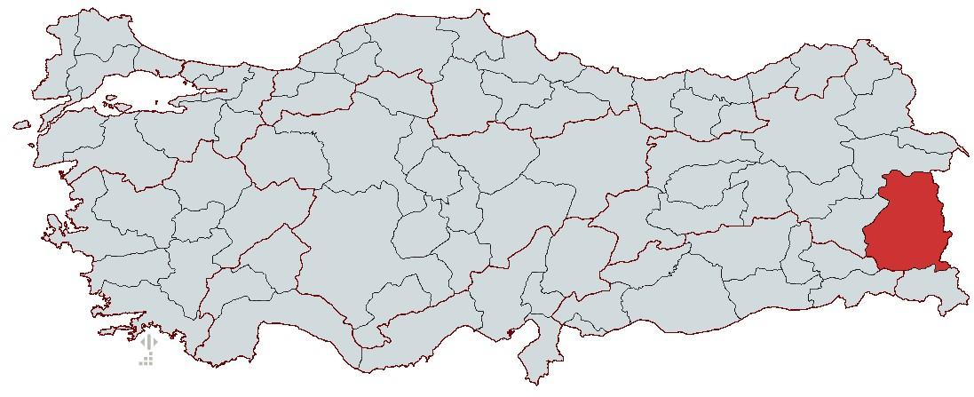
Van
Country | Türkiye | ||||||||
|---|---|---|---|---|---|---|---|---|---|
Region(s) | Eastern Anatolia Region | ||||||||
Population | 1,118,087 | ||||||||
Area(s) | 19 069 km² | ||||||||
Climate(s) | Continental Climate | ||||||||
Important Structure(s) | Halime Hatun Tomb Hüsrev Pasha Mosque Kayan Çelebi Mosque Akdamar Church Van Castle | ||||||||
Area Code(s) | 432 | ||||||||
License Plate | 65 | ||||||||
Governor(s) | Ozan Balcı | ||||||||
Metropolitan Municipality | Ozan Balcı | ||||||||
Van is a settlement center located on the east border of Türkiye and has been a crossroads of many civilizations throughout history. Geographically, Van is one of the largest provinces in the Eastern Anatolia Region and shares its eastern border with Iran. Its historical past extends back to the Urartians and it has been part of the political and cultural spheres of various civilizations. Particularly as the capital of the Urartian Kingdom, Van holds significant archaeological importance due to its castles, rock tombs, and inscriptions from that era. Türkiye’s largest lake, Lake Van, attracts attention for its ecological and geological features and is also unique in terms of the endemic Van Fish like biodiversity. City maintains its role as a regional center through its cultural heritage, natural beauty, and strategic location in tourism, trade and agriculture. Van possesses significant potential for both scientific research and cultural tourism due to its historical fabric, original kitchen culture, and natural resources.
The history of Van extends to prehistoric periods. Archaeological findings indicate continuous settlement in the region since the Chalcolithic Era. In the 2000s BCE, the Hurrians settled in the area and established the first political organizations. Later, in the 9th century BCE, the Urartian Kingdom emerged as a major power with its capital at Tušpa (modern-day Van). The Urartians transformed Van into a major center of Eastern Anatolia through their advanced water irrigation channels, walls, temples, and castle structures.
The Urartian Kingdom reached its peak during the 9th and 8th centuries BCE. The Van Castle, built by King Sarduri I, is one of the most important architectural monuments of the Urartians. Urartian territories expanded from the Euphrates River in the west to the Caspian Sea in the east. However, by the 7th century BCE, invasions by the Assyrians, Scythians, and Med weakened the kingdom, and it was completely destroyed by the Medes in 612 BCE.
After the fall of the Urartians, region came under Median rule. The Medes failed to establish a lasting political presence in Anatolia and were replaced by the Persians in 550 BCE. The Persian Empire administered the region through the satrapy system and used trade routes such as the Royal Persian Road. After King Alexander the Great defeated the Persians in 330 BCE, Van and its surroundings came successively under the control of the Macedonians, Seleucids, and Parthians.
From the 1st century BCE onward, Van and its surroundings became a contested region between the Roman and Sassanian Empires. The area was briefly captured by the Romans but later fell under Sassanian control. In 395 CE, Van came under Sassanian dominance and remained so until the 7th century when it was conquered by Muslim Arab forces.
In 644 CE, during the caliphate of Osman, Muslim armies defeated the Byzantines and captured Van and its surroundings. During the Umayyad and Abbasid periods, the region became one of the important cities of the Islamic world. However, the Armenian Kingdom of Vaspurakan also maintained a distinct period entity in Van. After the Battle of Manzikert in 1071, Van came under the control of the Great Seljuk Empire.
Following the decline of the Great Seljuks, Van came under the control of various Turkish principalities including the Ayyubids, Kara Koyunlu, and Akkoyunlu. Van was conquered by Ottoman Sultan II. Mehmet (Fatih Sultan Mehmet) in 1458 and definitively incorporated into Ottoman territory after the 1514 Battle of Çaldıran under Yavuz Sultan Selim. During the Ottoman period, Van was administered as a district center, with the construction of castles and madrasas transforming it into a major administrative and commercial hub.
In the late 19th century, during Armenian uprisings and the Ottoman-Russian wars, Van suffered extensive destruction. In 1915, Russian forces, supported by Armenian units, occupied Van, but the Turkish army recaptured the city in 1918. After the proclamation of the Republic, Van became a province of the Republic of Türkiye and was rebuilt. Today, it continues to exist as a significant culture center known for its historical heritage and natural beauty.
Van is located in the eastern part of Türkiye and is one of the largest provinces in the Eastern Anatolia Region. The city lies between 42°40' and 44°30' east longitude and 37°43' and 39°26' north latitude. It is bordered by Iran to the east, Bitlis and Muş to the west, Hakkâri to the south, and Ağrı to the north. Lake Van, Türkiye’s largest lake, lies at the center of the province and significantly shapes the city’s natural landscape.
With a total area of 19,069 km², Van has a rugged terrain composed of high plateaus and mountainous areas. Much of the city lies at high elevations, with an average altitude of 1,650 meters above sea level. The southern extensions of the Taurus Mountains lie within Van’s boundaries, and one of the province’s highest peaks is Artos Mountain at 4,058 meters. Volcanic mountains such as Tendürek and Süphan also play a significant role in the region’s geological structure.
A harsh continental climate dominates Van, with cold and snow rainy winters and hot, dry summers. The presence of Lake Van slightly moderates the climate along its shores, but temperature differences in inland areas remain pronounced. The annual average temperature is around 9°C, and winter temperatures can drop as low as -30°C. Spring and autumn seasons are long, while summer temperatures can reach up to 30°C. Van’s plant cover consists of steppe and mountain grasslands. Microclimatic effects along the shores of Lake Van and lake create partially more green areas and agricultural land. In addition, alpine vegetation is found at high elevations.
Van is a region rich in water resources. Lake Van, Türkiye’s largest lake, lies in the western part of the province and has a surface area of approximately 3,713 km². The lake is closed and characterized by saline and alkaline waters. Islands such as Akdamar, Çarpanak, Adır, and Kuş Adası are located within the lake. The province’s other important lake is Lake Erçek, which serves as a major habitat for migratory birds. The most significant rivers flowing into Lake Van are Muradiye Çayı, Bendimahi Çayı, and Karasu. Additionally, the Zap River flows through the southeastern part of the province toward the Hakkâri border.
Van lies in a region with active fault lines and has experienced numerous major earthquakes throughout history. Its proximity to the East Anatolian Fault results in high seismic activity. The 7.2 magnitude earthquake in 2011 demonstrated the extent of seismic vulnerability in the region. Volcanic rocks dominate the general geology of the province, and geothermal sources are also present.
Van’s soils are fertile in terms of agricultural production, but harsh climatic conditions limit agricultural activity. Irrigated agricultural areas are concentrated around Lake Van. Barley, wheat, and sugar beet are among the most commonly cultivated crops. Although Fruit production faces limited opportunities, apple, pear, and mulberry are also grown. Livestock farming is a major economic activity in Van, with extensive pastures suitable for both large and small animal husbandry.
Lake Van, besides being Türkiye’s largest alkaline lake, has a unique ecological structure. The endemic species, the Van Fish (Perca persica), is the only fish species capable of living in the lake’s waters and reproduces by migrating into sweet waters. The wetlands surrounding the lake form an important habitat for migratory birds, while Lake Erçek and its surroundings are of great importance for birdwatching. Van’s geographical structure possesses a rich combination of natural and cultural features. Its lakes, mountains, and wetlands define the region’s ecosystem and guide various economic activities, especially agriculture and livestock farming.
Van is one of the largest provinces in the Eastern Anatolia Region, with an economy based on agriculture, livestock, trade, and industry. Although its level of development is below the national average, recent investments and public support aim to promote economic development. The ecological diversity around Lake Van, its location along migration routes, and its border crossing with Iran give it an important position in regional trade.
Due to its geographical structure and climatic conditions, agricultural production in Van is limited to specific areas. Agricultural activity is concentrated around Lake Van and irrigable lands, while inland areas are dominated by pastures and pasture areas. Major agricultural products include wheat, barley, sugar beet, bean, and potato. Although Fruit production faces limited opportunities, apple, pear, and mulberry are cultivated.
Livestock farming holds a significant place in Van’s economy. Both large and small animal husbandry are widespread, and the province’s extensive pastures are suitable for animal breeding. Sheep farming is particularly prominent, with the Van sheep breed being an important regional variety. Milk and dairy production also play a role in the economy, with cheese and other dairy products being commercially traded.
The Industry sector occupies a more limited area in the provincial economy compared to agriculture and livestock. Small and medium-sized enterprises predominate, with food processing, textiles, and construction materials being the main industries. Industries based on livestock include milk and meat processing facilities. Additionally, factories producing bricks, lime, and cement operate in the province. An organized industrial zone exists, hosting businesses involved in textiles, furniture, and food production. However, industrial development remains limited due to insufficient capital, inadequate transportation infrastructure, and high energy costs.
Van is one of the provinces sharing a direct border with Iran and serves as a crucial transit point for foreign trade through the Kapıköy Border Gate. Van is one of the most visited provinces by Iranian tourists and diversifies its economic activities through border trade. Trade is primarily concentrated in the retail, accommodation, and service sectors.
Van has traditional marketplaces and bazaars where agricultural products, handicrafts, textiles, and consumer goods are sold. Small-scale retail is widespread, while large-scale import-export trade remains limited.
Van possesses significant tourism potential due to its natural beauty, historical structures, and cultural heritage. Destinations such as Lake Van, Akdamar Island, Van Castle, and Nemrut Crater Lake attract both domestic and foreign tourists. Urartian ruins and historical churches are key elements of archaeological tourism. The tourism sector is increasingly contributing to the provincial economy, with accommodation and food services showing growth. However, seasonal fluctuations and infrastructure deficiencies make it difficult to extend tourism throughout the year.
Energy and mining activities in Van are limited, but its geological structure indicates the presence of certain natural resources. Geothermal sources are found around Lake Van, and limited energy production is carried out in these areas. Hydroelectric power plants play a significant role in the province’s energy production. In terms of mining, Van has potential for marble, stone, and certain metallic minerals. However, sufficient industrial infrastructure for processing and commercially exploiting these resources is lacking.
Although Van is one of the largest cities in Eastern Anatolia, its transportation infrastructure is still developing. Highways are widespread, with motorways connecting Van to environment provinces and major cities. Van Ferit Melen Airport is open to both domestic and international hat flights. Ferry services operate on Lake Van, and a railway connection to Tatvan provides access to other parts of Türkiye and Iran. The Van-Tatvan ferry route is a vital corridor linking the eastern regions of Türkiye and plays a significant role in freight transport. Efforts are underway to enhance the functionality of border crossings to improve international logistics activities.
Van’s economy is largely based on agriculture, livestock, border trade, and the service sector. The industrial sector is in development, and potential in energy and mining is yet to be fully utilized. The border connection with Iran positively influences the provincial economy, particularly benefiting retail and tourism sectors. Infrastructure development projects and investments aim to increase economic diversity and ensure sustainable growth.
Van is one of the largest and most strategic cities in the Eastern Anatolia Region and serves as a regional transportation hub. It has various transportation options including road, air, rail, and lake transport. Road transport is the most common mode of transportation in the province. Van is connected to surrounding provinces and other regions of Türkiye via land routes. Direct road connections link Van to Erzurum, Hakkâri, Ağrı, Bitlis, and Şırnak. International road transport is conducted through the Kapıköy Border Gate to Iran.
Van Ferit Melen Airport is the most important air transport hub for the province, serving both domestic and international routes. Regular flights operate to major cities such as Istanbul, Ankara, and İzmir. International connections with countries like Iran are occasionally activated. Ferry services on Lake Van are particularly important for weight and passenger transport to Tatvan and Bitlis. The railway line connecting Tatvan across Lake Van provides rail access to other parts of Türkiye and Iran. The Van-Tatvan ferry route is a vital corridor linking eastern provinces of Türkiye and plays a major role in freight transport.
Van meets a large portion of its energy needs from outside sources but possesses certain potential in renewable energy resources. Geothermal energy sources are found around Lake Van, and projects are being developed to increase their utilization in energy production. Additionally, hydroelectric power plants (HES) generate energy in the eastern and southern parts of the province. Van has high potential for sun energy. The region’s high altitude and annual sunshine duration provide advantages for solar energy investments. Small-scale solar power plants (GES) have been established, and efforts continue to implement large-scale projects.
Van lies within the Euphrates Basin and is considered a relatively water-rich province. Lake Van, Türkiye’s largest alkaline lake, is not used as a drinking water source but contributes climatically to surrounding settlements. Drinking water needs are primarily met through natural source sources, groundwater, and rivers. The city’s water infrastructure is managed by the Van Water and Sewerage Administration General Directorate (VASKİ). Although water supply challenges occasionally occur in rural areas, infrastructure projects aim to address these deficiencies. Sewage infrastructure is largely completed in the city center, but rural areas lack yet complete sewerage systems. Wastewater is treated through treatment plants, and environmentally friendly projects are being developed.
Van has been home to many civilizations throughout history, and its urbanization process has developed differently across various periods. After the major 2011 Van earthquake, large-scale urban transformation projects were initiated. Modern residential areas have been constructed through projects by TOKİ (General Directorate of Housing Development Administration) and local administrations. Urban development is concentrated mainly in Van city center and districts such as Edremit. The surroundings of the historic Van Castle and the shores of Lake Van form key points of urban life. Efforts continue to strengthen the post-earthquake building stock and plan new settlement areas.
Van is a city in the process of developing its industrial infrastructure. The Van Organized Industrial Zone (OSB) is one of the areas where industrial investments are concentrated. Businesses producing in food, textiles, furniture, and construction materials operate in the OSB. Additionally, Small Industrial Sites (KSS) attract attention as areas where local artisans and small-scale producers operate. Industry based on agriculture also holds an important place in Van, particularly in milk and dairy production.
The Kapıköy Border Gate is one of the most important points for trade with Iran. Modernization of the gate and development of logistics centers aim to further increase border trade.
Van is one of the important educational and health centers in the Eastern Anatolia Region. Van Yüzüncü Yıl University is the largest higher education institution in the province and serves as a regional educational center in health sciences, agriculture, and engineering. In terms of health services, Van has hospitals including Van Education and Research Hospital, other public hospitals, private hospitals, and family health centers. Following the 2011 Van earthquake, investments were made to improve the health infrastructure, resulting in the construction of new hospitals and health complexes.
Van holds an important position as a regional center in transportation, energy, water, industry, education, and health infrastructure. Urban transformation projects after the 2011 earthquake have strengthened the city’s building stock and contributed to the creation of modern living areas. However, infrastructure deficiencies persist in rural areas, and projects aimed at improving transportation and industrial infrastructure are prioritized.
Van cuisine is one of the richest and most original culinary cultures in the Eastern Anatolia Region. Local food products and traditional cooking methods, shaped by its geographical structure, climatic conditions, and historical past, form the core characteristics of its cuisine. Particularly livestock-based nutrition habits, intensive use of milk and dairy products, and the variety of grain and meat dishes stand out.
Milk and dairy products hold an important place in Van cuisine. Van herb cheese is a regional specialty, made with various herbs and preserved for long periods. In addition, yogurt, ayran, and butter are essential in daily nutrition. During winter, hardened yogurt lumps known as kurut are widely consumed to enhance nutritional value.
Due to widespread livestock farming, meat dishes hold a significant place in Van cuisine. Lamb, beef, and chicken meat are frequently used in dishes. Kavurma, a traditional meat product prepared for winter storage, is consumed both on its own and with pilaf and börek. Regional meat dishes such as liver köfte and meat köfte (Acem köfte) are also very popular.
Grain products are one of the fundamental components of Van cuisine. Dishes such as bulgur, erişte, flour-based products, and keledoş exemplify the intensive use of grains and legumes. Keledoş is a regional dish made with green lentils, chickpeas, and meat, enriched with yogurt. Dishes like ayran aşı and lentil bulgur pilaf are favored for their nutritional and filling qualities.
Vegetable dishes also hold an important place in Van cuisine. Vegetables such as potato, pumpkin, and onion are commonly used with meat and grains to enhance flavor. Dishes like kabak çırtması, kabak borani, and bostaniye are among the healthy and delicious options. Onion stuffing and lorik (lorlu) are notable examples of the regional cuisine.
Dough products hold an important place in Van cuisine. Traditional dough items such as Van pastry (sodalı), ka’de (kete), erişte pilaf, and su eriştesi are commonly consumed. Kete, prepared especially for breakfast or special occasions, is a dough product filled with walnuts or plain. Pestilli cabbage stuffing combines dough and vegetables in a unique flavor.
Van breakfast is considered one of Türkiye’s most famous breakfasts, offering a rich and satisfying gastronomic experience to both local people and tourists. The main components of Van breakfast include:
This variety has made Van breakfast one of the region’s most important gastronomic heritages.
Van desserts are generally divided into syrup-based and milk-based varieties. Date (kalburabandı) dessert, made with flour and walnut filling, is one of the most famous desserts specific to Van. Milk-based wheat dessert and cheese halva are also commonly consumed regional sweets.
The Van Fish (inci kefali), an endemic species living in Lake Van, is the region’s most important aquatic product. This fish, capable of surviving in the lake’s saline and alkaline waters, is consumed grilled or prepared in a tandır. Tandır-cooked Van fish is one of the region’s unique dishes, prepared using traditional methods.
Van has become one of Anatolia’s most important settlement centers due to its rich historical past and cultural heritage. The city, which has hosted many civilizations from the Urartians to the Ottomans, is notable for its historical structures. Castles, mosques, churches, madrasas, and bridges in Van are significant monuments reflecting the city’s deep history.
Van Castle, built on a rocky mass extending east-west across the Van Plain, was founded by Urartian King Sarduri I between 840 and 825 BCE. This castle, the capital of the Urartian Kingdom under the name Tušpa, is one of the most magnificent examples of Urartian architecture. It contains the Madır (Sardur) Tower, the Analı Kız Open-Air Temple, rock tombs, and curtain walls. The castle remained in use during the Ottoman period and is currently on UNESCO’s Tentative List of World Heritage Sites.
Hoşap Castle, located in the Gürpınar district of Van, was built in 1643 by the Mahmudi Beyler, who were subordinate to the Ottoman State. Built on a steep rock formation, the castle contains the Mahmudi Palace, a mosque, prison, oven, and cisterns. The northern entrance gate, with its original iron door wings and stone reliefs, is particularly striking.
Ayanis Castle, built by Urartian King Rusa between 645 and 643 BCE, is strategically located on the shores of Lake Van. It contains a large temple, storage areas, and palace structures. The castle provides important clues about the late Urartian period and is being excavated to reveal its full extent.
Çavuştepe Castle, located in the Gürpınar district, was built by Urartian King Sarduri II between 764 and 734 BCE. The castle is notable for its temple dedicated to Haldi and other significant Urartian structures.
The mosque, known to have been repaired during the reign of Kanuni Sultan Süleyman, has a symmetrical plan and is covered by a flat soil roof. The mosque’s minaret is an important structure symbolizing Ottoman dominance in the region.
Constructed in 1567 by Van Beylerbeyi Köse Hüsrev Pasha, the mosque is among the important works of Ottoman architecture. The structure, attributed to Sinan, has a square plan and is covered by a dome. Surrounding the mosque are külliye buildings such as madrasa and bathhouse.
Dated to the 14th and 15th centuries, the mosque has a square prayer hall. It was built adjacent to a medrese. Its architectural features reflect influences from Seljuk-era structures.
The minaret dates to the Seljuk period, while the mosque itself is from the Ottoman period. The minaret, a unique example of Seljuk architecture, is decorated with geometric patterns.
Akdamar Church, located on Akdamar Island in Lake Van, was built between 915 and 921 by King Gagik I of Vaspurakan. The structure is notable for its stone reliefs depicting scenes from the Bible and Torah. It is an important example of Armenian architecture and was restored in 2007 and reopened to visitors as a museum.
Located in the Başkale district, church is believed to have been built over the tomb of Saint Bartholomeus. The church, constructed in the 13th century, underwent repairs during the Ottoman period.
Originally built in the 8th century as St. Sophia Church, the complex was expanded between 1003 and 1021 with the addition of Holy Church of the Virgin Mary, jamaton, and other churches to form a monastery complex. It contains sections decorated with frescoes.
Constructed in 1305, the monastery was later expanded with the addition of St. George’s Church and chapels. Only a portion of the Cross plan has survived to the present day.
This cemetery in the Gevaş district is an important historical heritage site featuring Seljuk-era grave stones and tombs. The most notable structure is the Halime Hatun Tomb, built in 1335 by Melik İzzeddin for his daughter Halime Lady.
Constructed in 1563 by Haz Bey’s son Hasan Bey, the tomb is an example of Ottoman-era tomb architecture.
This tomb, with its twelve-sided body and pyramidal cap, is a typical example of Seljuk tomb architecture and has survived to the present day in strong condition.
The historic bridge located over the Bend-i Mahi River, fed by Mount Tendürek, is one of Van’s important architectural structures.
The Hurkan Bridge, built during the Ottoman period, continues to exist as one of the region’s historic stone bridges.
The Satan Bridge, notable for its natural structure and surrounding cliffs, is one of Van’s important natural and historical structures.
Van holds the status of a metropolitan municipality within Türkiye’s administrative structure and maintains its administrative functions through central and local government units.
The Van Governorship carries out the province’s central administrative affairs under the Ministry of Interior, with governors appointed directly by the President of the Republic.
The Van Metropolitan Municipality is responsible for local government services and operates in coordination with district municipalities due to its metropolitan status.
Ottoman Period
Republican Period
Van consists of a total of 13 districts.
Türkiye Diyanet Vakfı İslam Ansiklopedisi. "Van." Author: Orhan Kılıç. Accessed February 17, 2025. https://islamansiklopedisi.org.tr/van.
Türkiye Kültür Portalı. "Van Genel Bilgiler." Accessed February 17, 2025. https://www.kulturportali.gov.tr/turkiye/van.
Van Büyükşehir Municipality. "Resmi Web Sitesi." Accessed February 17, 2025. https://van.bel.tr/.
Van Valiliği. "Resmi Web Sitesi." Accessed February 17, 2025. http://www.van.gov.tr/.

Van
Country | Türkiye | ||||||||
|---|---|---|---|---|---|---|---|---|---|
Region(s) | Eastern Anatolia Region | ||||||||
Population | 1,118,087 | ||||||||
Area(s) | 19 069 km² | ||||||||
Climate(s) | Continental Climate | ||||||||
Important Structure(s) | Halime Hatun Tomb Hüsrev Pasha Mosque Kayan Çelebi Mosque Akdamar Church Van Castle | ||||||||
Area Code(s) | 432 | ||||||||
License Plate | 65 | ||||||||
Governor(s) | Ozan Balcı | ||||||||
Metropolitan Municipality | Ozan Balcı | ||||||||
History
From Ancient Times to the Urartian Kingdom
The Urartian Period and Its Decline
The Medes, Persians, and Hellenistic Period
Roman, Sassanian, and Byzantine Rule
The Islamic Period and Seljuk Rule
Principalities and the Ottoman Period
World War I and the Republican Era
Geographical Structure
Location and Boundaries
Area and Terrain Structure
Climate and Vegetation
Rivers and Lakes
Seismic Activity and Geological Structure
Soil and Agricultural Structure
Lake Van and Ecological Importance
Economic Structure
General Economic Overview
Agriculture and Livestock
Industry and Production
Trade and Border Crossings
Tourism and Service Sector
Energy and Mining
Transportation and Logistics
Infrastructure
Transportation Infrastructure
Energy Infrastructure
Water and Sewage Infrastructure
Urban and Housing Infrastructure
Industrial and Commercial Infrastructure
Educational and Health Infrastructure
Cuisine and Dishes
Milk and Dairy Products
Meat and Meat Products
Grains and Legumes
Vegetable and Legume Dishes
Dough Products and Flour-Based Foods
Van Breakfast
Desserts
Fish and Aquatic Products
Historical Structures
Castles
Van Castle
Hoşap Castle
Ayanis Castle
Çavuştepe Castle
Mosques and Külliyes
Süleyman Han Mosque
Hüsrev Paşa Mosque and Külliye
İzzeddin Şir Mosque
Kızıl Minareli Mosque
Churches and Monasteries
Akdamar Church
St. Bartholomeus Church
Seven Churches (Varak Monastery)
Adır Church
Historical Cemeteries and Tombs
Gevaş Seljuk Cemetery
Hoşap Hasan Bey Tomb
Erciş Kadem Paşa Hatun Tomb
Bridges and Other Structures
Bend-i Mahi Bridge
Hurkan Bridge
Şeytan Bridge
Administration
Governorship
Van Governors
Municipality
Mayors
Districts
District List